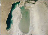
Acquired March 26, 2010, this natural-color image shows a plume rising from the eastern lobe of the South Aral Sea. The dust blows toward the southeast, along the Kazakhstan-Uzbekistan border.
Published Mar 30, 2010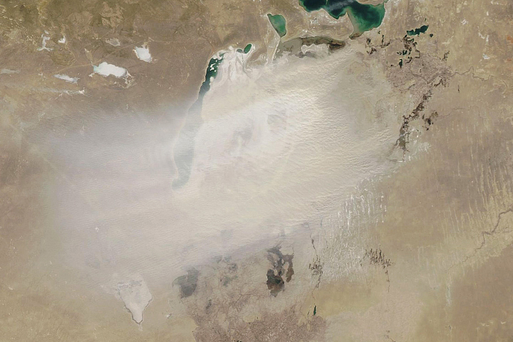
The shrinking of this once-vast inland lake means winds more frequently pick up dust from the exposed lakebed.
Published Mar 25, 2020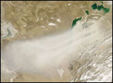
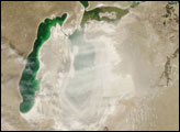
large dust storm blew westward from the Aral Sea in late April 2008. Dry lake bed sediments provide plentiful material to be blown by dust storms, and such sediments surround the Aral Sea.
Published Apr 29, 2008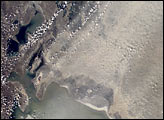
The Aral Sea has shrunk to less than half its size since 1985. It receives little water (sometimes none) from the two major rivers that empty into it—the Syr Darya and Amu Darya. Instead, the river water is diverted to support irrigation for the region’s extensive cotton fields. Recently, water scarcity has increased due to a prolonged drought in Central Asia. As the Aral Sea recedes, its former seabed is exposed. The Aral’s sea bed is composed of fine sediments—including fertilizers and other agricultural chemicals—that are easily picked up by the region’s strong winds, creating thick dust storms. The International Space Station crew observed and recorded a large dust storm blowing eastward from the Aral Sea in late June 2001. This image illustrates the strong coupling between human activities (water diversions and irrigation), and rapidly changing land, sea and atmospheric processes—the winds blow across the Sea and pick up dust (former sea bottom sediments) as soon as the blowing air masses hit land.
Published Dec 30, 2001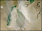
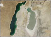
A Soviet-era plan to turn the arid plains of Kazakhstan, Uzbekistan, and Turkmenistan into fertile cropland resulted in the near-total diversion of the water that once fed the Aral Sea. Prior to the scheme, two rivers—the Amudar’ya in the south and the Syrdar’ya in the north—flowed out of distant mountains and pooled in a desert basin in what is now southern Kazakhstan and northern Uzbekistan. The irrigation project began in the mid-1900s, and by 1960, the sea had already begun to dry out.
Published Aug 26, 2008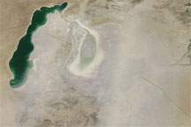
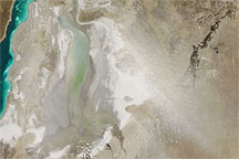
This true-color image shows a dust storm blowing over the desiccated Southern Aral Sea in late June 2009. Dust blows over southern Kazakhstan and across Uzbekistan.
Published Jun 30, 2009
In 1964, it was the world's fourth largest lake. Thanks to irrigation projects, now it is mostly gone.
Published Feb 24, 2012