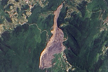
On June 5, 2009, a mountainside collapsed in the Chingqing region of southern China, burying dozens of people. The landslide remained visible in satellite imagery nearly two weeks later.
Published Jun 19, 2009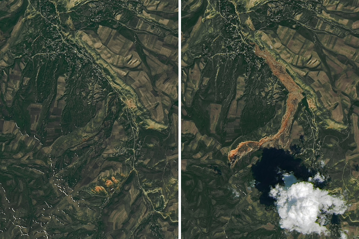
Debris spread more than 3 kilometers (2 miles) from the source to the toe of the landslide.
Published May 22, 2017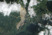
On January 4, 2009, a mountainside in northern Guatemala suddenly collapsed, sending thousands of tons of rock and debris downhill and burying a nearby road. The event occurred in the state of Alta Verapaz, some 200 kilometers (124 miles) north of Guatemala’s capital city.
Published Jan 15, 2009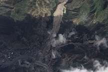
Acquired September 7, 2010, this natural-color image shows the Zhouqu landslide remaining visible on the landscape weeks after its occurrence.
Published Sep 13, 2010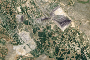
In February 2011, landslides decimated an open pit coal mine near Elbistan.
Published Jun 21, 2012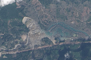
On March 22, 2014, a rainfall-triggered landslide near Oso, Washington, sent muddy debris spilling across the North Fork of the Stillaguamish River.
Published Mar 27, 2014
Acquired on April 20 and May 6, 2012, these images compare conditions before and after a landslide in Nepal. The slide likely led to deadly flooding.
Published May 24, 2012
A new NASA project improves landslide inventories with data from the public.
Published Jul 11, 2019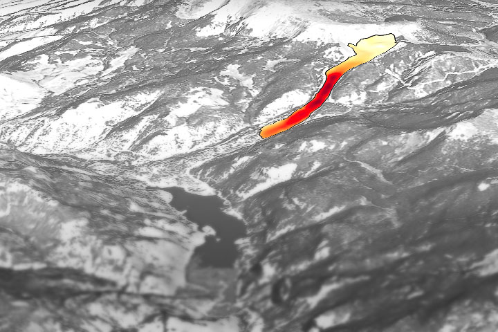
Through the study of an unusual, long-lasting slide, has developed a new technique to make prediction easier and more accurate.
Published Jun 5, 2020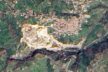
A pale tan scar in this natural-color image from March 14, 2010, marks the location of a landslide outside the southern Italian town of Maierato.
Published Mar 17, 2010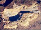
The Bingham Canyon Mine is one of the largest open-pit mines in the world, measuring over 4 kilometers wide and 1,200 meters deep. Mining first began in Bingham Canyon in the late nineteenth century, when shafts were sunk to remove gold, silver, and lead deposits that played out by the early 1900s. It would take the advent of open-pit mining in 1899 to turn the Bingham copper deposit into an economically favorable resource.
Published Oct 22, 2007
For the first time, scientists can examine rain–induced landslide threats anywhere around the world every 30 minutes.
Published Apr 18, 2018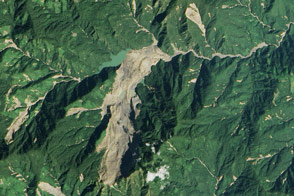
Heavy rainfall from tropical storm Komen triggered a large landslide in Myanmar (Burma).
Published Nov 8, 2015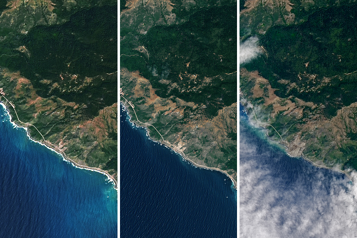
More than a million tons of rocks and dirt covered the road.
Published May 24, 2017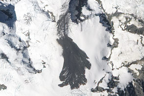
A slide of rock, ice, dust, and snow left a scar of gray across the landscape around one of New Zealand’s largest mountains.
Published Feb 15, 2013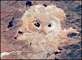
One of the largest open-pit copper mines in the world, the Cananea mine produced over 164,000 tonnes of copper in 2006. The active, 2-kilometer-diameter Colorada Pit is recognizable by the concentric steps, or benches, cut around its perimeter.
Published Apr 21, 2008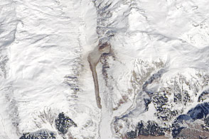
A rock avalanche in the Swiss Alps sent debris sliding down the Strem valley.
Published Apr 6, 2016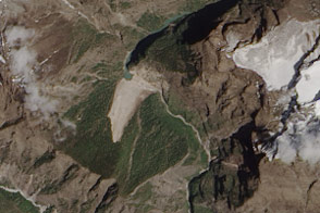
Debris from an earthquake-induced landslide has dammed a river in Nepal.
Published May 7, 2015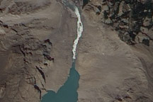
On July 2, 2010, a landslide-dammed lake in Pakistan appeared to have overtopped the dam, and water was streaming out through a man-made spillway.
Published Jul 2, 2010