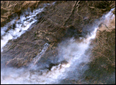
A NASA project is providing maps of satellite data to emergency response teams during the Woolsey Fire.
Published Nov 16, 2018
A wildfire in Fresno County, California has burned more than 28,000 acres.
Published Jul 20, 2020
The Thomas fire has set new records while ravaging several communities.
Published Dec 24, 2017
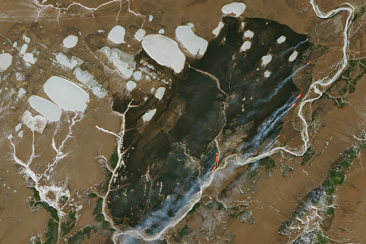
The blaze is the largest in Arizona this year and the largest in the United States right now.
Published Jun 16, 2020Image of the Day Heat Land Fires Human Presence Remote Sensing
The Landsat 8 satellite acquired a scene of contrasts in Siberia.
Published Apr 9, 2019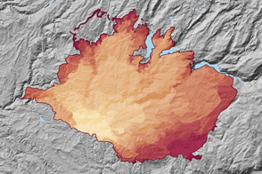
At 369 square miles in size, the Rim Fire is the largest in the United States in 2013.
Published Sep 4, 2013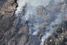
This false-color image illustrates the extent of the Station Fire in southern California.
Published Sep 15, 2009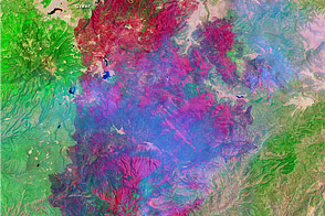
This image shows the extent of Arizona’s Wallow Fire on June 15, 2011.
Published Jun 16, 2011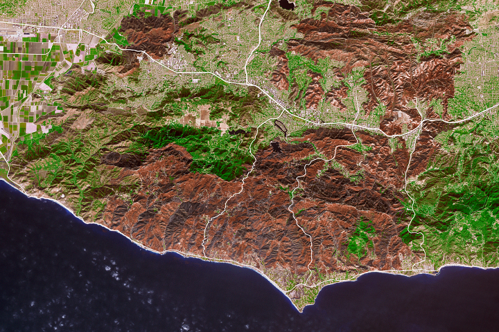
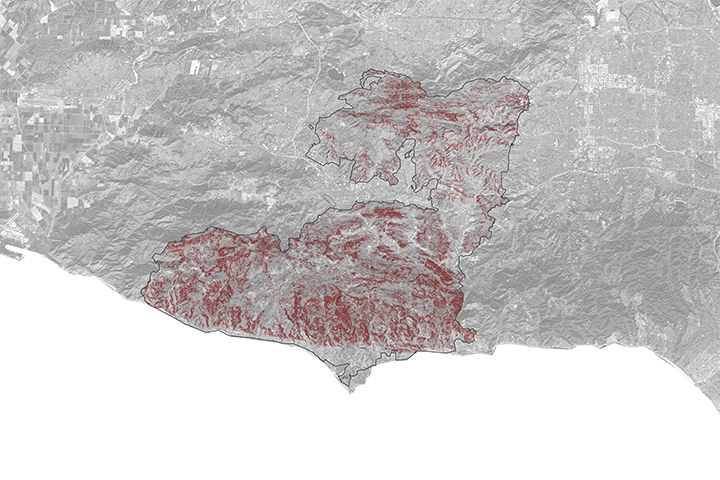
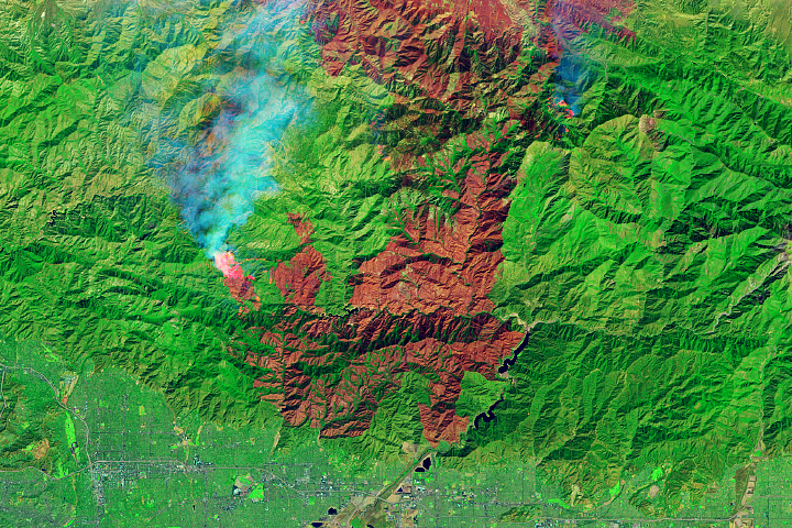
As the destructive California fire nears full containment, it has left behind an expanse of charred land.
Published Nov 19, 2018
Temperature, humidity, and winds contributed to the rapid spread of fire in Lake County, about 100 miles northwest of Sacramento.
Published Jun 27, 2018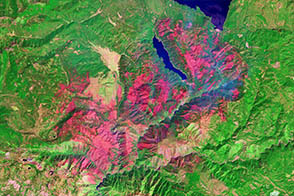
One of a number of large wildfires that have affected northern California in 2012, the Chips fire burned more than 75,000 acres by the time firefighters had contained it.
Published Sep 5, 2012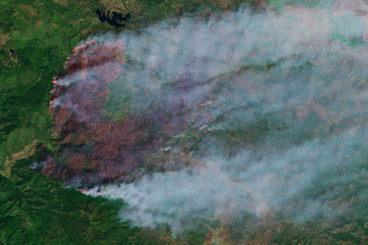
The wildfire has burned more than 50,000 acres, making it the state’s largest blaze in 2019.
Published Sep 13, 2019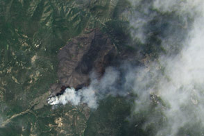
Landsat 8 satellite captured this image of the Jaroso fire burning in northern New Mexico in June.
Published Jun 24, 2013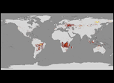
The fire is among the largest Los Angeles County has ever faced.
Published Sep 23, 2020
This image from June 9, 2011, shows Arizona’s Wallow Fire in the White Mountains near the border with New Mexico.
Published Jun 10, 2011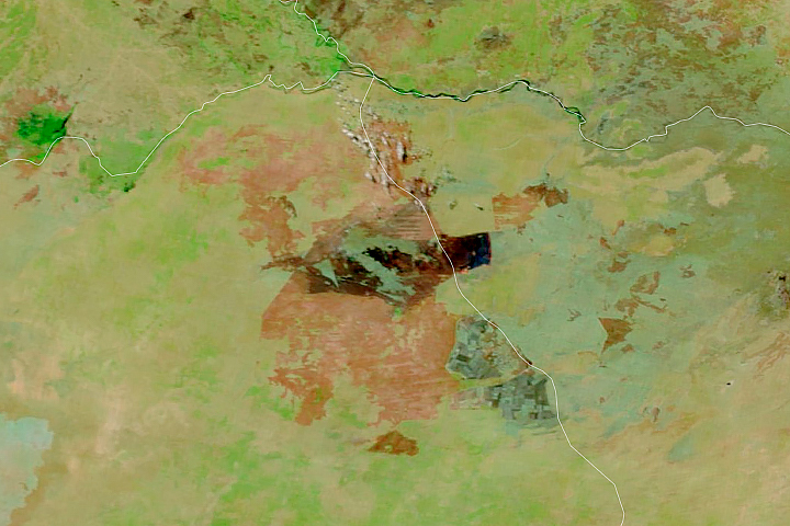
Satellites detect fires that are not necessarily being reported. Scientists are taking note and compiling global views of fire behavior and evolution.
Published Oct 22, 2018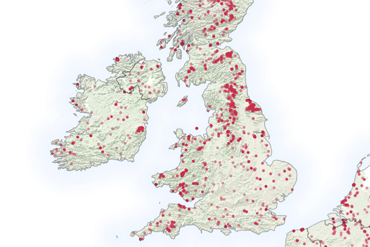
It is not even summertime, but already the United Kingdom has seen a significant number of wildfires.
Published May 6, 2019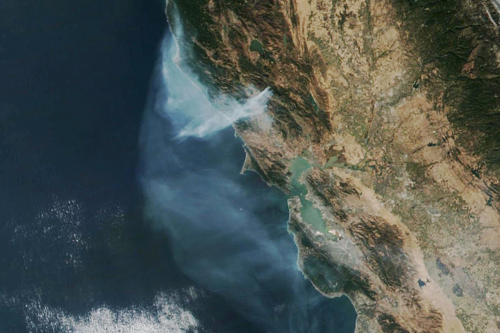
The eastern part of the fire was active overnight, expanding the burned area to 76,000 acres.
Published Oct 30, 2019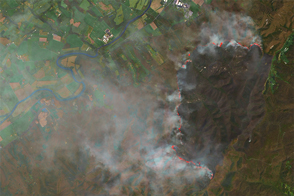
In April 2016, a wildfire broke out in Shenandoah National Park.
Published Apr 22, 2016
In August 2013, the Silver Fire burned 20,000 acres near Banning, California.
Published Aug 14, 2013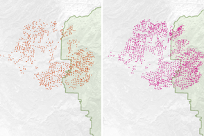
Scientists have found a way to detect nighttime fires even sooner, when they are still relatively small.
Published Apr 7, 2017
A wildfire burning in Los Padres National Park charred more than 500 acres—including the home of Big Sur’s fire chief.
Published Dec 17, 2013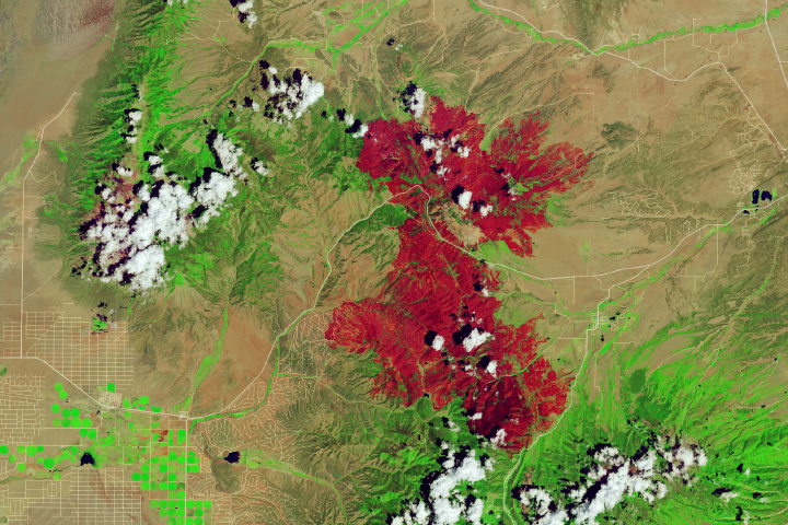
Dry, hot conditions in Colorado helped lead to the state’s third-largest wildfire in history.
Published Jul 13, 2018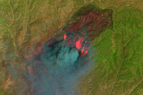
Peer through the billowing plume of smoke to see the hot spots associated with the Cedar fire in eastern Arizona.
Published Jun 23, 2016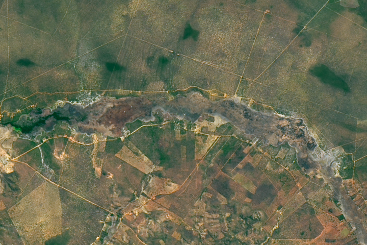
A smoldering fire that burned through soil underground and up hollow palm trunks left this distinctive burn scar along the Peruaçu River.
Published Sep 5, 2017