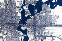
A second round of spring flooding on the Red River was captured in an astronaut photo from April 9, 2009.
Published Apr 27, 2009
The grid-like pattern that spreads across the encompassing flatlands is typical of the Great Plains region and of Nebraska in particular.
Published Nov 29, 2019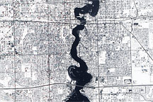
Held in place by reinforced levees, the swollen Red River snakes through Fargo, North Dakota, and Moorhead, Minnesota, in this image captured by the Advanced Land Imager on the EO-1 satellite on March 28, 2009.
Published Mar 31, 2009
As they prepare for a satellite that will measure the height and areal extent of rivers in unprecedented detail, hydrologists have released a better map of North American river widths.
Published Jul 9, 2015
Acquired April 2, 2011, and February 27, 2011, these natural-color images show rising waters on the Kuiseb River, which flowed all the way to the Atlantic Ocean for the first time in decades.
Published Apr 12, 2011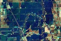
A pair of false-color and natural-color images acquired March 21, 2010, show flooding in agricultural areas north of Fargo, North Dakota.
Published Mar 24, 2010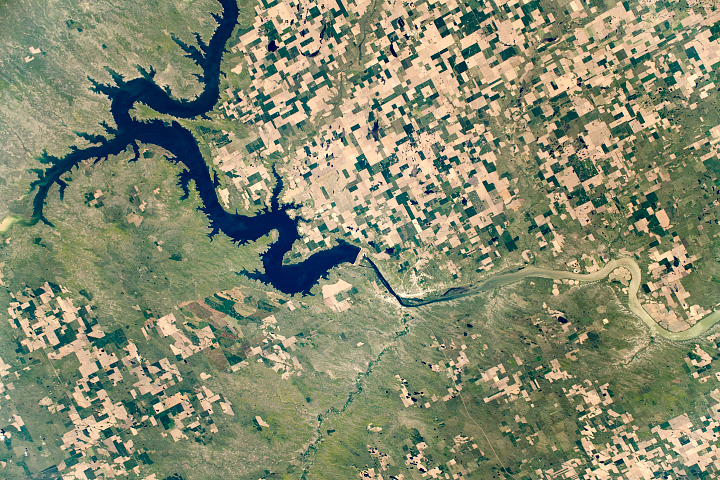
The fourth largest man-made reservoir in North America extends from Pierre, South Dakota, to Bismarck, North Dakota.
Published Dec 8, 2019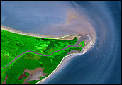
Acquired April 6, 2011, March 18, 2011, and March 7, 2011, these false-color images show melting snow and rising water levels in North Dakota, South Dakota, and Minnesota.
Published Apr 11, 2011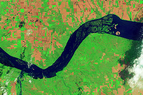
Acquired June 5, 2011, and May 19, 2005, these false-color images compare conditions around Lewis and Clark Lake in South Dakota.
Published Jun 7, 2011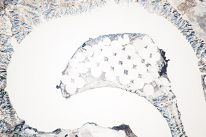
The meandering Missouri River doubled back on itself and formed this U-shaped lake.
Published Jan 13, 2014
An ancient collision between continents left a series of fractures in the bedrock around Virginia’s Massanutten Mountains. The event spawned some unusual zig-zagging stretches on the Shenandoah River.
Published Dec 5, 2014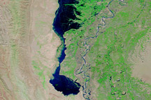
Images from September 3, October 2, and November 1, 2010, show the development and slow draining of a massive floodwater lake west of the Indus River.
Published Nov 3, 2010
Taken May 12, 2011, this astronaut photograph shows flooding near New Madrid, Missouri.
Published May 17, 2011