The Thermal Infrared Sensor on the newest Landsat provides insight into something invisible to human eyes: the temperature of the land surface.
Published Apr 18, 2013Image of the Day Heat Drought Human Presence Temperature Extremes
A new study found that the abundance of these floating plants has increased due to urbanization.
Published Sep 2, 2020
Natural vegetation and irrigated farmland along the Snake River Plain in Idaho use dramatically different amounts of water during the growing season.
Published Jan 26, 2010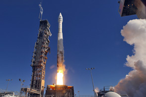
LDCM extends an unprecedented four-decade record of global land observations.
Published Feb 12, 2013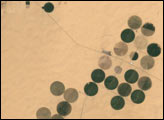
Although it is now the largest desert on Earth, during the last ice age the Sahara was a savannah with a climate similar to that of present-day Kenya and Tanzania. The annual rainfall was much greater than it is now, creating many rivers and lakes that are now hidden under shifting sands or exposed as barren salt flats. Over several hundred thousand years, the rains also filled a series of vast underground aquifers. Modern African nations are now mining this fossil water to support irrigated farming projects.
Published Mar 2, 2002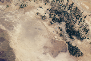
Underground channels have supplied towns in southeastern Morocco for centuries.
Published Nov 19, 2016
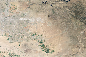
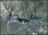
An arid region grew even drier between 2003 and 2009 due to human consumption of water for drinking and agriculture.
Published Mar 13, 2013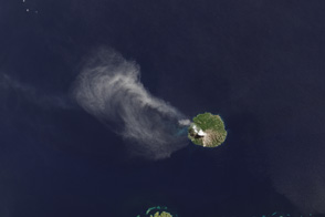
The TIRS instrument on the new Landsat Data Continuity Mission satellite helps scientists pinpoint fine differences in temperature.
Published May 7, 2013Image of the Day Atmosphere Heat Land Volcanoes Temperature Extremes
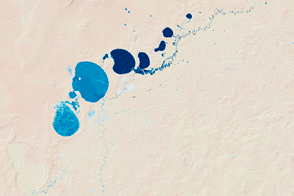
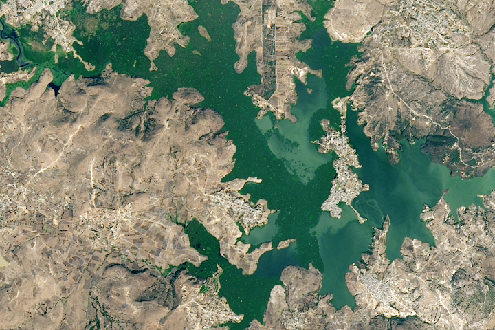
New maps show the fluctuating river and lake levels in the Murray-Darling Basin.
Published Jul 16, 2016
For more than 100 years, groups in the western United States have fought over water. During the 1880s, sheep ranchers and cattle ranchers argued over drinking water for their livestock on the high plains. In 1913, the city of Los Angeles began to draw water away from small agricultural communities in Owen Valley, leaving a dusty dry lake bed. In the late 1950s, construction of the Glen Canyon Dam catalyzed the American environmental movement. Today, farmers are fighting fishermen, environmentalists, and Native American tribes over the water in the Upper Klamath River Basin. The Landsat 7 satellite, launched by NASA and operated by the U.S. Geological Survey, documented an extreme drought in the area along the California/Oregon border in the spring of 2001.
Published Sep 8, 2001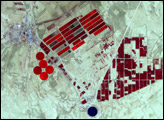
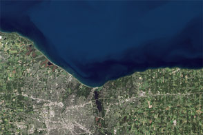
Like an interesting novel, Landsat 8 provides a good read for a day along the shore.
Published Aug 22, 2014
A new tool helped detect water-stressed vegetation near some 2019 Amazon rainforest fires.
Published Nov 8, 2019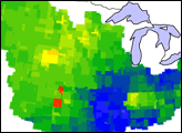
These images show how terrestrial water storage in the four major sub-basins of the United States’ Mississippi River basin differed from average in January and July 2005.
Published Jan 26, 2007