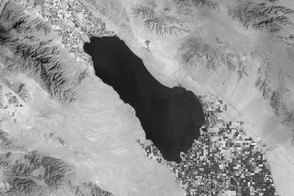
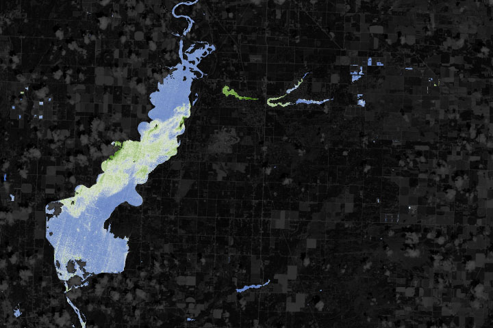
Thermal infrared imagery of the Southern California desert picks up the invisible water in the farmland around the Salton Sea.
Published Apr 23, 2013Image of the Day Heat Land Water Drought Temperature Extremes
The TIRS instrument on the new Landsat Data Continuity Mission satellite helps scientists pinpoint fine differences in temperature.
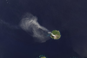
Published May 7, 2013Image of the Day Atmosphere Heat Land Volcanoes Temperature Extremes

Natural vegetation and irrigated farmland along the Snake River Plain in Idaho use dramatically different amounts of water during the growing season.
Published Jan 26, 2010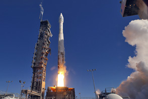
LDCM extends an unprecedented four-decade record of global land observations.
Published Feb 12, 2013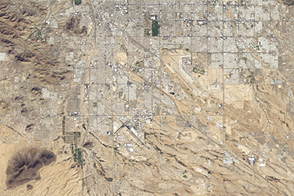
An astronaut photo from 1965 and a satellite image from 46 years later show cityscape engulfing green areas in the dry Southwest.
Published Jul 24, 2012
When the Landsat archive is combined with modern computing power, scientists can view the planet not just across space, but also time.
Published Jun 11, 2013Image of the Day Land Unique Imagery Human Presence Remote Sensing
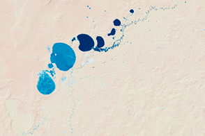
New maps show the fluctuating river and lake levels in the Murray-Darling Basin.
Published Jul 16, 2016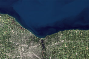
Like an interesting novel, Landsat 8 provides a good read for a day along the shore.
Published Aug 22, 2014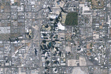
Las Vegas experienced rapid growth between 1984 and 2009, and the growth was recorded by NASA’s long-lived Landsat 5 satellite.
Published Mar 1, 2009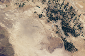
Underground channels have supplied towns in southeastern Morocco for centuries.
Published Nov 19, 2016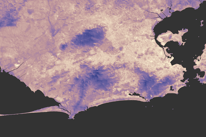
Civic officials from Rio and scientists from NASA are talking about ways the city can combat rising urban temperatures.
Published Aug 9, 2017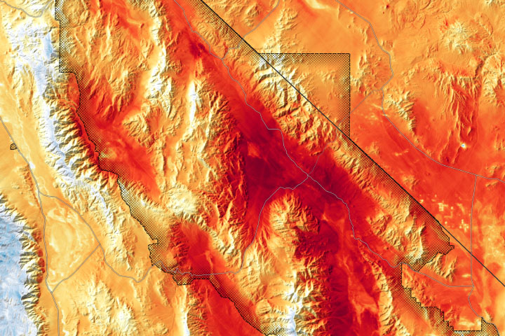
NASA’s ECOSTRESS instrument observed extreme early morning temperatures in the desert of California and Nevada.
Published Aug 20, 2020Atmosphere Heat Land Water Drought Remote Sensing Temperature Extremes
With limited resources to monitor often-unpredictable blooms, water managers are turning to new technologies to detect and keep track of hazards.
Published Jun 22, 2019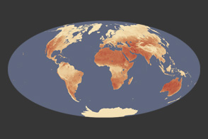
The Sun heats not only the air around us, but the land we walk on. Scientists are interested in the difference between the two.
Published May 2, 2012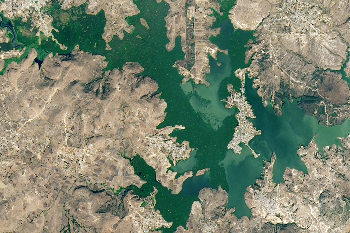
A new study found that the abundance of these floating plants has increased due to urbanization.
Published Sep 2, 2020
These images show how terrestrial water storage in the four major sub-basins of the United States’ Mississippi River basin differed from average in January and July 2005.
Published Jan 26, 2007
For more than 100 years, groups in the western United States have fought over water. During the 1880s, sheep ranchers and cattle ranchers argued over drinking water for their livestock on the high plains. In 1913, the city of Los Angeles began to draw water away from small agricultural communities in Owen Valley, leaving a dusty dry lake bed. In the late 1950s, construction of the Glen Canyon Dam catalyzed the American environmental movement. Today, farmers are fighting fishermen, environmentalists, and Native American tribes over the water in the Upper Klamath River Basin. The Landsat 7 satellite, launched by NASA and operated by the U.S. Geological Survey, documented an extreme drought in the area along the California/Oregon border in the spring of 2001.
Published Sep 8, 2001