Preventive management fires can prevent even larger fires later.
Published May 8, 2012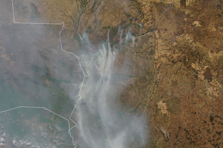
Drought-parched wetlands in South America have been burning for weeks.
Published Sep 17, 2020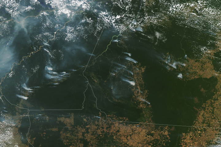
Following a notable increase in fire activity in August 2019 and a gradual rise in deforestation, scientists have been watching for signs of how 2020 might shape up. Several worrisome signs have emerged.
Published Aug 19, 2020Image of the Day Heat Land Fires Human Presence Remote Sensing
Fire is ubiquitous, both a tool and a destructive force. Like plants, fire grows and wanes in seasons.
Published Dec 31, 2008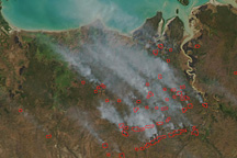
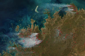
This image from the Moderate Resolution Imaging Spectroradiometer (MODIS) on NASA’s Aqua satellite on June 17, 2009, shows fires (locations outlined in red) burning across the Top End and spreading thin plumes of smoke toward the northwest.
Published Jun 18, 2009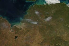
The beginning of the dry season also brings the beginning of the burning season to fire-prone savannas and grasslands.
Published May 10, 2014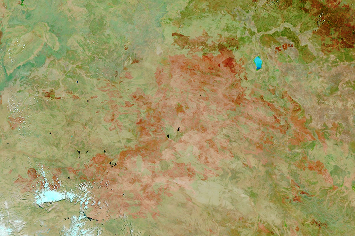
The satellite-based atlas includes information about more than 13 million fires.
Published Aug 8, 2019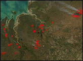

The reality of science, statistics, and satellites is that a deep understanding of the causes, effects, and severity of a fire season takes time.
Published Mar 3, 2020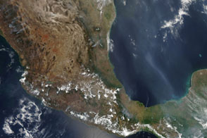
The widespread fires shown in this image taken on May 20, characterizes the extreme fire season Mexico experienced in 2011.
Published May 25, 2011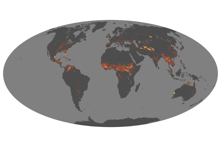
Scientists have answered some important questions about how fires vary around the world and are changing over time.
Published Aug 21, 2019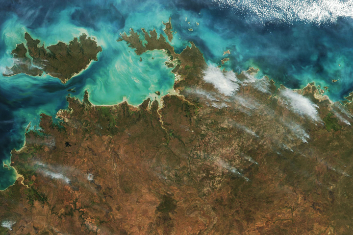
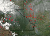
As is common during the dry season, satellites detected many fires in Northern Territory.
Published Jun 11, 2018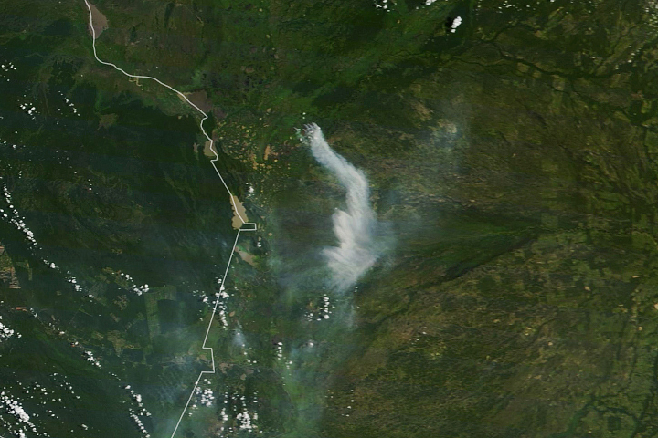
Even during the wet season, fires can burn in the large wetland region in southwestern Brazil.
Published Mar 10, 2020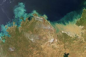
Though fires are larger and more frequent at the end of the dry season, several fires burned in Western Australia and Northern Territory in April 2015.
Published Apr 9, 2015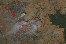
Dozens of fires burn in farmland around Cambodia’s Tonle Sap in this photo-like image taken on January 21, 2011.
Published Jan 24, 2011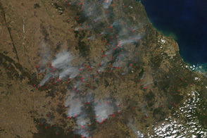
Numerous fires clouded the skies of southern Queensland with smoke on September 26, 2011.
Published Sep 26, 2011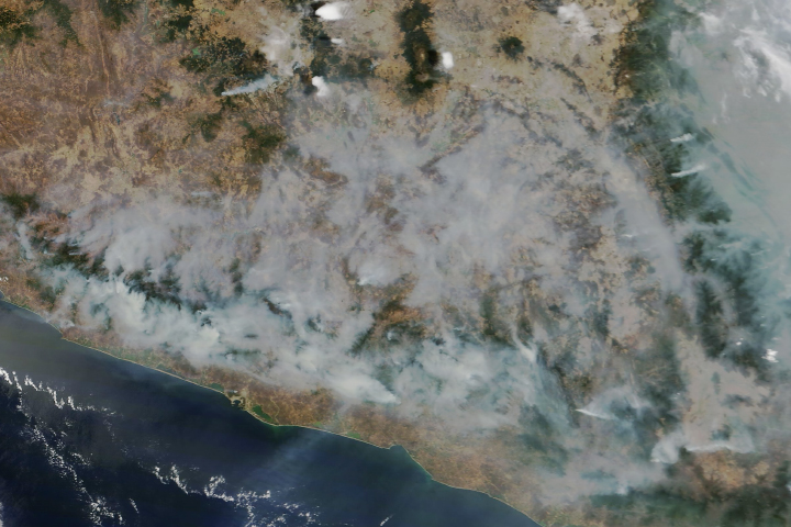
The blazes have been difficult to control because of strong winds.
Published May 10, 2019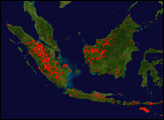
During the May-October dry season, fire often smolders through Indonesia’s tropical forests. The challenge is to keep track of the fires set in remote regions, a task perfectly suited to satellite imagery. Fire locations from MODIS for the week of August 4, 2008, are marked with red dots here. Officials were concerned that fires during the 2008 season could be more intense than normal because the dry season had been especially dry.
Published Aug 23, 2008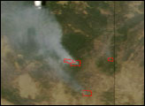
Fires are concentrated in agricultural areas of northwestern Guatemala. Although agricultural fires are not necessarily immediately hazardous, they can have a strong influence on weather, climate, human health, and adjacent natural resources. Each fire season scientists in the tropical forests of northern Guatemala must keep a close eye on agricultural fires to make sure they do not accidentally invade natural areas and preserves that protect archaeological ruins from the Maya civilization.
Published Apr 19, 2007