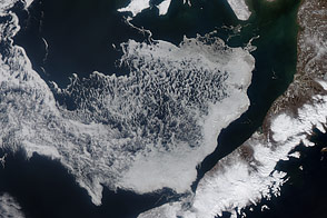
Acquired April 11 and 24, 2012, these images show the movement of sea ice in the Bering Sea with the advance of spring.
Published May 6, 2012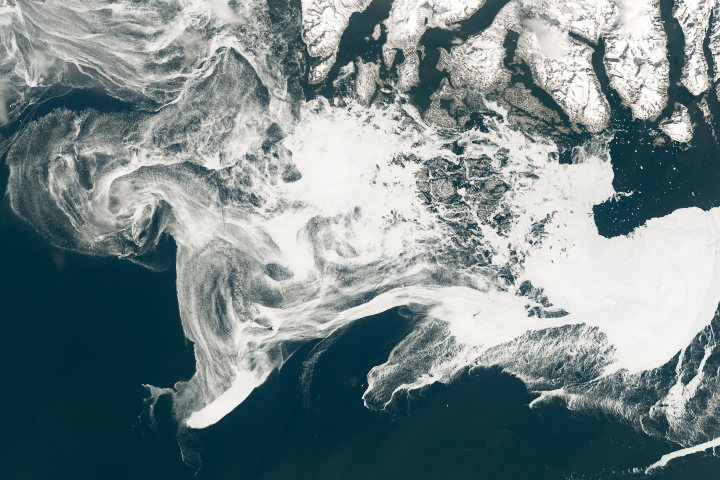
Filaments of sea ice stretch across the waters off southern Greenland, an area that is typically ice-free.
Published May 18, 2019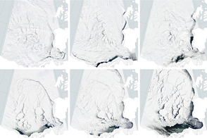
In April 2016, unusually warm temperatures and heavy winds broke the sea ice pack to pieces.
Published May 20, 2016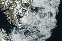
Sea ice formed delicate swirls along the coast of Baffin Island in this true-color image acquired July 11, 2009.
Published Jul 24, 2009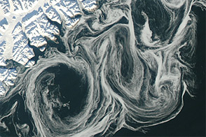
Thin sea ice swirled along the east coast of Greenland in October 2012, against a backdrop of overall thinning sea ice.
Published Oct 27, 2012
Carried by winds and currents, sea ice can reach the coast of Hokkaido, Japan.
Published Mar 19, 2020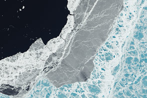
A mixture of ice types exists where frozen water meets open water.
Published Mar 11, 2015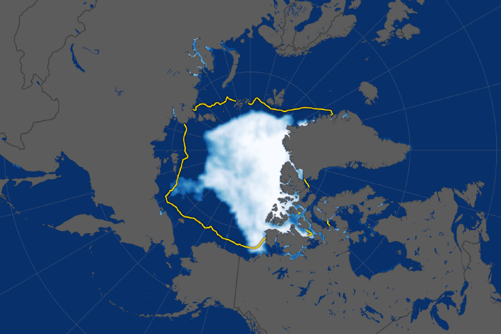
The ice cap tied for the sixth lowest extent on record, continuing a long-term decline.
Published Sep 28, 2018Image of the Day Water Snow and Ice Remote Sensing Sea and Lake Ice
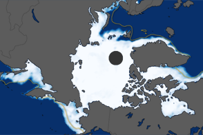
On September 12, 2009, sea ice reached its annual minimum extent, covering 5.10 million square kilometers (2.97 million square miles) of the Arctic Ocean. This image shows the 2009 ice extent compared to the 1979-2000 average.
Published Sep 19, 2009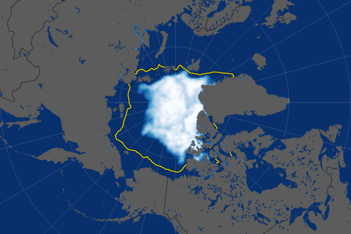
The long-term trend for Arctic sea ice extent has been definitively downward.
Published Sep 23, 2019Image of the Day Heat Water Snow and Ice Remote Sensing Sea and Lake Ice
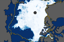
The extent of Arctic sea ice peaked at 15.24 million square kilometers on March 18, 2012. It was the ninth consecutive year of maximum extents below the long-term average.
Published Mar 27, 2012
New elevation measurements will give researchers an unprecedented understanding of the thickness of sea ice, which will be used to help improve climate modeling and forecasts.
Published Dec 18, 2018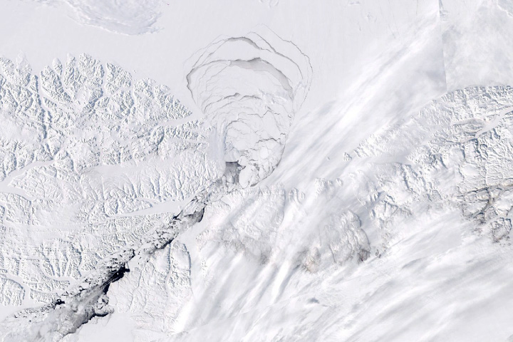
The structure that prevents sea ice from exiting the Arctic Ocean through the Nares Strait crumbled months earlier than usual.
Published Jun 26, 2019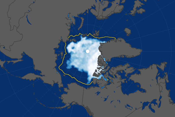
Arctic sea ice has been retreating the fastest in the Beaufort Sea.
Published Oct 18, 2017
The 2014 arctic sea ice minimum is the sixth lowest on record, while antarctic sea ice continues to exceed the record maximum extent.
Published Sep 24, 2014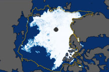
These images show overall Arctic sea ice extent on September 19, 2010 (the date of the 2010 minimum), and sea ice growth in mid-September 2010.
Published Oct 6, 2010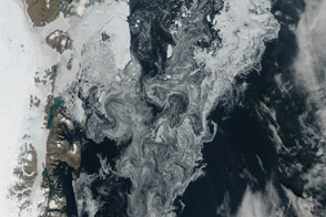
Sea ice and glacial ice mixes off the northeast coast of the great island.
Published Aug 24, 2014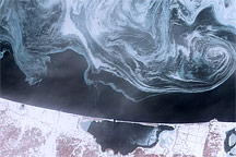
Sea ice formed delicate swirls of blue and white in the Sea of Okhotsk in February 2009.
Published Feb 27, 2009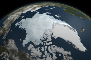
This animation shows Arctic sea ice shrinking to a near record minimum in the summer of 2011.
Published Sep 22, 2011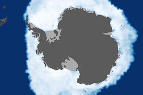
As the Arctic experienced a new record summer minimum for ice extent, the Antarctic set a new record for maximum winter sea ice.
Published Oct 11, 2012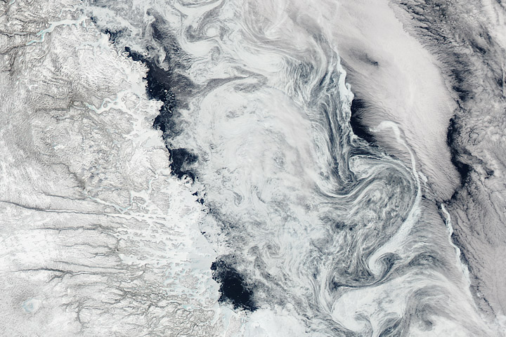
A combination of winds and currents steered sea ice into interlocking swirls.
Published May 16, 2017
In 1984, there were 1.86 million square kilometers of old ice spread across the Arctic at its yearly minimum extent. In September 2016, there were only 110,000 square kilometers of old ice left.
Published Nov 4, 2016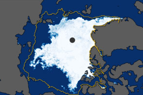
In September 2011, the extent of sea ice covering the Arctic Ocean declined to the second-lowest extent on record.
Published Oct 5, 2011