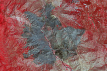
Land recently burned in Southern California’s Bull Fire is charcoal black in this false color image taken on August 1, 2010, when the fire was nearly contained.
Published Aug 2, 2010
A wildfire in Fresno County, California has burned more than 28,000 acres.
Published Jul 20, 2020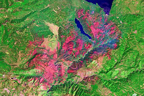
One of a number of large wildfires that have affected northern California in 2012, the Chips fire burned more than 75,000 acres by the time firefighters had contained it.
Published Sep 5, 2012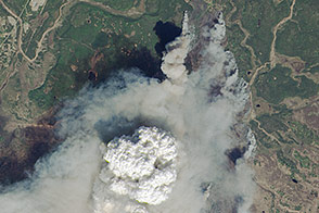
Fire weather clouds are one indication of the intensity of the fast-growing fire on Alaska’s Kenai Peninsula.
Published May 23, 2014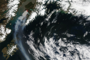
Burning on Alaska’s Kenai Peninsula south of Anchorage, the Funny River fire produced dense smoke that affected air quality throughout the region.
Published May 21, 2014
A NASA project is providing maps of satellite data to emergency response teams during the Woolsey Fire.
Published Nov 16, 2018
The Whitewater-Baldy Fire is the largest on record in New Mexico.
Published Jun 14, 2012
The wildfire has burned more than 50,000 acres, making it the state’s largest blaze in 2019.
Published Sep 13, 2019
Exceptional heat fueled fires across Australia in January 2013. Tasmania and New South Wales were among the hardest-hit areas.
Published Jan 11, 2013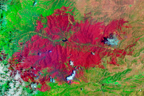
The EO-1 satellite observed the burn scar from the Little Bear Fire.
Published Jun 14, 2012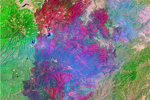
This image shows the extent of Arizona’s Wallow Fire on June 15, 2011.
Published Jun 16, 2011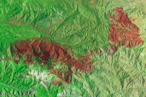
Little heat remained, but the California fire left behind a burn scar spanning almost 50 square miles.
Published Jul 7, 2015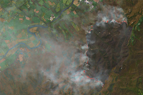
In April 2016, a wildfire broke out in Shenandoah National Park.
Published Apr 22, 2016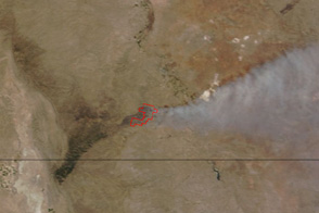
Smoke streams east from a fire in Carlsbad Caverns National Park in this true-color image from June 14, 2011.
Published Jun 14, 2011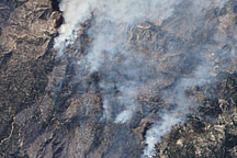
This false-color image illustrates the extent of the Station Fire in southern California.
Published Sep 15, 2009
The blaze is the largest in Arizona this year and the largest in the United States right now.
Published Jun 16, 2020Image of the Day Heat Land Fires Human Presence Remote Sensing
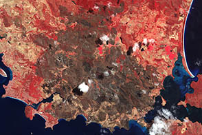
The Terra satellite captured this image of the charred landscape near Dunalley after intense bushfires tore through the area. The fire destroyed about 30 percent of the buildings in the town.
Published Jan 27, 2013
At 369 square miles in size, the Rim Fire is the largest in the United States in 2013.
Published Sep 4, 2013