At the surface, moisture is more abundant than in 2012. But time will tell if it seeps down to restore aquifers parched by drought.
Published Jun 18, 2013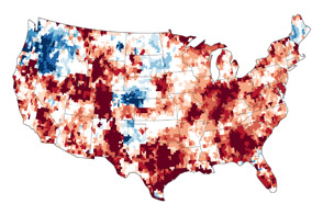
The GRACE satellites can detect the movement and depletion of water supplies at and below Earth’s surface.
Published Sep 20, 2012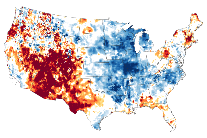
The failure of the summer monsoon and other moisture carrying systems has parched more than 90 percent of some states.
Published Aug 13, 2020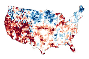
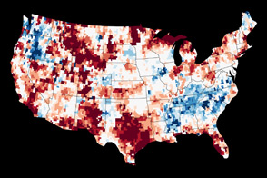
Dry conditions at the surface in the continental United States are mirrored underground in many places.
Published Jul 24, 2014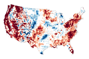
In mid-September 2015, water stored near the surface and underground in the U.S. West was far-below-normal.
Published Sep 18, 2015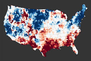
A new map reveals the extreme depletion of groundwater in Texas and other parts of the southern United States due to drought.
Published Dec 1, 2011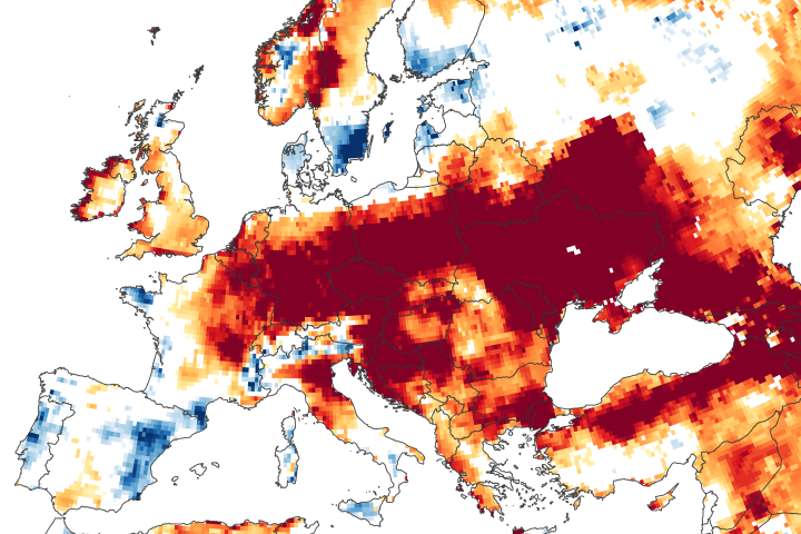
Long-term rainfall deficits, heat waves, and increased evaporation have depleted some of the groundwater supply beneath central and eastern Europe.
Published Jun 25, 2020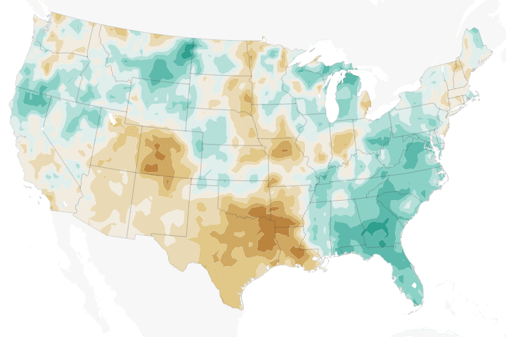
Temperatures across much of the region in 2018 have been well above the norms, while precipitation has been well below—a recipe for struggling farmers and concerned forest fire managers.
Published Jun 12, 2018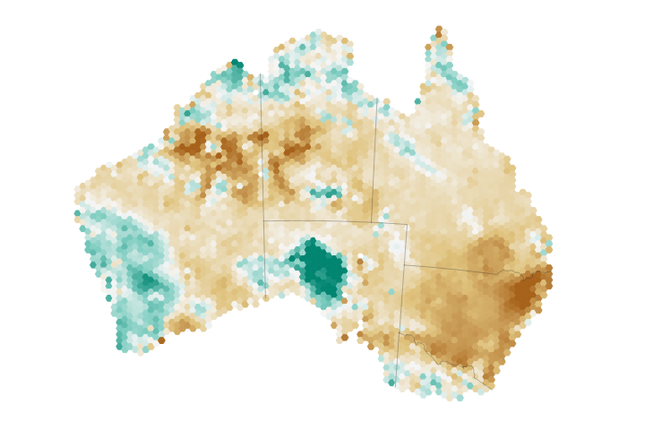
Eastern Australia has been hit particularly hard by drought, taking a toll on the region’s soil moisture and agriculture.
Published Aug 9, 2018Image of the Day Land Water Drought Human Presence Remote Sensing
By late February 2018, an estimated 55 percent of the continental U.S. was classified as abnormally dry.
Published Mar 2, 2018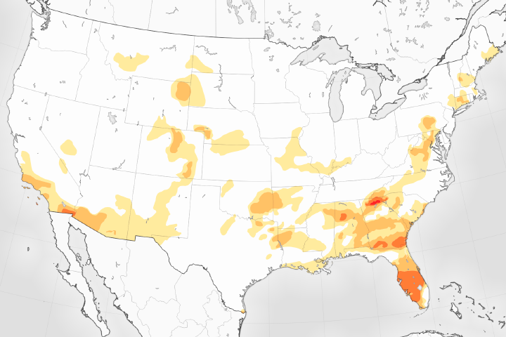
The U.S. Drought Monitor reports its lowest levels in 17 years.
Published May 5, 2017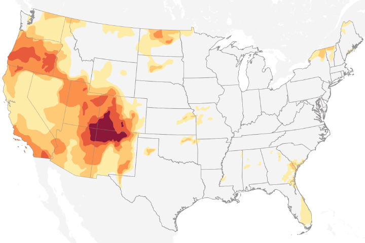
Drought conditions in 2018 are extreme over the Four Corners region of the United States.
Published Nov 8, 2018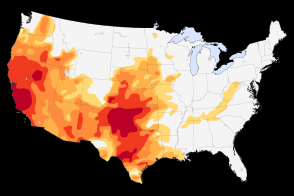
Severe to extreme drought persists in the Southwest and the Plains in May 2014.
Published May 13, 2014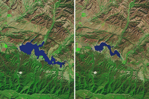
While autumn rains offered some relief to Northern California, drought still reigns in the southern part of the state.
Published Nov 16, 2016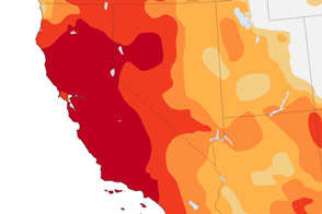
More than 64 million people are directly affected by drought in the Southwest and Southern Plains, and far more are indirectly affected because of the vast number of farms, orchards, and ranches that supply the rest of the United States.
Published Nov 27, 2014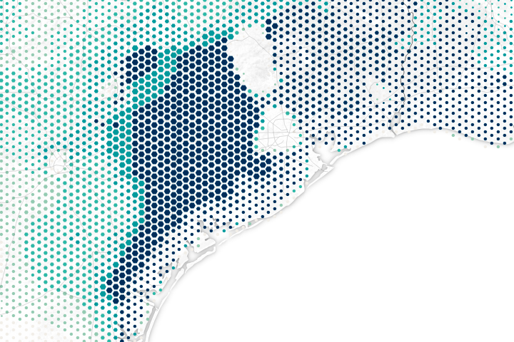
Harvey dropped buckets of rain on areas that were already very dry or very wet.
Published Aug 31, 2017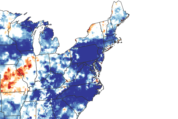
See where shallow groundwater has responded to the unusually wet conditions this year.
Published Dec 20, 2018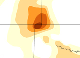

Views from the ground and from space are helping scientists understand how soil moisture affects U.S. agriculture.
Published Nov 25, 2015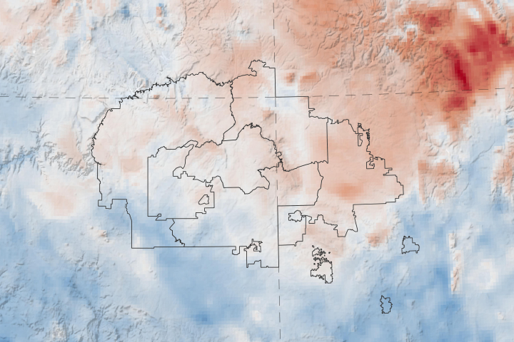
A new web tool designed by NASA applied scientists could help the tribe anticipate and respond to drought.
Published Apr 20, 2020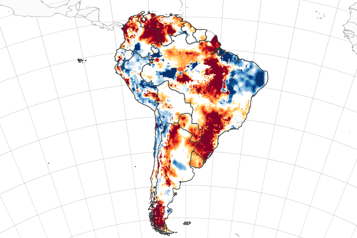
Twin satellites are assessing the state of soil moisture and groundwater on the continent and around the world.
Published Apr 6, 2020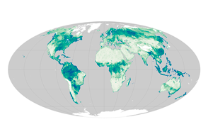
Satellite sensors uncover a global view of the water hidden between soil particles.
Published Nov 12, 2015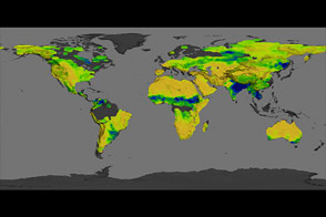
The Aquarius instrument was designed to study ocean salinity, but it is also making an important contribution to studies of the water cycle on land.
Published Jul 15, 2014
After a wet spring, a quick-onset drought has parched fields.
Published Oct 23, 2019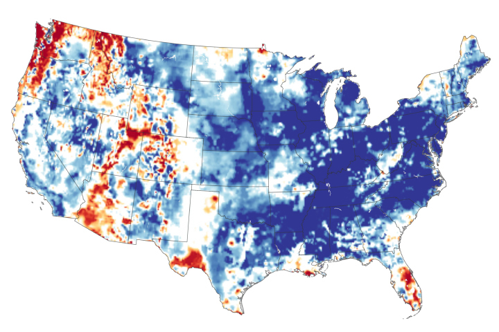
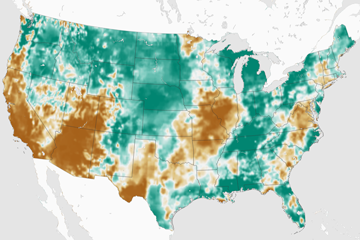
The continental United States recently finished its wettest twelve months in 124 years of modern recordkeeping.
Published May 24, 2019
The Dolmen de Guadalperal resurfaced after five decades underwater.
Published Sep 19, 2019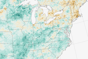
A dry summer is giving farmers in the Northeast one of their toughest seasons in years.
Published Sep 13, 2016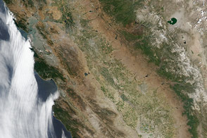
The typically green valleys and snow-covered mountains of California have grown dusty after three years of drought.
Published Jul 18, 2014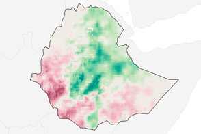
Following Ethiopia’s worst drought in decades, rainfall in 2016 is off to an uneven start.
Published Apr 19, 2016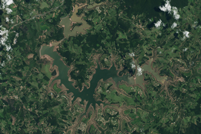
Satellite imagery shows reservoirs still perilously low in the midst of Brazil’s rainy season.
Published Mar 7, 2015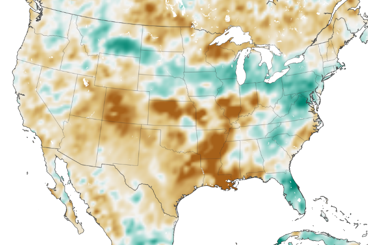
The amount of water contained in the top few centimeters of soil is small on a global scale, but it is critical for agriculture analysts trying to monitor commodity production and humanitarian need.
Published Jun 2, 2018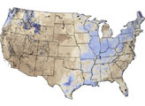
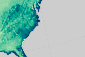
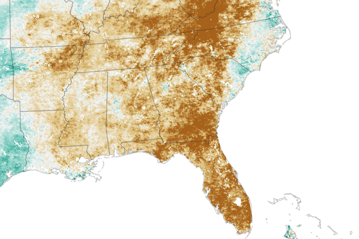
An extreme rainfall event saturated the soil along the U.S. East Coast.
Published Oct 8, 2015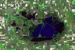
Kansas wetlands dry out across two rain-scarce summers.
Published Oct 7, 2012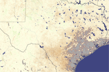
Most of Texas is brown in this vegetation index image, revealing the negative impact drought had on plants in August 2009.
Published Aug 12, 2009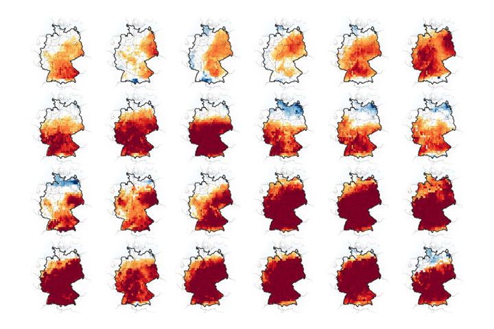
If no significant rain falls in May 2020, the country could face a drought for the third summer in a row.
Published May 1, 2020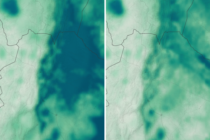
A hot, dry growing season has scorched soybean and corn crops in the Pampas.
Published Apr 17, 2018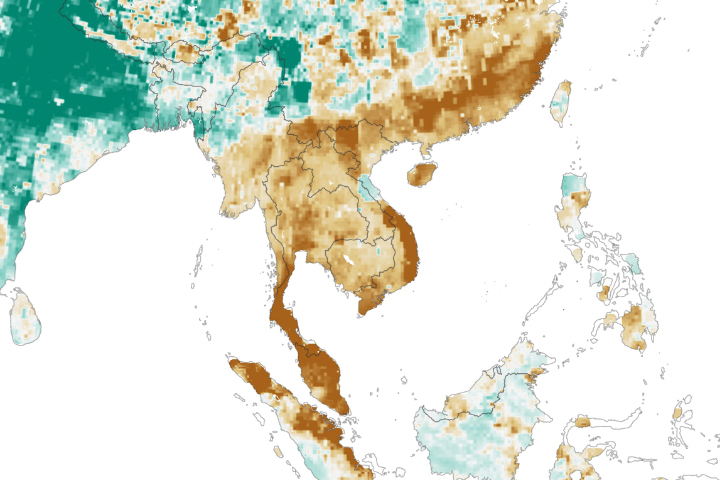
A severe drought in Thailand is affecting agriculture and drinking water in the region.
Published Feb 15, 2020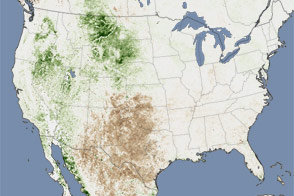
Extreme heat helped push as much as 26 percent of the contiguous United States into drought in July 2011. This image shows the impact on plants throughout the month.
Published Aug 11, 2011