As is common during the dry season, satellites detected many fires in Northern Territory.
Published Jun 11, 2018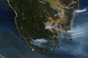
Exceptional heat fueled fires across Australia in January 2013. Tasmania and New South Wales were among the hardest-hit areas.
Published Jan 11, 2013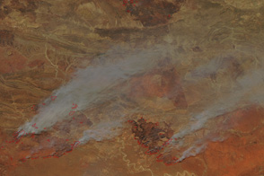
Many large fires burn across central Australia in this image from September 30, 2011.
Published Oct 1, 2011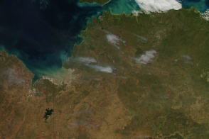
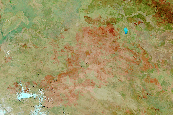
The beginning of the dry season also brings the beginning of the burning season to fire-prone savannas and grasslands.
Published May 10, 2014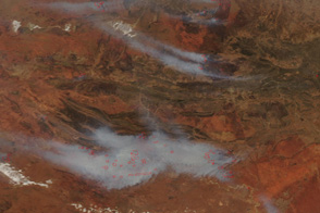
Thick smoke blankets hundreds of kilometers around Alice Springs, Australia, in this image from September 29, 2011.
Published Sep 29, 2011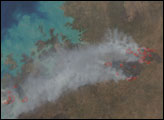
The satellite-based atlas includes information about more than 13 million fires.
Published Aug 8, 2019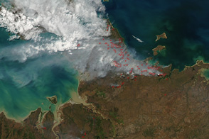
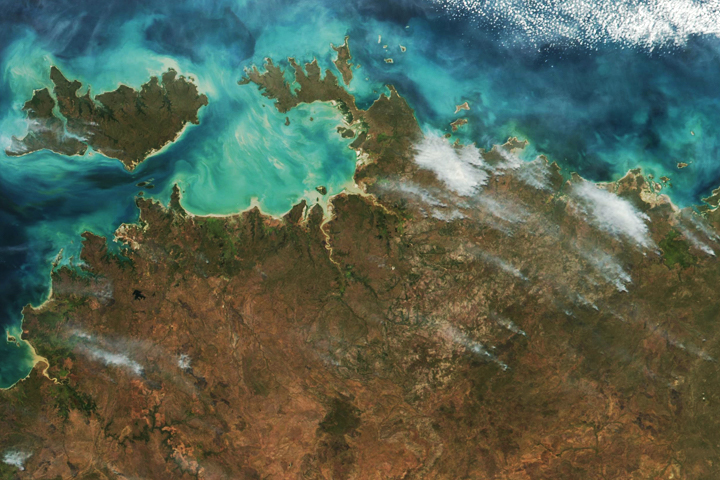
Smoke drifts over the aquamarine waters off northern Australia in this true color image taken on July 30 as the winter fire season gets underway.
Published Jul 31, 2011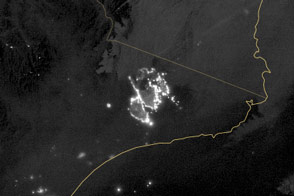
Melbourne was not the only bright spot in the nighttime view of Victoria. A massive bushfire rivals the city in size.
Published Feb 13, 2014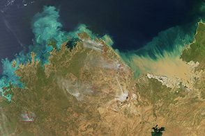
Though fires are larger and more frequent at the end of the dry season, several fires burned in Western Australia and Northern Territory in April 2015.
Published Apr 9, 2015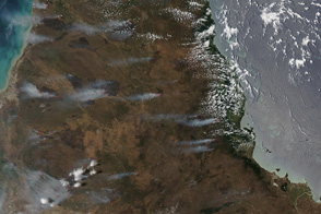
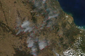
Hazardous fire conditions led to widespread, large fires in Queensland, Australia in mid-November.
Published Nov 17, 2011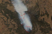
Acquired September 24, 2009, these true-color images show wide-area and close-up views of fires in Queensland, Australia.
Published Sep 24, 2009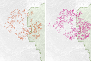
Scientists have found a way to detect nighttime fires even sooner, when they are still relatively small.
Published Apr 7, 2017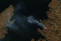
This true-color image shows a large fire burning on the western coast of Scotland.
Published May 5, 2011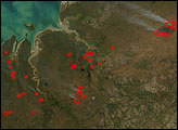
Numerous fires clouded the skies of southern Queensland with smoke on September 26, 2011.
Published Sep 26, 2011