Exceptional heat fueled fires across Australia in January 2013. Tasmania and New South Wales were among the hardest-hit areas.
Published Jan 11, 2013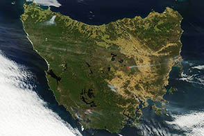
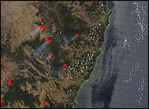
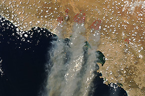
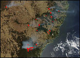
Extreme heat and strong winds fueled destructive bushfires across Tasmania in January. The Terra satellite captured this view of the fires on January 7, 2013.
Published Jan 7, 2013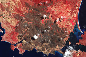
The Terra satellite captured this image of the charred landscape near Dunalley after intense bushfires tore through the area. The fire destroyed about 30 percent of the buildings in the town.
Published Jan 27, 2013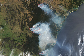
On October 21, 2013, destructive wildfires burning in New South Wales were poised to worsen.
Published Oct 21, 2013
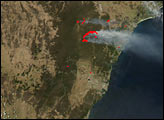
An intense heat wave that struck Australia in January 2013 fueled damaging fires not only in Tasmania but in central Australia as well. Satellites captured images of the fires during the night and day on January 9.
Published Jan 11, 2013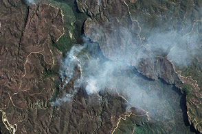
A rash of fires raged through Australia’s Blue Mountains in October 2013. The EO-1 satellite captured this view of a portion of the burn scar left by the State Mine fire.
Published Oct 29, 2013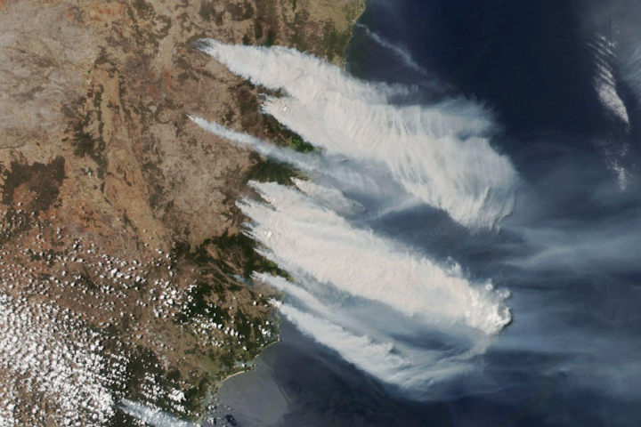
Dry, hot, windy conditions persist as bushfires burn in the eastern part of the Australian state.
Published Nov 8, 2019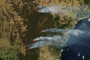
Cooler weather helped firefighters control bushfires in New South Wales, but dozens of blazes were still active on October 24, 2013.
Published Oct 25, 2013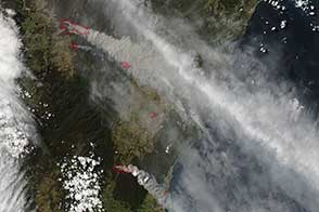
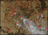
Dry conditions, heat, and gusty winds combined to make October 17 a very dangerous fire day in New South Wales, Australia.
Published Oct 18, 2013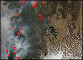
Extreme heat and strong winds fueled smoky grass fires in South Australia in January 2014.
Published Jan 16, 2014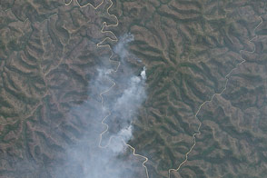
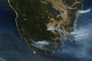
While the bushfire crisis that gripped New South Wales in mid-October 2013 has eased, some fires continue to burn in the Blue Mountains.
Published Nov 7, 2013
Bushfires continued in early December to produce smoke along the the country's eastern coast.
Published Dec 4, 2019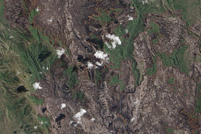
Tasmania’s Southwest National Park was the scene of a large bushfire that burned through a fire-adapted ecosystem during an extreme heatwave in January 2013.
Published Jan 28, 2013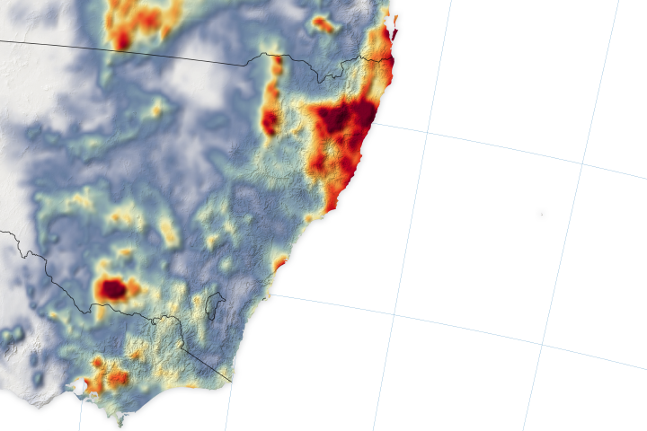
Bushfire counts dipped in mid-January when much-needed rainfall poured down on New South Wales and Victoria.
Published Jan 24, 2020Image of the Day Atmosphere Heat Land Unique Imagery Remote Sensing
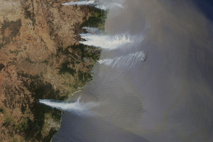
Smoke billowed from a string of bushfires lining the coast of the Australian state.
Published Nov 7, 2019