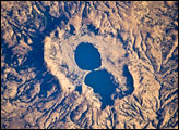
The approximately 4-kilometer-wide Dendi Caldera includes some of this silica-rich volcanic rock: the rim of the caldera, visible in this astronaut photograph, is mostly made of poorly consolidated ash erupted during the Tertiary Period (approximately 65–2 million years ago).
Published Mar 31, 2008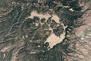
Acquired May 22, 2002, this natural-color image shows Valles Caldera in New Mexico.
Published May 22, 2011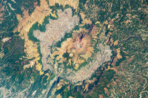
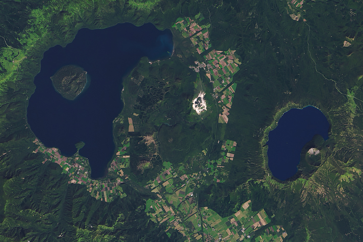
Formed during four explosive eruptions that took place between 300,000 and 90,000 years ago, the volcanic caldera is now home to human settlements and 17 younger volcanoes.
Published Dec 24, 2012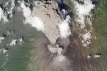
Satellite view of an ash plume and pyroclastic flow on Sakurajima Volcano.
Published Aug 20, 2010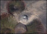
These nested volcanic features grew as small, secondary vents along the flanks of larger volcanoes.
Published Mar 19, 2020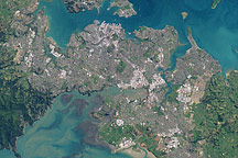
This natural-color (photo-like) image of Auckland was acquired on August 27, 2002, by NASA’s Landsat 7 satellite. The most densely developed areas appear white and gray, while suburban areas appear grayish green—a mixture of houses, streets, and lawns. The city spreads out across various peninsulas surrounding Tamaki Strait and other bays and inlets.
Published Mar 3, 2009
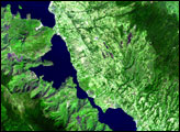
Acquired October 20, 2009, this high-resolution image of Chaitén Volcano shows a volcanic plume that appears almost white near the summit, likely due to high water content.
Published Oct 26, 2009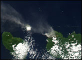
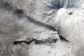
Tolbachik Volcano is not a single peak, but a complex of volcanic features superimposed on one another.
Published Apr 14, 2013