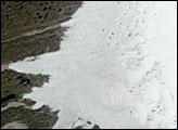
Although 2005 overall saw a new record, the extent of June melting in 2005 was unexceptional. The same held true for 2006, when this picture was taken.
Published Jun 30, 2006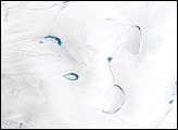
Thinner than the 2.3-kilometer-thick center, the outer edges of the Greenland ice sheet develop melt zones like the one shown here during the warm summer months.
Published Apr 7, 2007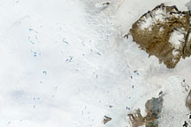
To understand ice sheets, glaciologists venture both below the surface with ice cores, and into the sky with satellites. Satellite imagery of the Greenland Ice Sheet reveals melt ponds that can affect glacier flow and sea level.
Published Oct 29, 2008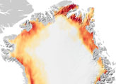
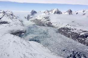
NASA aircraft return to the Arctic to assess the health of the region’s ice.
Published May 3, 2012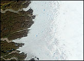
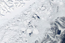
Acquired March 27, 2010, this natural-color image shows part of the southeastern coast of Greenland, fringed by multiple forms of sea ice: fast ice, multiyear ice fragments, and small pieces of ice shaped into swirls by currents.
Published Apr 2, 2010
Melt ponds on the surface of Greenland’s ice sheet are an important indicator of the strength of the 2013 melt season.
Published Jul 9, 2013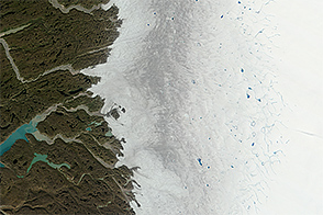
Melting of the Greenland Ice Sheet reveals impurity-rich ice that is thousands of years old.
Published Oct 28, 2014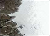
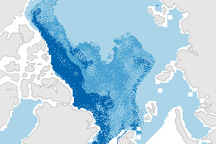
This pair of maps shows how the sea ice covering the Arctic at winter maximum in 2009 is younger than it was in the past.
Published Apr 10, 2009