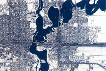
A second round of spring flooding on the Red River was captured in an astronaut photo from April 9, 2009.
Published Apr 27, 2009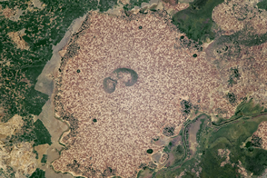
Standing beside floodplains and wetlands, the highlands are packed with farms.
Published Apr 3, 2017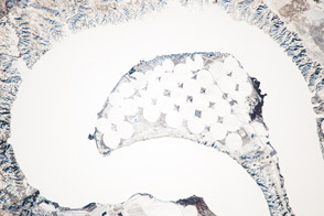
The meandering Missouri River doubled back on itself and formed this U-shaped lake.
Published Jan 13, 2014
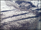
>The dark spikes slashing across this agricultural area between the Ob River and the Irtysh River (out of the view left) form a familiar visual cue for astronauts that they are flying over Western Siberia. The signature pattern across the center is made by forests in a great plain that has been folded by tectonic forces—the surface rock layers form a long series of gentle folds aligned NE-SW. The lower zones are darker because the snow disappears through the Scotch pine trees. The higher areas are occupied by numerous angular fields of the steppe, etched by snow.
Published Jun 1, 2003
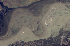
Acquired May 1, 2011, this natural-color image shows the James River completely filling the river valley near Jamesville, South Dakota.
Published May 3, 2011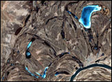
This false-color image from April 1, 2002, shows numerous braided channels and oxbow lakes along the Songhua River in northeastern China, just upstream of the city of Harbin.
Published Dec 27, 2005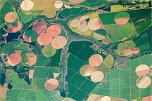
Astronaut photograph of the diverse agricultural landscape in the western part of Minas Gerais state in Brazil.
Published Feb 21, 2011
2013 brought record flooding to the Amur (Heilong) River.
Published Oct 27, 2013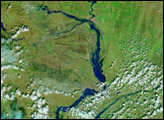
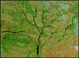
As the ground began to thaw and snow melted, the Dnieper River and its tributaries swelled with spring run-off. According to news reports, the rivers caused some damage as flood waters inundated small cities along their banks. The Moderate Resolution Imaging Spectroradiometer (MODIS) on the Aqua satellite captured this image of the river system on April 4, 2004. Four major rivers are shown running into the Dnieper, the large river that forms the trunk of this tree-like structure. On the far right is the Desna River, with the Seym River branching off of it. The center right branch is formed by the Sozh River and its tributaries. The center left branch is the Dnieper, and running into it from the top left is the Byarezina River. The far left branch is formed by the Prypyats River.
Published Apr 8, 2004