In the midst of a sharp cold snap, the Terra satellite captured this image of cloud streets over the Atlantic Ocean.
Published Jan 11, 2014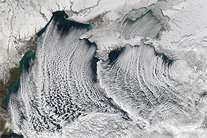
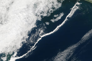
The Aqua satellite captured this image of cloud streets over the Black Sea in January 2015.
Published Jan 9, 2015
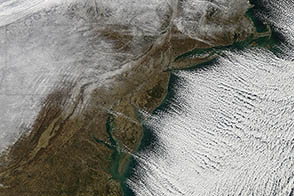
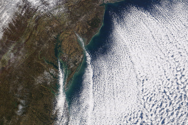
The MODIS instrument on NASA’s Terra satellite collected this natural-color view of cloud streets over the ocean off of New England and the Canadian Maritimes on January 24, 2011.
Published Feb 15, 2011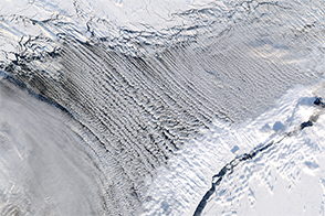
Cloud streets form thousands of feet above the Earth’s surface.
Published Mar 12, 2017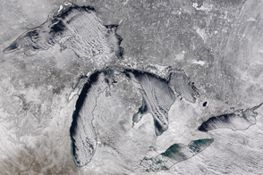
Long bands of cumulus clouds lined up over the Great Lakes in this spectacular display of “cloud streets.”
Published Feb 12, 2016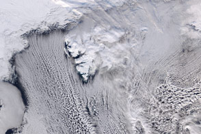
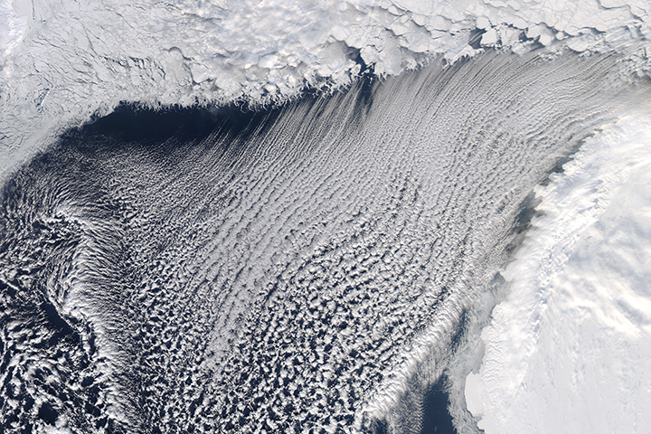
Cool air moving across Arctic sea ice gives rise to long parallel bands of cumulus clouds over the Norwegian Sea.
Published Mar 31, 2016Image of the Day Atmosphere Land Water Unique Imagery Snow and Ice
Cold air moving over relatively warm ocean water produced a pattern of clouds that lined up in organized rows.
Published Nov 14, 2019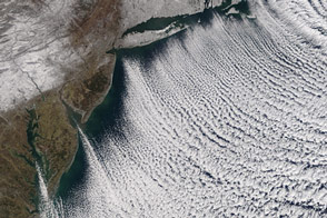
Valentine’s Day didn't warm a lot of hearts in the eastern United States.
Published Feb 16, 2016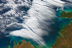
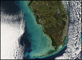
An uncommon display of cloud streets formed off of the northern coast of Australia.
Published Jul 24, 2016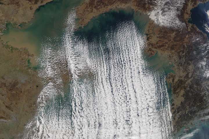
Cold and dry air from Siberia typically produce this cloud formation over the sea from November through January.
Published Jan 7, 2018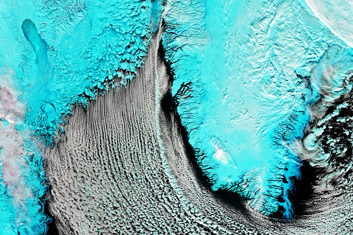
Cold winds blowing over the sea helped form rows of cumulus clouds.
Published Mar 4, 2020Image of the Day Atmosphere Water Unique Imagery Snow and Ice
Parallel rows of clouds can stretch for hundreds of kilometers over the open ocean.
Published Jul 27, 2013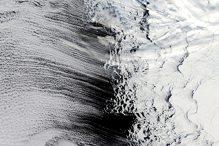
Cold air blows over warmer water to produce thin, parallel lines of clouds.
Published Oct 8, 2018
Downdrafts from thunderstorms sometimes fuel thin bands of cumulus clouds that race ahead of cold fronts.
Published Feb 13, 2016
South of the loosely packed ice in the northern part of the sea, parallel rows of clouds line up along the north-south axis of the wind. These “streets” of clouds form when cold air blows over the warmer, moister air that sits over the water.
Published Jan 15, 2008
Most of us prefer our winter roads free of ice, but some cloud formations depend on it.
Published Jan 12, 2012
Perhaps the most impressive of cloud formations, cumulonimbus (from the Latin for “pile” and “rain cloud”) clouds form due to vigorous convection (rising and overturning) of warm, moist, and unstable air. Surface air is warmed by the sun-heated ground surface and rises; if sufficient atmospheric moisture is present, water droplets will condense as the air mass encounters cooler air at higher altitudes. The air mass itself also expands and cools as it rises due to decreasing atmospheric pressure, a process known as adiabatic cooling. This type of convection is common in tropical latitudes year-round and during the summer season at higher latitudes.
Published Mar 10, 2008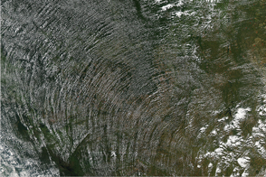
Puffy cumulus clouds spin around a high-pressure system in the Amazon rainforest.
Published Jun 19, 2014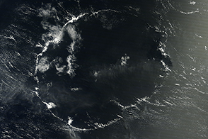
An open-celled cloud over the Pacific Ocean had a shape reminiscent of a certain circular letter of the alphabet.
Published Sep 27, 2014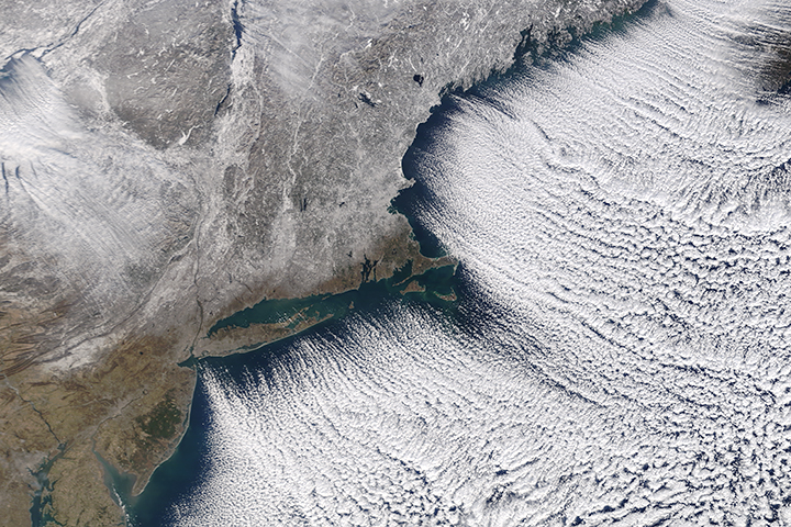
Blasts of Arctic air spilling into the Midwest and Northeast are poised to make New Year’s Eve frigid for many Americans.
Published Dec 29, 2017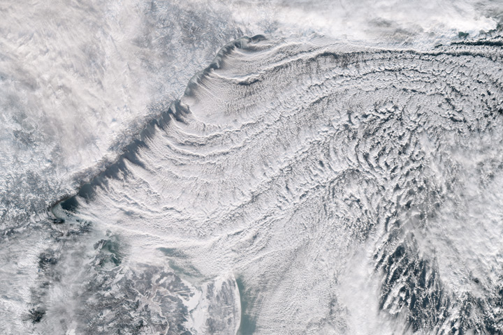
The Sea of Okhotsk is a winter ice factory and a year-round cloud factory.
Published Jan 3, 2018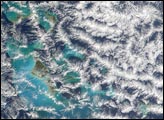
Cool air blowing southward across the sea ice and over the comparatively warmer open water produced long, parallel bands of cumulus clouds.
Published Mar 30, 2018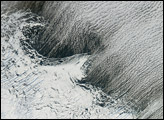
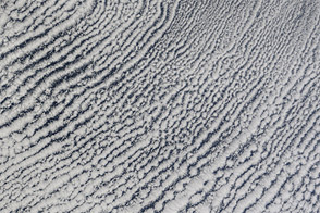
At mid- and high latitudes during the winter, clouds often form neat, parallel rows. Called cloud streets, these formations can persist for hundreds of kilometers if the land or water surface underneath is uniform.
Published Sep 15, 2006
Strong winds gusted over the Gulf of Mexico on December 16, 2007, and though the wind is invisible in these photo-like snapshots, its presence is written in the clouds and on the surface of the water.
Published Dec 19, 2007