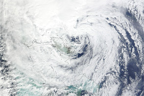
Acquired October 26, 2012, this natural-color image shows Hurricane Sandy east of Florida.
Published Oct 26, 2012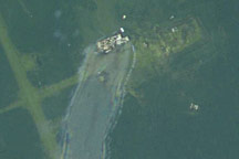
East of Galveston, Texas, a thin barrier beach—Bolivar Peninsula—stretches along the coastline. On the far eastern end of Bolivar Peninsula is High Island, so named for the salt dome that boosts the area some 11.6 meters (38 feet) above the rest of the Gulf Coast. After Hurricane Ike passed, rescuers combed through the destroyed communities along Bolivar Peninsula. Thanks to its elevation, High Island fared better than other parts of the Peninsula.
Published Sep 20, 2008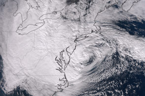
The dramatic late-season storm was observed shortly before making landfall on the U.S. Northeast Coast.
Published Oct 30, 2012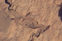
Acquired on May 23, 2010, this natural-color image shows the Colorado Plateau’s Rainbow Bridge, a natural sandstone arch, casting a slim shadow to the northwest.
Published May 30, 2010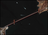
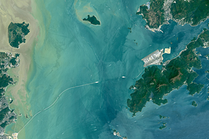
Once completed, the Hong Kong-Zhuhai-Macau Bridge will be one of the longest water crossings in the world.
Published May 15, 2016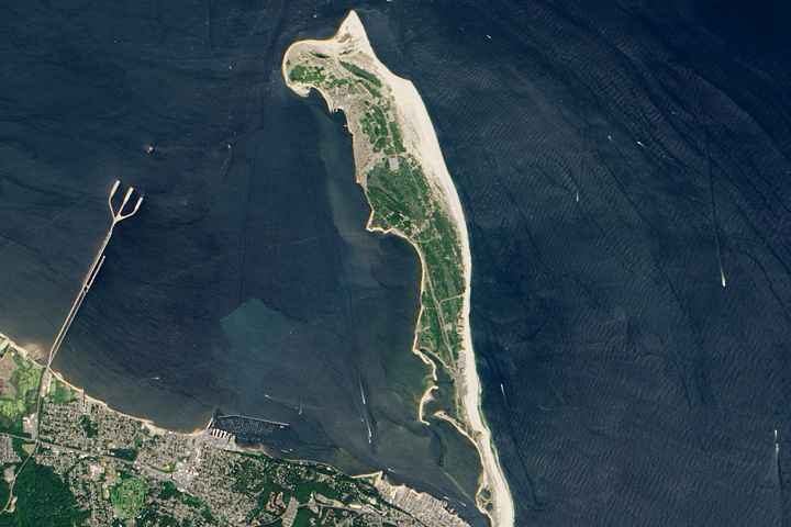
A beach oasis stands within a few miles of the densest urban area in the United States.
Published Jul 16, 2017

Acquired October 23, 2012, this image shows Tropical Storm Sandy over the Caribbean Sea.
Published Oct 25, 2012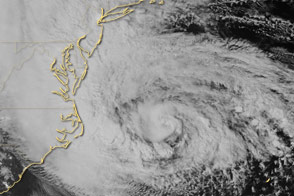
Special sensors on the Suomi NPP satellite captured this view of the storm and the East Coast.
Published Oct 29, 2012
Acquired August 28, 2011, this aerial photo shows damage to Highway 12 on North Carolina’s Outer Banks. Highway breaches stranded at least 2,500 residents of Hatteras Island.
Published Aug 30, 2011