A U.S. geostationary weather satellite captured this image of the storm on the afternoon of October 28, 2012.
Published Oct 28, 2012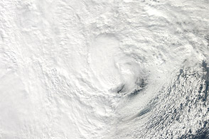
NASA’s Aqua satellite acquired this natural-color view of the storm just before it hit New Jersey.
Published Oct 29, 2012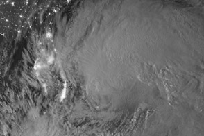
This satellite image shows the cloud tops of Hurricane Sandy lit by a nearly full moon.
Published Oct 26, 2012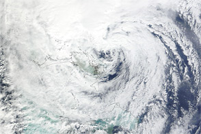
Acquired October 26, 2012, this natural-color image shows Hurricane Sandy east of Florida.
Published Oct 26, 2012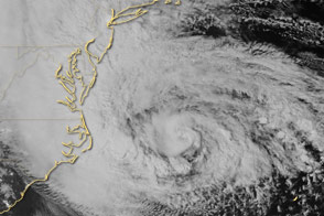
Special sensors on the Suomi NPP satellite captured this view of the storm and the East Coast.
Published Oct 29, 2012
Acquired October 23, 2012, this image shows Tropical Storm Sandy over the Caribbean Sea.
Published Oct 25, 2012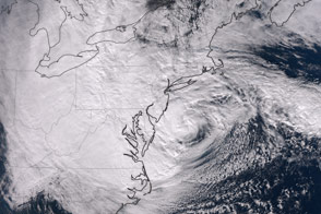
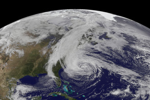
The dramatic late-season storm was observed shortly before making landfall on the U.S. Northeast Coast.
Published Oct 30, 2012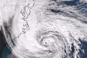
The VIIRS instrument on the Suomi NPP satellite captured this afternoon view of the dangerous storm.
Published Oct 28, 2012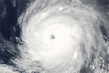
Acquired June 24, 2010, this natural-color image shows powerful Hurricane Celia over the Pacific Ocean.
Published Jun 26, 2010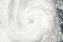
Acquired August 27, 2010, this natural-color image shows Hurricane Danielle over the Atlantic Ocean.
Published Aug 27, 2010