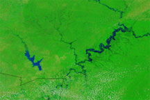
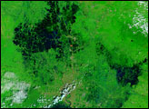
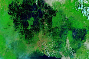
Satellite images show stark changes around the confluence of the Niger and Benue Rivers, in a region where more than a million people have been displaced in 2012.
Published Oct 16, 2012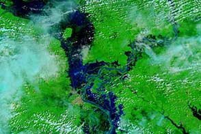
The lower Mekong River caused widespread flooding in Cambodia.
Published Oct 21, 2013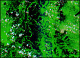
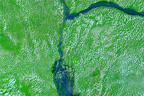
Acquired on August 28 and September 8, 2009, these false-color images show swollen waterways in southeastern Burkina Faso and the surrounding region.
Published Sep 8, 2009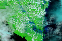
Crops, roads, and homes were all swamped when rivers burst their banks in southern Sumatra in late December 2008.
Published Jan 6, 2009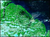
Acquired in November 2008 and 2011, these images compare conditions in Bangkok, where floods crept toward the city center in 2011.
Published Nov 8, 2011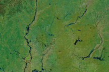
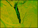
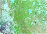
Swollen rivers and greening land in this image of southern Indiana on March 1, 2011, are signs that spring is approaching.
Published Mar 3, 2011