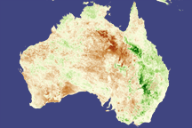
La Niña’s fingerprint is all over plants in eastern Australia and southern Africa in this pair of vegetation images from the SPOT satellite.
Published Mar 15, 2008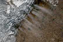
This photo-like image paints a picture of the movement of air and weather over the Ural Mountains in southern Russia, with the western mountains covered with snow and the eastern plain dry. The image also illustrates the influence of the mountains on cloud formations.
Published Nov 21, 2008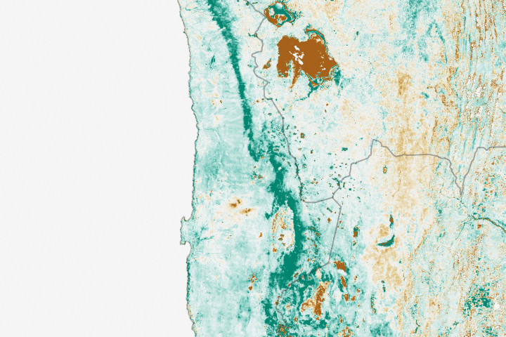
A burst of wildflowers and other plant growth followed damaging floods in northern Chile.
Published May 2, 2019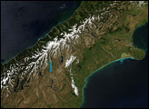
Colors ranging from deep brown to stark white give New Zealand’s South Island its intense beauty. The snow-capped Southern Alps run down the northern shore of the island. The mountains are rising as the Pacific Plate, the section of the Earth’s crust that holds the Pacific Ocean, including parts of New Zealand’s South Island, sinks beneath the Australia Plate, which holds the rest of New Zealand.
Published Dec 22, 2007
This cut-away-view of two common weather patterns is providing insight that could improve your weather forecast.
Published May 13, 2011
The Cascades, Rockies, and Coast Mountains divide the damp coastal and dry interior landscapes of British Columbia, Washington, and Oregon.
Published Jun 22, 2015
December rains and groundwater pumping keep vegetation looking green amidst a deep drought.
Published Feb 26, 2015
In late April 2006, a spring snow storm hammered the northern Plains of the midwestern United States.
Published Apr 20, 2006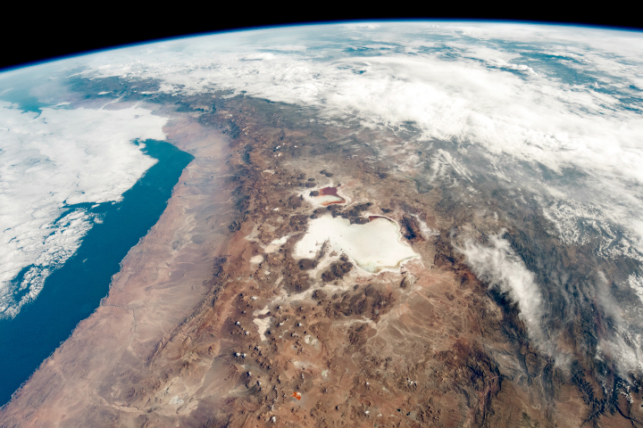
High altitudes in the Andes beget salt flats and rain shadows along the border of Chile and Bolivia.
Published Apr 14, 2019
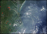
Smoke from fires in southwestern Oregon drifted over much of Oregon in this true color image from late September 2009. The associated aerosol image reveals that the smoke reached as far east as eastern Montana and central Canada, illustrating that pollution travels long distances.
Published Oct 21, 2009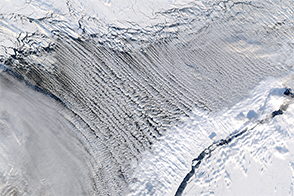
Cloud streets form thousands of feet above the Earth’s surface.
Published Mar 12, 2017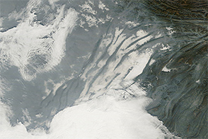
Haze, clouds, and fog mingled in China’s Sichuan Basin on December 24, 2014.
Published Dec 26, 2014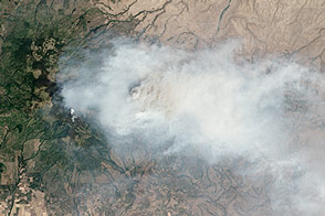
Landsat 8 captured this view of smoke billowing from a wildfire in southern Washington on July 28, 2013.
Published Jul 31, 2013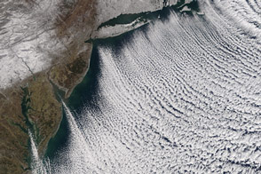
Valentine’s Day didn't warm a lot of hearts in the eastern United States.
Published Feb 16, 2016