At the surface, moisture is more abundant than in 2012. But time will tell if it seeps down to restore aquifers parched by drought.
Published Jun 18, 2013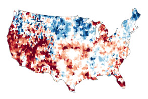
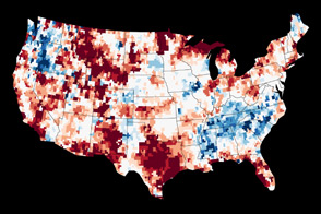
Dry conditions at the surface in the continental United States are mirrored underground in many places.
Published Jul 24, 2014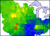
These images show how terrestrial water storage in the four major sub-basins of the United States’ Mississippi River basin differed from average in January and July 2005.
Published Jan 26, 2007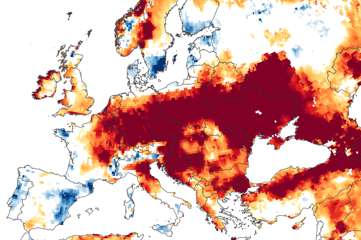
Long-term rainfall deficits, heat waves, and increased evaporation have depleted some of the groundwater supply beneath central and eastern Europe.
Published Jun 25, 2020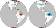
In much of the world, differences in seasonal precipitation—and in how that water gets stored on land—are big enough to affect Earth’s gravity field.
Published Oct 22, 2010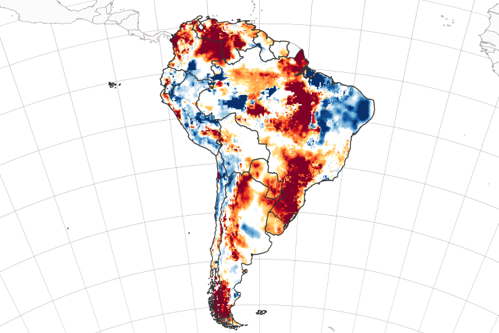
Twin satellites are assessing the state of soil moisture and groundwater on the continent and around the world.
Published Apr 6, 2020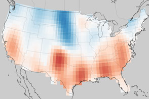
Groundwater supplies are decreasing across much of the world.
Published Nov 1, 2013
An arid region grew even drier between 2003 and 2009 due to human consumption of water for drinking and agriculture.
Published Mar 13, 2013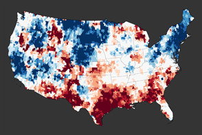
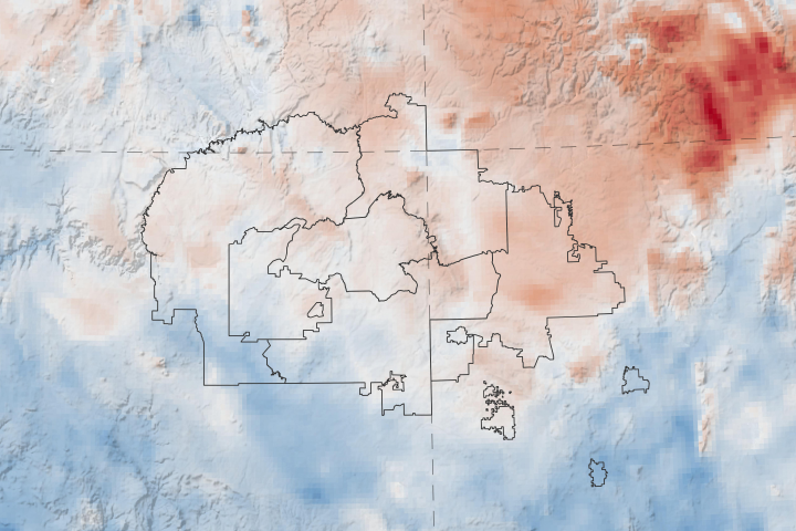
A new map reveals the extreme depletion of groundwater in Texas and other parts of the southern United States due to drought.
Published Dec 1, 2011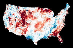
Though a series of winter storms provided some relief, a pair of satellites operated by NASA shows that groundwater supplies remained unusually low in many parts of the country.
Published Jan 19, 2013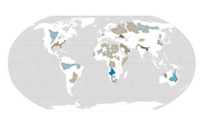
About one third of Earth’s large groundwater basins are being rapidly depleted by human consumption even though we have little accurate data about how much water remains in them.
Published Jul 24, 2015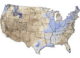
A new web tool designed by NASA applied scientists could help the tribe anticipate and respond to drought.
Published Apr 20, 2020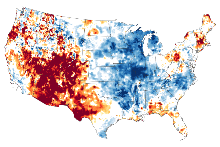
The failure of the summer monsoon and other moisture carrying systems has parched more than 90 percent of some states.
Published Aug 13, 2020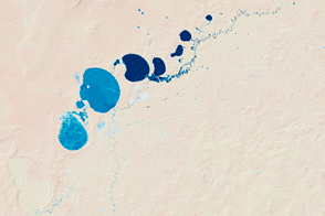
New maps show the fluctuating river and lake levels in the Murray-Darling Basin.
Published Jul 16, 2016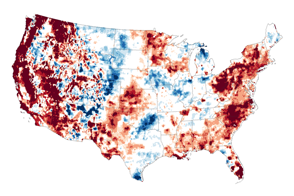
In mid-September 2015, water stored near the surface and underground in the U.S. West was far-below-normal.
Published Sep 18, 2015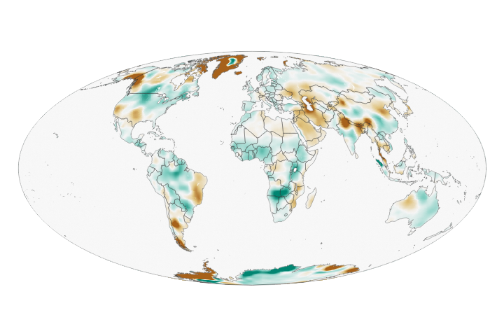
Wet landscapes are getting wetter and dry areas are getting drier due to a variety of factors, including water management, climate change, and natural cycles.
Published May 23, 2018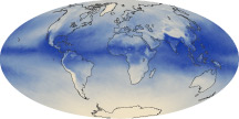
The tiny amount of water vapor in our atmosphere has an outsized influence on the planet as a potent greenhouse gas.
Published Oct 7, 2010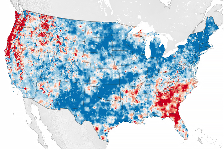
Scientists have developed a new way to measure water cycle intensity over time.
Published Jul 26, 2019
Earth is a water planet. Three-quarters of the planet’s surface covered by ice or oceans, and the sky is filled with clouds.
Published Oct 2, 2010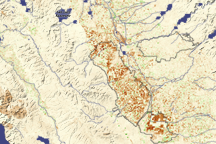
Dark brown squares mark fields that would ordinarily support irrigated crops in California’s Central Valley in this vegetation image. In 2009, a lack of water meant that the crops were not growing well or the fields lay fallow.
Published Aug 16, 2009