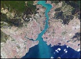
This metropolis of 15 million people occupies both sides of the entrance to the narrow, 20-mile long Bosporus Strait connecting the Mediterranean and Sea of Marmara (south) to the Black Sea (north). From its founding as Byzantium by the Greeks in 600 B.C., this strategically located city has been a focus of maritime trade and commerce as well as an outpost and threshold for cultural exchange and conflict between Europe and Asia. This digital camera image was taken by the crew of the International Space Station on April 16, 2004. When this image was taken, strong currents carried turbid coastal waters from the Black Sea through the Strait and into the Sea of Marmara.
Published May 10, 2004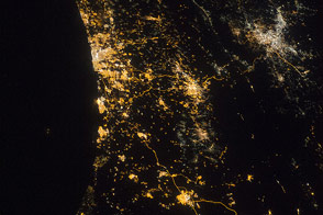
The bright lights of the cities are intersected and offset by the dark valley of the Jordan River and Dead Sea.
Published Aug 18, 2014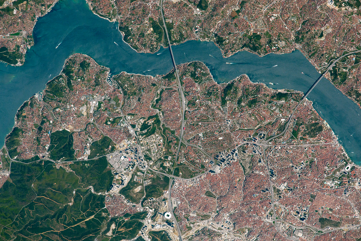
The famous strait bisects Turkey’s largest city and marks the line between Europe and Asia.
Published Sep 25, 2017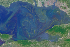
Freshened surface water and abundant nutrients lead to an explosion of algae in the inland sea.
Published May 31, 2015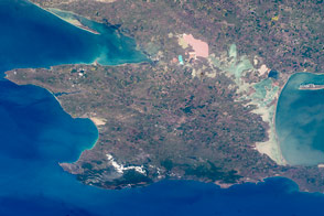
Crimea is a small piece of the world with a large role in modern history.
Published Feb 29, 2016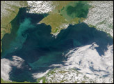
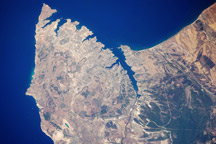
The urban landscape of Sevastopol, on the Ukrainian coast of the Black Sea, is featured in this astronaut photo from August 5, 2009.
Published Aug 24, 2009
Milan, the largest city in Italy, is one of Europe’s major transportation, industrial, and commercial hubs, and a global center of fashion and culture.
Published Mar 14, 2011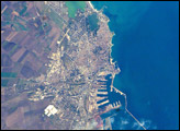
The modern city of Constanta, is located on the western coast of the Black Sea and is the principal seaport for Romania. It is the site of the ancient Greek city of Tomis It acquired its current name from the emperor Constantine I. Today, Constanta is a thriving port-of-entry for Romania, offering both tourist attractions and an expanding, modern port facility that is among the largest on the Black Sea.
Published Nov 17, 2002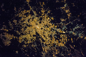
The radial pattern of highways echoes the ancient saying that “all roads lead to Rome.”
Published Jul 28, 2016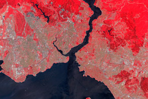
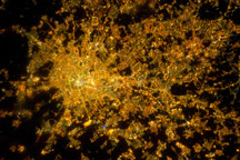
The population of Turkey’s economic and cultural center has exploded in recent decades.
Published Jan 28, 2012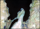
The lowest spot on dry land, the Dead Sea depression sinks 400 meters (1,300 feet) below sea level.
Published Nov 12, 2006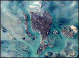
The compact Italian city of Venice with its renowned canals is situated on a small, fish-shaped island in the Laguna Veneta at the northwest corner of the Adriatic Sea. In this photo taken from the International Space Station by the Expedition 1 Crew on February 21, 2001, one can see part of the causeway connecting the city to the mainland. The sinuous Canal Grande bisecting the city is easily visible in this scene as is the larger Canal Giudecca to the west, which leads to the port facilities on the northwestern end of the island. For centuries, the low-lying city has successfully coped with the three-foot tidal range experienced at this end of the Adriatic Sea, and the series of barrier islands has offered some protection from storm waves. However, a combination of both regional land subsidence and recent slight rises in sea level pose a significant threat this historic city and its priceless art treasures.
Published Jul 8, 2001
The arrow-shaped island in the Aral Sea used to be a 35-kilometer-long visual marker, indicating the Aral Sea to astronauts. An image from the present International Space Station increment shows how much the coastline has changed as the sea level has dropped during the last three decades.
Published Aug 15, 2005