
Acquired April 2, 2011, and February 27, 2011, these natural-color images show rising waters on the Kuiseb River, which flowed all the way to the Atlantic Ocean for the first time in decades.
Published Apr 12, 2011
In the past few centuries, a river in northwestern Canada stopped wandering and assumed a more direct route to the sea.
Published Sep 4, 2012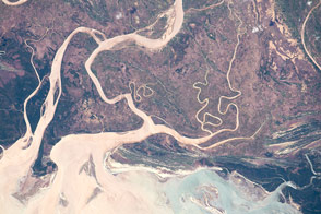
Muddy river flow builds up the delta and the coastline on the island’s west coast.
Published May 4, 2015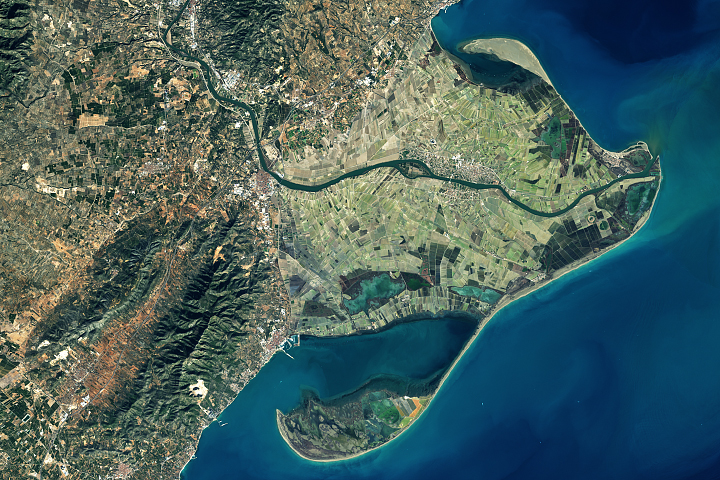
Spain's Ebro Delta has recently experienced tremendous shape-shifting.
Published Mar 13, 2018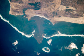
An astronaut shot this photograph of a complex shoreline environment in southern Madagascar.
Published Oct 12, 2015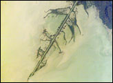
The Ural River is one of the two major rivers (the other is the Volga) that empty into the northern coast of the Caspian Sea, creating extensive wetlands. This image shows details of the Ural’s tree-like (or “digitate”) delta. This type of delta forms naturally when wave action is low, and sediment content in the river is high. New distributary channels form in the delta when the river breaches natural levees created by sediment deposition. The long main channel of the river in this image and several of the distibutary channels are too regular to be entirely natural, however. Like the famous Mississippi River delta in the United States, the Ural River delta has been significantly modified to reduce flooding and divert water.
Published Jun 6, 2005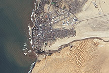
Acquired April 2, 2011, this natural-color image shows the Swakop River draining into the Atlantic Ocean just south of Swakopmund.
Published Apr 12, 2011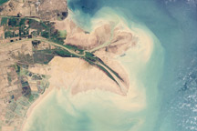
Chinese engineers changed the main channel through the delta, changing the shape of the land at the river’s mouth.
Published Jan 27, 2010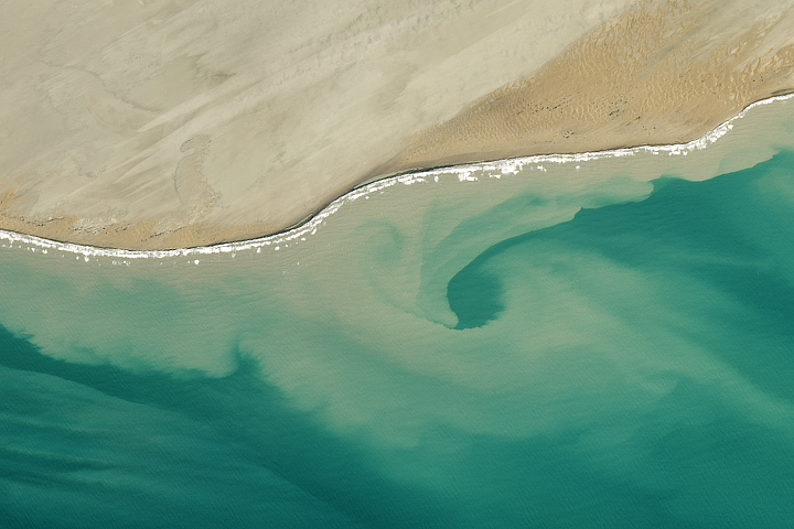
Currents and sediment created a swirl-like pattern in the Arabian Sea near Pakistan.
Published Jul 29, 2017
The Ebro River Delta, located along the eastern coast of Spain, is one of the largest wetland areas in the western Mediterranean region.
Published Jul 26, 2004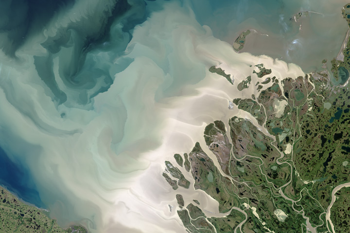
Canada’s largest and longest river delivers vast amounts of fresh water and sediment to the sea.
Published Aug 6, 2017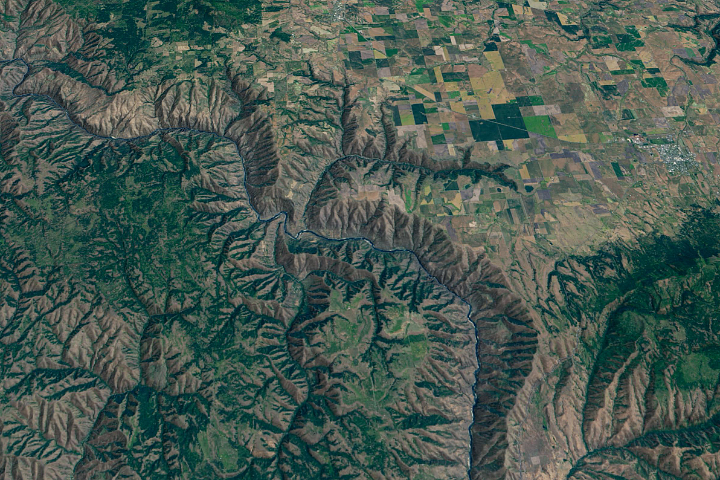
The Salmon River in Idaho, one of the longest free-flowing rivers in the United States, rushes through a geologic wonderland of wooded ridges, eroded bluffs, and stone towers and crags.
Published Jul 22, 2020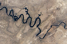
In September 2010, water again flowed through this riverbed after several dry years.
Published Oct 8, 2010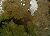
Russia’s Ob River flows from south to north, and each summer, it thaws in the same direction. The result is that an ice jam sits downstream from thawed portions of the river, which is laden with heavy runoff from melted snow.
Published Jul 11, 2007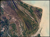
This astronaut photograph highlights an ancient shoreline, or strandplain, on the coast of Brazil. The image is dominated by numerous fine, parallel lines (trending diagonally from upper left to lower right), each of which is an ancient shoreline made up of sand transported from rivers to the north.
Published Mar 19, 2007