The Zagros Mountains in southwestern Iran present an impressive landscape of long linear ridges and valleys. Formed by collision of the Eurasian and Arabian tectonic plates, the ridges and valleys extend hundreds of kilometers. Stresses induced in the Earth’s crust by the collision caused extensive folding of the preexisting layered sedimentary rocks. Subsequent erosion removed softer rocks, such as mudstone and siltstone while leaving harder rocks, such as limestone and dolomite. This differential erosion formed the linear ridges of the Zagros Mountains. This astronaut photograph of the southwestern edge of the Zagros mountain belt includes another common feature of the region—a salt dome (Kuh-e-Namak or “mountain of salt” in Farsi).
Published Apr 17, 2006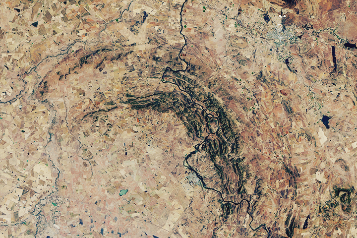
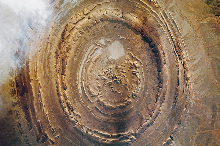
The world’s oldest and largest known impact structure shows some of the most extreme deformation conditions known on Earth.
Published Sep 1, 2018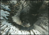
This geologic feature has captured the attention of astronauts for about as long as NASA has sent humans into orbit around Earth.
Published Apr 29, 2018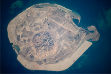
This astronaut photograph illustrates the varying character of surfaces on Sir Bani Yas, an island in the Persian Gulf near the west coast of the United Arab Emirates.
Published Mar 15, 2010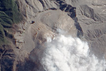
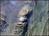
Fresh lava domes fill most of the 10,000-year old caldera of Chaitén volcano.
Published Oct 1, 2009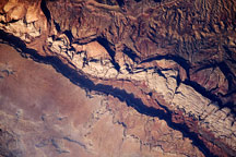
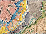
One hundred million years of rock formation are visible in exposed layers at Waterpocket Fold in Capital Reef National Park. This astronaut photo from June 14, 2009, shows the layered, multi-colored rock formations.
Published Jul 6, 2009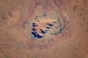
This ancient rock is one of Australia’s major tourist attractions and a sacred place for indigenous people.
Published Dec 19, 2016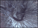
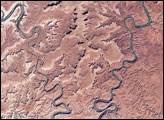
This park in Utah encompasses some of the most remote and rugged terrain in the continental United States.
Published Jan 3, 2008