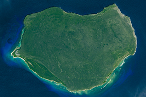
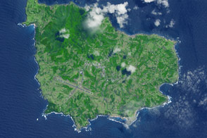
The small Puerto Rican island is a natural reserve that has been nicknamed the “Galapagos of the Caribbean.”
Published Feb 28, 2016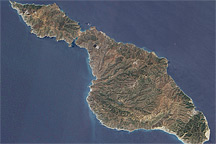
Off the coast of California, rugged Santa Catalina Island is encircled by a white perimeter of breaking waves in this satellite image from May 11, 2010.
Published Jun 6, 2010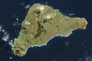
The island once looked very different from how it does today.
Published Apr 16, 2017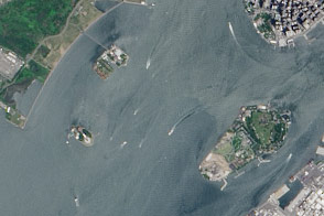
A pair of modest oyster flats turned into two of most important islands in the United States.
Published Mar 20, 2016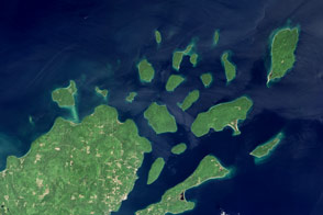
Lighthouses and sandstone formations draw visitors to the shores of Lake Superior.
Published Aug 28, 2016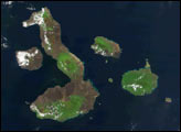
A 35-square-kilometer island rises from the Pacific Ocean about 1,400 kilometers from the Australian mainland.
Published May 23, 2015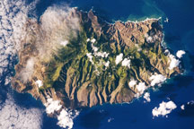
This astronaut photo shows the sharp peaks and deep ravines of Saint Helena Island, in the remote South Atlantic Ocean.
Published Jun 15, 2009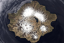
Semisopochnoi is the “Island of the Seven Mountains, ” or more precisely in Russian: “having seven hills.” This uninhabited volcanic island is also an important nesting area for maritime birds of the North Pacific.
Published Dec 29, 2010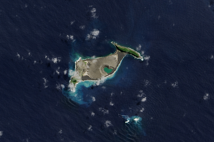
Hunga Tonga-Hunga Ha'apai is likely to persist for years, maybe decades.
Published Dec 11, 2017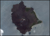

This photo-like image of Chincoteague Island and the southern section of Assateague was acquired by the IKONOS satellite on June 27, 2001.
Published Oct 28, 2008
This natural-color image shows Henrietta Island, with a smooth, dome-capped surface and a rugged coastline, illuminated by low-angled sunlight.
Published May 3, 2009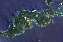
Acquired September 17, 2005, this true-color image shows Tortola, the largest of the British Virgin Islands. Also shown are Tortola’s smaller neighbors: Guana Island, Grand Camanoe, and Beef Island.
Published Nov 29, 2009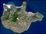
The Aeolian Islands formed from a chain of volcanoes in the Tyrrhenian Sea north of the island of Sicily. Geologists and volcanologists have studied the islands since the eighteenth century, and the United Nations Educational, Scientific, and Cultural Organization (UNESCO) declared them a World Heritage Site in 2000 because of their value to the study of volcanic processes.
Published Sep 1, 2008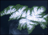
Attu Island is so far west, it’s actually in the Eastern Hemisphere. It is the westernmost of Alaska’s Aleutian Islands, even farther west than the Hawaiian Islands.
Published Jul 5, 2006