Record heat helped fuel a wildfire north of Colorado Springs that destroyed more than 360 homes in June 2013.
Published Jun 14, 2013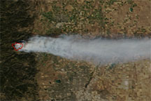
Acquired September 6, 2010, this natural-color image shows a river of smoke flowing eastward from a wildfire west of Boulder, Colorado.
Published Sep 8, 2010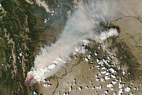
A fire began burning in Bridger-Teton National Park on June 24, 2012.
Published Jun 29, 2012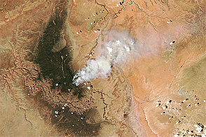
Fire charred forests along the North Rim of the Grand Canyon in July 2016.
Published Jul 20, 2016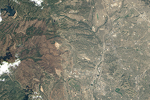
Development on the edge of the wilderness is increasing the risk of destructive wildfires in Colorado.
Published Nov 8, 2013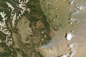
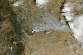
Intense wildfires burned in Colorado on June 11, 2013.
Published Jun 13, 2013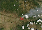
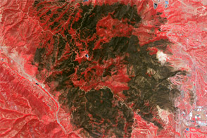
The Waldo Canyon Fire, the most destructive in Colorado history, charred thousands of acres near Colorado Springs.
Published Jul 6, 2012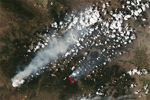
Acquired June 23, 2012, this image shows wildfires burning across Colorado, including the second-largest fire in Colorado history.
Published Jun 26, 2012
The fast-moving King fire burned in Eldorado National Forest in September 2014.
Published Sep 18, 2014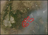

On May 2, 2013, the MODIS instrument on NASA’s Aqua satellite captured this view of wildfires burning near Lassen Volcanic National Park.
Published May 3, 2013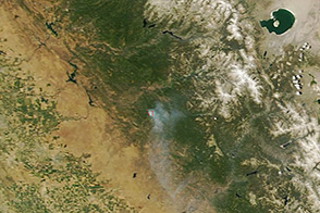
On June 17, 2013, NASA’s Terra satellite captured this image of the Carstens fire burning southwest of California’s Yosemite National Park.
Published Jun 19, 2013