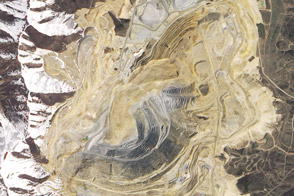
A massive landslide occurred at Utah’s Bingham Canyon Mine on April 10, 2013. It was the largest non-volcanic landslide on record in North America.
Published Jun 13, 2013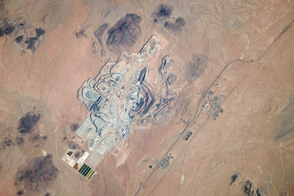
One of Earth’s richest borate deposits is at the center of the largest open-pit mine in California.
Published Nov 11, 2013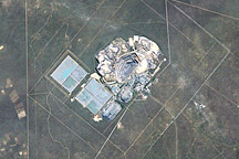
otswana ranks first among the world’s gem-quality diamond producers, and diamond mining makes up 70 percent of the nation’s export revenue. The Jwaneng Diamond Mine, in south-central Botswana, sits atop the convergence of three kimberlite pipes—diamond-rich geologic formations. Because the pipes meet just below the surface and cover some 520,000 square meters (128.5 acres) at ground level, the diamonds are mined from an open pit rather than a mine tunneled below the surface.
Published Oct 26, 2008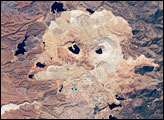
One of the largest open-pit copper mines in the world, the Cananea mine produced over 164,000 tonnes of copper in 2006. The active, 2-kilometer-diameter Colorada Pit is recognizable by the concentric steps, or benches, cut around its perimeter.
Published Apr 21, 2008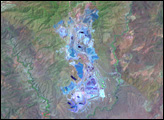
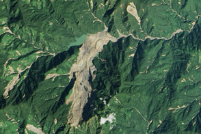
Heavy rainfall from tropical storm Komen triggered a large landslide in Myanmar (Burma).
Published Nov 8, 2015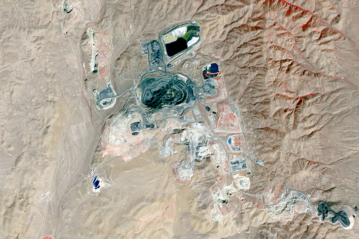
Northeastern Nevada has a geological feature rich with gold.
Published Aug 27, 2017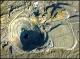
Although this photograph may appear to be a small pit mine as seen from the air, it is actually a pit mine that is about a mile wide and just over a thousand feet deep as photographed by astronauts orbiting the Earth on board the International Space Station. The New Cornelia Mine is located just south of Ajo, Arizona. Small-scale mining of copper in this area began with the Spaniards and Mexicans as early as 1750. This large-scale, systematic operation began in 1912 and expanded rapidly for the next 50 years. Since the mid 1980s, activity has been limited because of low prices for copper on the world market. Note the tailings deposits to the east (right) and the larger containment ponds for extraction processes to the northeast.
Published Jun 23, 2002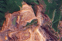
The terraced layers of red earth that make up the Carajás Iron Ore Mine contrast with the deep green Amazon Rainforest in this cloud-free image.
Published Jul 29, 2009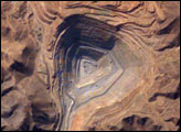
The rugged, mineral-rich Andes support some of the world’s biggest mines (gold, silver, copper, and more). This image looks down the bullseye of Peru’s Toquepala copper mine, a steep sided and stepped open-pit mine.
Published Oct 13, 2003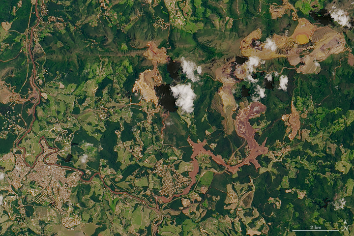
A torrent of waste sludge from an iron mine has devastated a small town in Minas Gerais.
Published Feb 1, 2019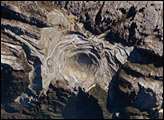
Located in the Sudirman Mountains of the Irian Jaya province of Indonesia, the Grasberg complex is one of the largest gold and copper mining operations in the world.
Published Aug 1, 2005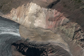
A combination of seismographic data and satellite imagery is making it easier for scientists to locate elusive landslides. In summer 2013, Landsat 8 helped pinpoint a slide in eastern Alaska.
Published Aug 30, 2013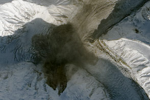
Using seismometers and satellites, scientists identified a large landslide in southwestern Yukon.
Published Oct 20, 2015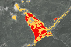
New open-source software called SLIP-DRIP uses satellite images and rainfall data to help identify otherwise overlooked landslides.
Published Jul 8, 2016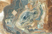
Acquired December 4, 2009, this true-color image shows the Sunrise Dam Gold Mine, roughly 55 kilometers (35 miles) south of Laverton, Western Australia.
Published Dec 20, 2009