
In August 2010, Lake Mead reached its lowest level since 1956, the result of a persistent drought and increasing human demand.
Published Sep 23, 2010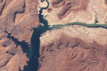
In the early twenty-first century, Lake Powell faced the combined threats of drought and rapid water withdrawals.
Published May 13, 2009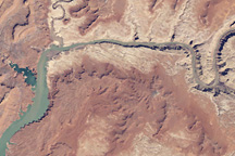
This April 7, 2010, image from Landsat 5 shows water levels in Lake Powell on the Colorado River.
Published May 12, 2010
Parts of the Glen Canyon that John Wesley Powell explored in 1869 have been submerged by Lake Powell.
Published Oct 16, 2016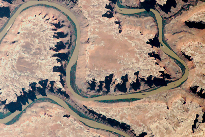
The old river has cut compelling patterns and formations into the red rocks of Utah.
Published Sep 18, 2018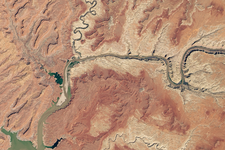
Heavy winter and spring snowfall provided much-needed meltwater, but the effects of long-term drought mean the lake is nowhere near its highs from the 1980s and 90s.
Published Oct 1, 2019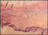
he largest tributary of the Colorado River between Lake Powell and the Grand Canyon, the Paria River flows southeast from its headwaters in southernmost Utah to join the Colorado River between Page, Arizona, and Marble Canyon. The Paria River provides spectacular scenery, and is known for the very narrow “slot” canyons that it cuts through the layered rocks of the Colorado Plateau.
Published Jun 23, 2008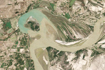
Between 1992 and 2009, a section of the lower Indus River changes course following the formation of an oxbow lake.
Published May 9, 2010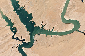
In spring 2014, visitors to Lake Powell will find beaches and rock formations that are usually underwater. After several years of drought, the reservoir has dropped below 50 percent capacity.
Published May 22, 2014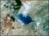
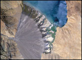
Meltwater from glaciers to the east and west drains into Lake Morari, a large lake that lies at an altitude of 4,521 meters (14,830 feet) on the Tibetan Plateau. A stream on the west side provides the lake’s main inflow. Mud from this river gives the light blue hues to the lake water. The well-formed alluvial fan (image center), built by sediment from the main inflow river, is the reason the lake has formed at this point in the valley.
Published Dec 18, 2006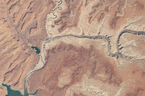
The last decade has been rough for the reservoir at the heart of the intricate water storage system that sustains the American Southwest.
Published May 10, 2013
Surging with fresh water from heavy winter snow melt, Lake Powell rose significantly in the summer of 2011 after many years of low levels.
Published Aug 12, 2011