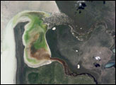
Etosha Pan in northern Namibia is a large, dry lakebed in the Kalahari Desert. The 120-kilometer-long (75-mile-long) lake and its surroundings are protected as one of Namibia’s largest wildlife parks. About 16,000 years ago, when ice sheets were melting across Northern Hemisphere land masses, a wet climate phase in southern Africa filled Etosha Lake. Today, Etosha Pan is seldom seen with even a thin sheet of water covering the salt pan. This astronaut photograph shows the point where the Oshigambo River runs into the salt lake during an unusually wet summer in southern Africa, in March 2006.
Published May 1, 2006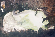
Flood water in the Oshigambo River, resulting from heavy rains in Angola, appears as a gray stream entering the northwest corner of Namibia’s Etosha Pan in this astronaut photo from March 26, 2009.
Published Apr 13, 2009
For more than 100 years, groups in the western United States have fought over water. During the 1880s, sheep ranchers and cattle ranchers argued over drinking water for their livestock on the high plains. In 1913, the city of Los Angeles began to draw water away from small agricultural communities in Owen Valley, leaving a dusty dry lake bed. In the late 1950s, construction of the Glen Canyon Dam catalyzed the American environmental movement. Today, farmers are fighting fishermen, environmentalists, and Native American tribes over the water in the Upper Klamath River Basin. The Landsat 7 satellite, launched by NASA and operated by the U.S. Geological Survey, documented an extreme drought in the area along the California/Oregon border in the spring of 2001.
Published Sep 8, 2001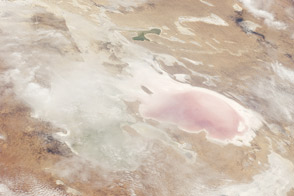
Lake Eyre did something in 2011 that it doesn’t do very often: it took on new water.
Published Dec 19, 2011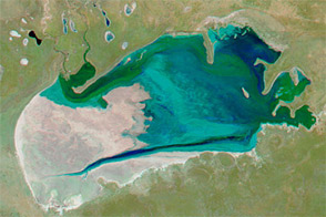
Acquired at the end of July in 2009, 2010, 2011, and 2012, these false-color images show changing conditions in Namibia’s Etosha Pan.
Published Sep 2, 2012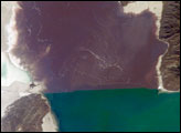
The Great Salt Lake of northern Utah is a remnant of glacial Lake Bonneville that extended over much of present-day western Utah and into the neighboring states of Nevada and Idaho approximately 32,000 to 14,000 years ago. The north arm of the lake, displayed in this astronaut photograph from April 30, 2007, typically has twice the salinity of the rest of the lake due to impoundment of water by a railroad causeway that crosses the lake from east to west. The causeway restricts water flow, and the separation has led to a striking division in the types of algae and bacteria found in the north and south arms of the lake.
Published Jul 16, 2007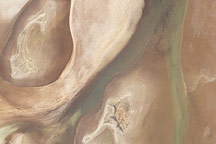
Acquired on April 10, 2010, and and March 7, 2009, these natural-color images show changes in a central Australian saltpan, Lake Frome. In 2010, water has seeped into the salt lake, leaving standing water in some areas and muddying much of the ground surface.
Published Apr 14, 2010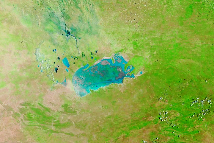
For much of the year, the salt pan is bone dry. But when the wet season brings abundant rains, the large, shallow basin becomes a temporary oasis.
Published Jan 21, 2020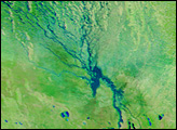

Ongoing drought and diminished snowpack in the Rockies have combined with increasing demands downstream to cause the great reservoir to drop to historically low levels.
Published Aug 1, 2014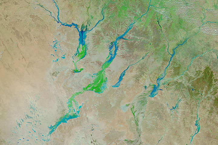
Big rain events in Queensland can alter the landscape for months as water—and then a carpet of vegetation—moves toward Lake Eyre.
Published Apr 3, 2019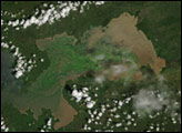
Native to the tropics of South America, the water hyacinth now thrives on every continent except Europe. It was introduced in Africa around 1879, and 110 years later, established itself on the continent’s largest lake, Lake Victoria.
Published Feb 21, 2007
In May 2016, the reservoir behind Hoover Dam reached its lowest level since the 1930s.
Published May 27, 2016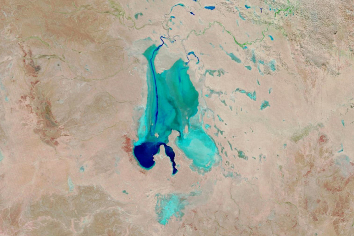
Floodwaters have worked their way through a series of parched channels, watering holes, and lagoons to start filling the iconic Australian lake.
Published May 28, 2019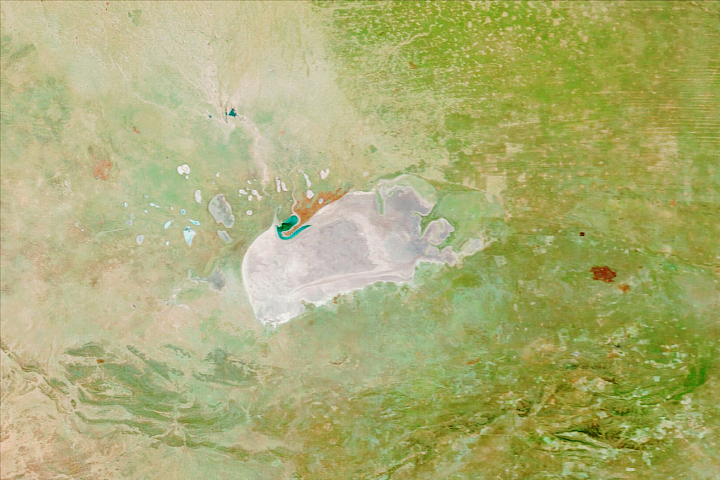
Repeated pooling and evaporation of water built this expansive salt pan in northern Namibia.
Published Sep 14, 2020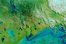
Acquired March 20, 2011, and March 17, 2010, these false-color images show evidence of unusually heavy precipitation in 2011.
Published Mar 24, 2011