
In the Jordan rift valley, the continents of Africa and Asia are pulling apart from each other, and the land in between has been subsiding for millennia. The sinking has created the Dead Sea.
Published Dec 25, 2005
As water levels drop in the Dead Sea, salt is piling up on the lakebed.
Published Jul 31, 2019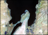
The lowest spot on dry land, the Dead Sea depression sinks 400 meters (1,300 feet) below sea level.
Published Nov 12, 2006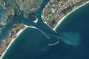
The waters that once protected Venice now threaten it. A complex engineering project is being installed to beat back the tide.
Published Mar 25, 2014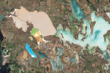
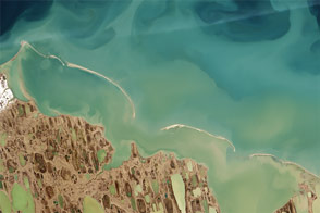
Acquired on June 6, 2010, this natural-color image shows brightly hued waters in a network of salt marshes between the Black Sea and the Sea of Azov.
Published Nov 20, 2010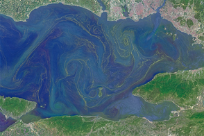
Freshened surface water and abundant nutrients lead to an explosion of algae in the inland sea.
Published May 31, 2015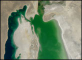

When the Landsat archive is combined with modern computing power, scientists can view the planet not just across space, but also time.
Published Jun 11, 2013Image of the Day Land Unique Imagery Human Presence Remote Sensing
By analyzing satellite images of sediments, coastal researchers and cartographers can identify potential shallows, shoals, and shipping hazards.
Published Sep 17, 2015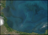

A composite view of the United States represents one of the ways scientists are exploring Landsat 8’s capabilities.
Published Feb 11, 2014
LDCM extends an unprecedented four-decade record of global land observations.
Published Feb 12, 2013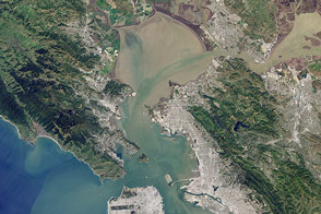
Landsat 8 can observe wavelengths of blue light that will make it easier to observe the swirl of life and water along the world’s coastlines.
Published May 31, 2013
50 trillion pixels of Landsat data give researchers a lot of opportunities to look at Earth processes on scales from days to decades.
Published Apr 16, 2015
What does Landsat have in common with the Gutenberg Bible, Tolstoy’s personal library, and the Book of Kells?
Published Nov 24, 2011