Acquired August 17, 2011, this natural-color image shows Franz Josef Land, a 191-island archipelago in the northeastern Barents Sea.
Published Aug 28, 2011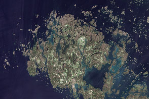
This summertime, natural-color image shows the Åland Islands between Sweden and Finland.
Published Sep 20, 2011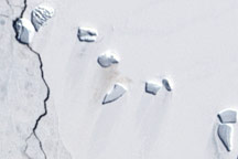
A guano stain betrays the location of an emperor penguin colony on Antarctic ice in this Landsat image from December 4, 2002.
Published Jun 5, 2009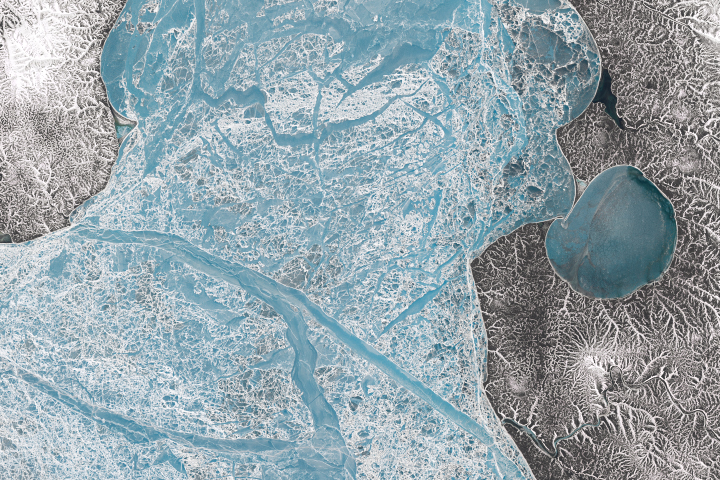
June is a time of transition around the New Siberian Islands as snowmelt uncovers the sea ice and gives way to bare land.
Published Dec 1, 2018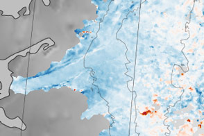
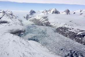
Sections of the Greenland Ice Sheet that end on land are slowing—a sliver of good news for sea level rise.
Published Oct 30, 2015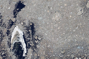
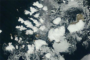
Sea ice from the Foxe Basin tends to be rougher and more stained than other parts of the Arctic.
Published May 24, 2014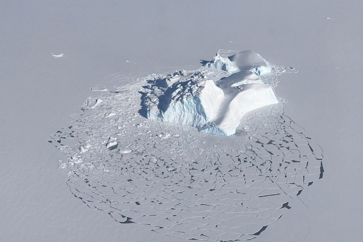
Starting out as land ice, these icebergs are now trapped in sea ice off the east coast of Greenland.
Published May 13, 2018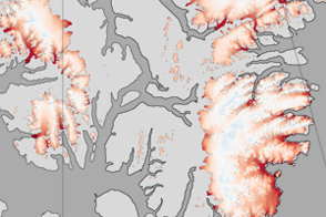
These color-coded maps show ice mass changes in the northern Canadian Arctic Archipelago from 2004 to 2009.
Published Jun 1, 2011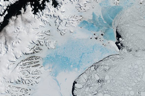
When this closely watched slab of floating ice births a giant iceberg, it will not be the first time it has seen dramatic change.
Published Feb 7, 2017Image of the Day Heat Land Water Snow and Ice Sea and Lake Ice
NASA aircraft return to the Arctic to assess the health of the region’s ice.
Published May 3, 2012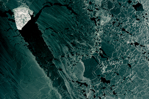
A diamond-shaped piece of ice is a stranger amid thin ice.
Published Mar 1, 2017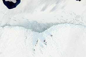
The land and sea along Antarctica’s Mawson Coast offer a study in ice forms.
Published Dec 31, 2011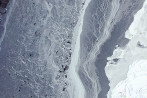
Sea ice in the Amundsen Sea was among the first images acquired by the airborne campaign designed to study Earth's polar ice.
Published Oct 16, 2014
Unlike the vegetated tundra of its neighboring islands, Bunge Land is a barren sandy plain that also serves as a land bridge.
Published Oct 5, 2020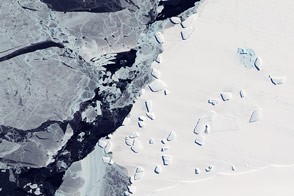
Acquired October 7, 2011, this natural-color image shows an ice menagerie off the coast of East Antarctica.
Published Oct 23, 2011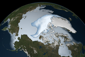
Thick ice that used to last through multiple summers has been in steep decline for three decades.
Published Mar 1, 2012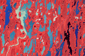
The landscape of the Kitikmeot region of Nunavut Territory was carved by ice and water.
Published Jul 13, 2012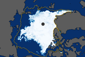
In September 2011, the extent of sea ice covering the Arctic Ocean declined to the second-lowest extent on record.
Published Oct 5, 2011