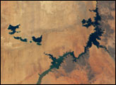
Sections of Australia have been experiencing their worst drought in 100 years. Astronauts aboard the International Space Station documented conditions in Australia in 2002, including these images of Lake Tandou in the Menindee Lake system along the Darling River. The Menindee Lakes are part of an innovative water conservation project. This lakebed is protected from flooding and is used for agriculture—primarily cotton, sunflower and grains. It is one of several interconnected lakes that sit along the lower Darling River like a string of pearls. Other lakes function as water capture reservoirs to support controlled water flow for environmental and agricultural needs down river, and to provide flood mitigation.
Published Dec 1, 2002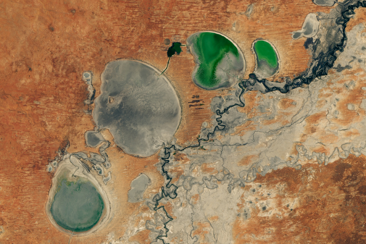
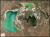
The Menindee Lakes in New South Wales are facing extremely low water levels.
Published Feb 26, 2019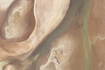
Acquired on April 10, 2010, and and March 7, 2009, these natural-color images show changes in a central Australian saltpan, Lake Frome. In 2010, water has seeped into the salt lake, leaving standing water in some areas and muddying much of the ground surface.
Published Apr 14, 2010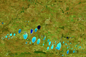
Many of the salt lakes in Western Australia are found along the valleys of ancient river systems that no longer flow.
Published Mar 26, 2016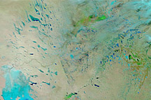
Acquired January 14, 2011, and December 29, 2010, these false-color images show changes to Australia’s interior caused by heavy rains.
Published Jan 14, 2011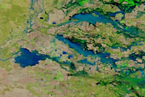
Acquired in late November and early December 2011, these images document the downstream movement of floods in New South Wales, Australia.
Published Dec 2, 2011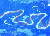
The Mamore River drains north from the Andes Mts. in lowland Bolivia. An image taken in July 2003 from the International Space Station (ISS007-E-10797, 14 June 2003, 12:36 GMT) shows an 85 km stretch of the river south of the lowland town of Trinidad in the Beni Province. Numerous changes in river pattern are visible in the decade since Landsat imagery of the same area was acquired.
Published Aug 18, 2003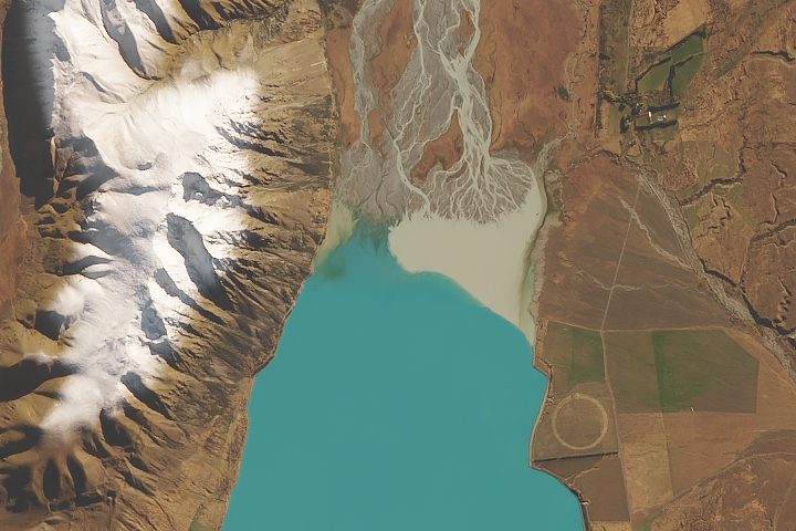
Fine particles of pulverized rock absorb and scatter sunlight in ways that can give water a striking blue-green color.
Published May 20, 2019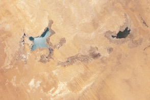
Between 2002 and 2012, water levels dropped significantly in these manmade lakes in the Sahara.
Published Jul 16, 2012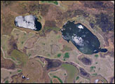
The central lake in this astronaut photograph is one of hundreds in the Iberá swamplands that were formed by South America’s second largest river, the Paraná. Although this great river now lies 120 kilometers to the north of this area today, its channel has swung over a great “inland delta” in the recent geological past.
Published Jan 31, 2005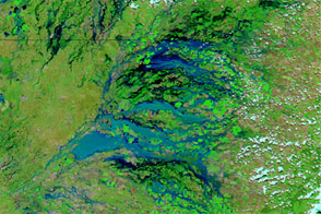
Flooded rivers have formed an inland sea in southeastern Australia in early February 2012.
Published Feb 7, 2012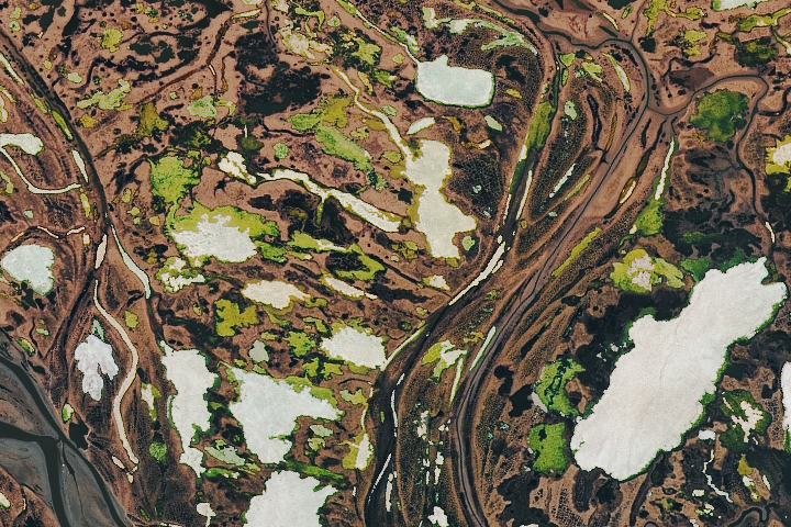
Tens of millions of small lakes dot frigid tundra landscapes in the Arctic—like the swampy Yana River Delta.
Published Jul 28, 2018