
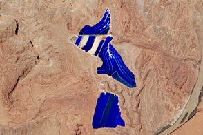
Colorful, mineral-rich salt flats are nestled between the Promontory Mountains and the Great Salt Lake.
Published Oct 4, 2020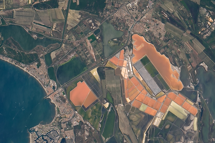
The salt produced from tidal marshes in southern France is the product of ideal climate conditions and careful management.
Published Apr 4, 2019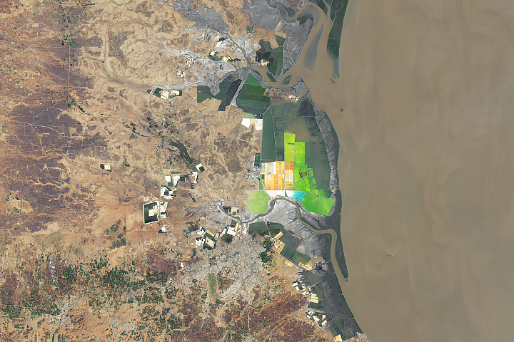
The west-central state of Gujarat accounts for nearly three-quarters of India’s annual salt production.
Published Oct 21, 2019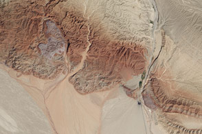
In this active tectonic environment, salt squeezes through faults in the rock until it reaches the surface and flows like a glacier.
Published Oct 25, 2015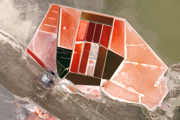
Makgadikgadi Pan is one of the largest salt flats in the world.
Published Jul 1, 2019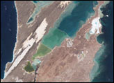

As water levels drop in the Dead Sea, salt is piling up on the lakebed.
Published Jul 31, 2019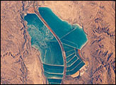
The complex of Jordanian salt evaporation ponds at the southern end of the Dead Sea has expanded significantly over the past dozen years. The western margin of the salt ponds marks the Jordan-Israel border. In August 1989, when the crew of Space Shuttle mission STS-28 photographed the region, the northern extension did not exist and the large polygonal ponds in the northwestern and northeastern sectors had not been subdivided. In the view taken by the STS-102 crew in March 2001, one can see that there has also been expansion at the southeastern end, and that levees now segment the northeastern wedge into four ponds.
Published May 13, 2001
Southeastern Iran is home to numerous salt domes and salt glaciers, which have been built over time by the movement of Earth’s crust.
Published Nov 13, 2017
One of the largest salt pans in the world spreads across northern Botswana, offering critical seasonal oases for mammals and birds.
Published Jul 7, 2018
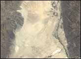
The rocks of Dasht-e Kavir tell tales of a much wetter environment millions of years ago.
Published Feb 17, 2013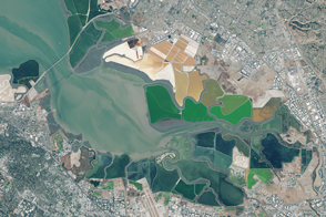
An ambitious project in South San Francisco Bay is designed to restore wetlands and marshes, as well as the species that go with them.
Published Feb 11, 2016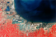
China’s Bo Hai coast is one example of the rapid expansion of aquaculture in the late twentieth century.
Published Feb 8, 2009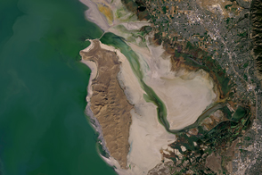
In October 2016, one of America’s largest lakes reached its lowest level on record.
Published Nov 3, 2016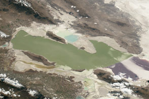
The lake and surrounding landscape are characterized by many flavors and mixtures of salt.
Published Feb 1, 2016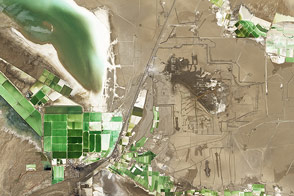
A rim of crystal salts surrounds Lake Qarhan, the largest salt lake playa in China and a significant source of minerals, including table salt and potassium for fertilizer.
Published Feb 2, 2014
Once submerged under an arm of the Arabian Sea, this dry lowland is now rich in salt.
Published May 18, 2015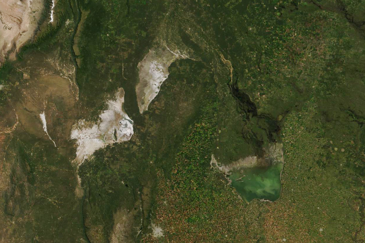
Sometimes the slow grind of plate tectonics can determine where and when lakes exist.
Published Apr 24, 2019
Hundreds of acres of bright-blue evaporation ponds are used to produce potassium-containing salts for fertilizers.
Published Jun 25, 2014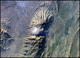
The Zagros Mountains in southwestern Iran present an impressive landscape of long linear ridges and valleys. Formed by collision of the Eurasian and Arabian tectonic plates, the ridges and valleys extend hundreds of kilometers. Stresses induced in the Earth’s crust by the collision caused extensive folding of the preexisting layered sedimentary rocks. Subsequent erosion removed softer rocks, such as mudstone and siltstone while leaving harder rocks, such as limestone and dolomite. This differential erosion formed the linear ridges of the Zagros Mountains. This astronaut photograph of the southwestern edge of the Zagros mountain belt includes another common feature of the region—a salt dome (Kuh-e-Namak or “mountain of salt” in Farsi).
Published Apr 17, 2006
The red and green colors of the salt ponds in South San Francisco Bay are brilliant visual markers for astronauts. The STS-111 crew photographed the bay south of the San Mateo bridge in June, 2002.
Published Jul 21, 2002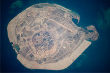
This astronaut photograph illustrates the varying character of surfaces on Sir Bani Yas, an island in the Persian Gulf near the west coast of the United Arab Emirates.
Published Mar 15, 2010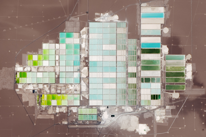
Chile’s Salar de Atacama has the world’s largest reserve of lithium, which is a key ingredient in rechargeable batteries.
Published Feb 9, 2019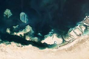
The United Arab Emirates coast is home to complex assortment of natural features.
Published Apr 13, 2013