An unnamed berg of unknown origin drifted in the South Atlantic Ocean.
Published Dec 14, 2014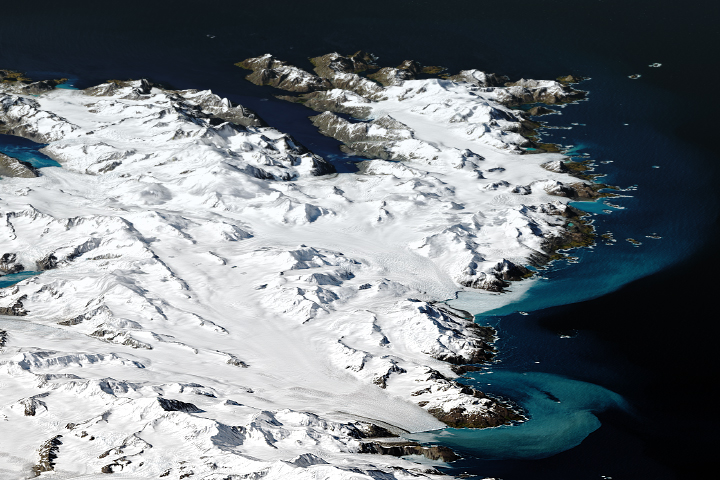
The remote island may be inhospitable to humans, but it provides a home to major populations of wildlife.
Published Mar 4, 2019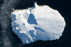
Bouvet Island, a territory of Norway, is one of the most remote islands in the world.
Published Feb 26, 2014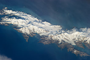
Astronauts capture a view of the South Atlantic Island that looks like it has been taken from an airplane. Mountains and glaciers stand in stark relief against the sea.
Published Apr 29, 2013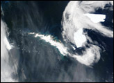
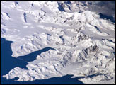
There is no permanent human base on South Georgia Island, a British territory in the South Atlantic Ocean that lies 1,300 kilometers east of the Falkland Islands. The crew of the International Space Station captured this image of the rugged and isolated landscape of the northern shore of the island. The first recorded explorer to land on the island was Captain James Cook aboard the HMS Resolution in 1775. He mapped part of the coastline, but was discouraged by the thick ice cover, lack of vegetation, and steep mountains. Mt. Paget, the highest peak, rises to 2,934 meters (9,625 feet) above sea level, and the island supports 161 glaciers. Cook named the southernmost point of the island “Cape Disappointment” when he realized he had not reached Antarctica.
Published Oct 17, 2005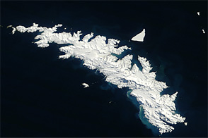
Acquired September 29, 2012, this natural-color image shows South Georgia Island and nearby icebergs.
Published Oct 6, 2012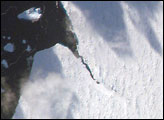
The iceberg A22A was photographed when it was about a third of the distance from South America towards Cape Town, South Africa. A22A is one of the largest icebergs to drift as far north as 50 degrees south latitude, bringing it beneath the daylight path of the International Space Station (ISS). A series of parallel lines can be seen in the lower image. These are probably “hummocks,” dunes of snow that have solidified, and they date back to the time when the iceberg was connected to Antarctica. A developing fracture in the ice can be seen in the lower, detailed view.
Published Jun 18, 2007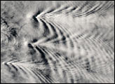
In the Southern Atlantic, a chain of eleven volcanic islands rises up from the ocean in an arc that extends roughly 240 miles (400 km) north to south. As is apparent in this true-color image, the islands are tall enough to disrupt the cloud patterns forming and flowing around them.
Published Jan 29, 2004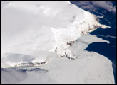
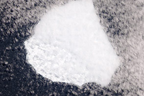
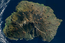
Bouvet Island is known as the most remote island in the world; Antarctica, over 1600 kilometers (994 miles) to the south, is the nearest land mass. Located near the junction between the South American, African, and Antarctic tectonic plates, the island is mostly formed from a shield volcano—a broad, gently sloping cone formed by thin, fluid lavas—that is almost entirely covered by glaciers.
Published Oct 6, 2008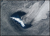
Acquired on on May 5, 2009, this true-color image shows Marion Island in the Indian Ocean. Sparsely vegetated, this volcanic island has remnants of snow near its summit.
Published Oct 18, 2009