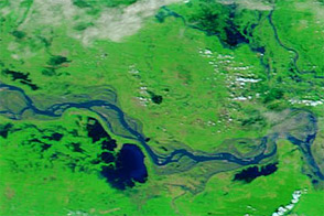
Acquired October 8, 2011, and October 10, 2010, these false-color images compare conditions along a stretch of the Ganga (Ganges) River, where flooding struck in 2011.
Published Oct 10, 2011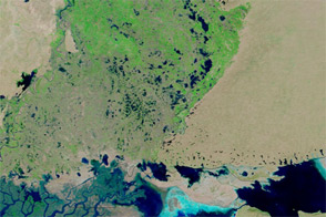
Patches of flood water remain in Pakistan’s Sindh Province, months after floods struck the region.
Published Jan 26, 2012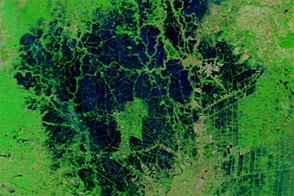
Although improved over the previous several weeks, flood conditions lingered around Ayutthaya and Bangkok in early December 2011.
Published Dec 16, 2011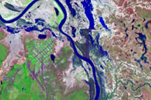
The extensive flooding that surrounded Normanton, Australia, had largely subsided by March 25, 2009, when the Advanced Land Imager on the EO-1 satellite captured this image.
Published Mar 25, 2009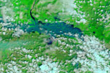
These false-color images show a portion of the Krishna River in southern India in flood stage on October 5, 2009 (top), and before the flooding on September 10, 2009 (bottom).
Published Oct 5, 2009
Acquired on July 18 and August 1, 2009, these false-color images provide a before-and-after view of the Sitamarhi District of the Indian state of Bihar. The image from August 1 shows swollen waterways and large areas of standing water.
Published Aug 3, 2009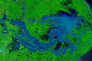
Acquired September 27, 2011, and September 28, 2010, these false-color images compare conditions along the Brahmani and Mahanadi Rivers in India. Severe flooding struck the region in 2011.
Published Sep 28, 2011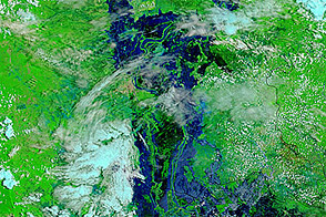
Acquired August 24, 2011, and August 26, 2010, these false-color images compare conditions in Cambodia. Flooding occurred along the Mekong River, Tônlé Sab, and around Phnum Penh in 2011.
Published Aug 29, 2011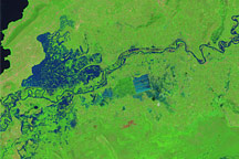
Like many rivers across the world, the Nzoia River in western Kenya pushes over its banks annually. In November 2008, the river burst through the dykes to flood the low-lying land around it.
Published Nov 22, 2008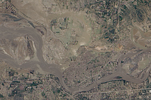
Acquired August 5, 2010, this natural-color image shows flooded crops and settlements around the Kabul River near the city of Kheshgi in northern Pakistan.
Published Aug 6, 2010