
The blaze is the largest in Arizona this year and the largest in the United States right now.
Published Jun 16, 2020Image of the Day Heat Land Fires Human Presence Remote Sensing
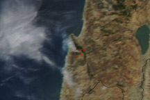
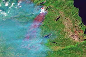
Thick smoke from a large forest fire blows over Haifa, Israel, in this true-color image taken at 12:10 p.m. on December 2, 2010.
Published Dec 2, 2010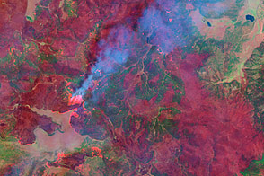
This false-color image taken by the Landsat-7 satellite on June 7, shows how completely the Wallow Fire is burning the forest in the mountains of eastern Arizona.
Published Jun 9, 2011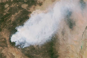
The Whitewater-Baldy wildfire is the largest on record in New Mexico.
Published May 30, 2012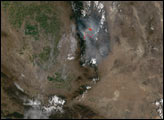
The fast-moving fire burned in Eldorado National Forest in September 2014.
Published Sep 23, 2014
A wildfire in Fresno County, California has burned more than 28,000 acres.
Published Jul 20, 2020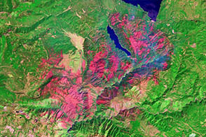
One of a number of large wildfires that have affected northern California in 2012, the Chips fire burned more than 75,000 acres by the time firefighters had contained it.
Published Sep 5, 2012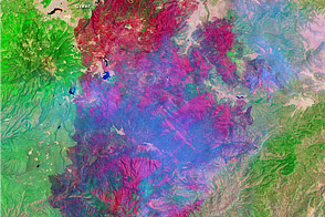
This image shows the extent of Arizona’s Wallow Fire on June 15, 2011.
Published Jun 16, 2011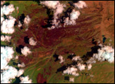

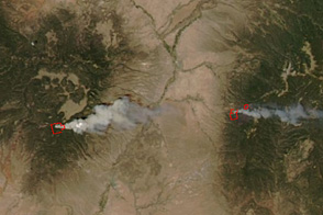
This image from June 9, 2011, shows Arizona’s Wallow Fire in the White Mountains near the border with New Mexico.
Published Jun 10, 2011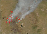
Taken an hour and a half after the Las Conchas Fire started in the mountains southwest of Los Alamos, New Mexico, on June 26, this image shows the large wildfire well underway.
Published Jun 27, 2011