Satellites have played a key role in monitoring and reducing the rate of deforestation in the rainforest.
Published Dec 19, 2019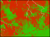
In 2007, the Amazon fire season was the worst of this decade. This pair of images shows deforestation and the smoke from intense fires in the 2007 dry season in northwest Rondônia, Brazil.
Published May 28, 2009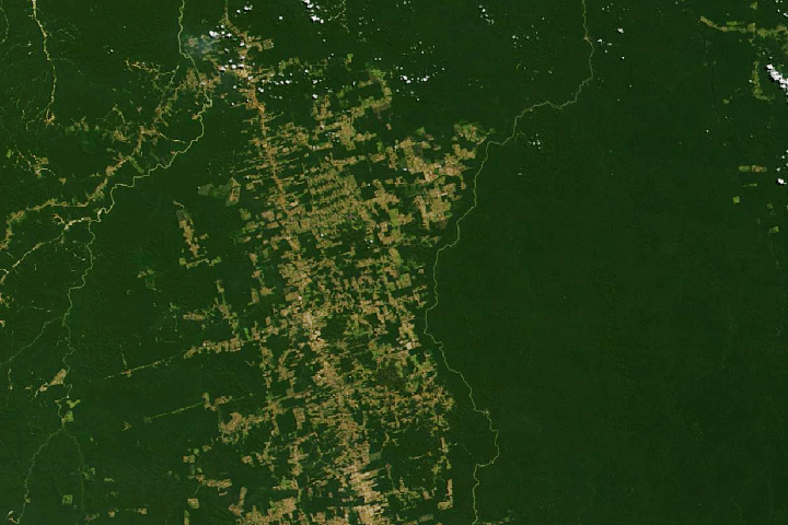
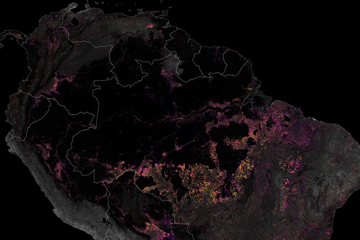
Decades of satellite data make it possible to map how deforestation has evolved over time.
Published Nov 21, 2019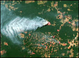
Free, open-access imagery helps scientists monitor remote areas and protect tropical forests.
Published Nov 19, 2013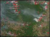
The Amazon Rainforest of South America is rapidly falling as people colonize and develop a new frontier. Where there was once no such thing as an “Amazon fire season,” fires are now widespread in the dry season as people clear forest or manage already cleared plots of crop or grazing land.
Published Aug 16, 2007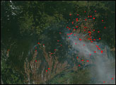
Although forest clearing for pasture is the primary driver of Amazon deforestation in the state of Mato Grosso, Brazil, a new study led by scientists at the University of Maryland showed that large-scale mechanized agriculture, mostly for soybeans, is rapidly becoming a major force behind forest loss in the region.
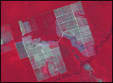
Published Sep 21, 2006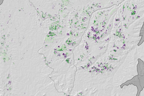
Soybeans spread across new frontiers in Mapitoba—a hotspot of soy expansion in the northeast region of Brazil’s Cerrado.
Published Feb 27, 2015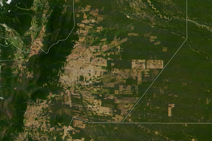
South America’s second-largest forest has been experiencing rapid tree losses in recent decades.
Published May 20, 2020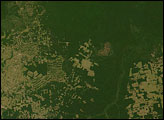
In 2005, the government of Brazil said that 48 percent of Amazon deforestation that took place in 2003 and 2004 occurred in Mato Grosso.
Published Aug 5, 2006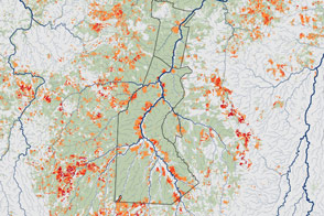
New maps of understory forest fires in the southern Amazon suggest there’s little connection between deforestation and understory fires. Some indigenous reserves where deforestation is minimal still have frequent understory fires.
Published Jun 8, 2013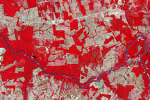
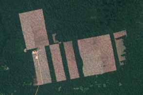
The most conspicuous difference between the images is the widespread forest clearing—visible as rectangles of gray-beige—that had occurred by 2006.
Published Nov 14, 2008