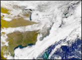
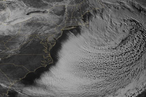
Acquired December 28, 2010, this natural-color image shows a combination of clouds and snow over the northeastern United States.
Published Dec 30, 2010
Snow cover sprawled across the northeastern United States in early March 2013, in the wake of a winter storm.
Published Mar 12, 2013
The snowpack near Boston is greater than in all but two reported locations in Alaska.
Published Feb 18, 2015
Snow blanketed the East Coast in this image from March 3, 2009.
Published Mar 4, 2009
A swath of snow stretches from Mississippi, across Alabama, and into Georgia in this photo-like satellite image from February 13, 2010.
Published Feb 15, 2010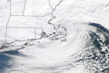
The storm that hammered New England on January 12, 2011, is a classic, comma shaped Nor’easter, as shown in this photo-like image.
Published Jan 13, 2011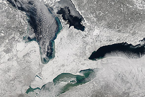
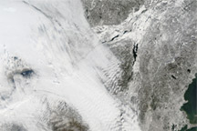
Acquired February 9, 2013, this image shows a blanket of snow left by a nor’easter.
Published Feb 11, 2013
This satellite map of snow cover shows that every state in the contiguous U.S., except for Florida, received snow in January 2011.
Published Feb 25, 2011