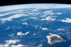
The Island of Hawaii is a vast canvas of environments from desert shores to rain forests to frozen mountain heights.
Published Jan 29, 2014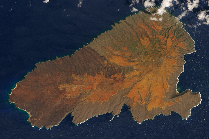
The Hawaiian island has been scarred by volcanic eruptions, livestock grazing, penal colonies, bombs, and fire. Yet there is hope for healing.
Published Mar 23, 2020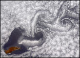
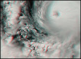
These Multi-angle Imaging Spectroradiometer (MISR) images from June 11, 2000 demonstrate a turbulent atmospheric flow pattern known as the von Karman vortex street.
Published Dec 7, 2000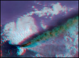

The most interesting geology lies just offshore and below the water line of this Northwest Australian island.
Published Aug 3, 2015
This natural-color image shows Henrietta Island, with a smooth, dome-capped surface and a rugged coastline, illuminated by low-angled sunlight.
Published May 3, 2009
On September 25, 2002, astronauts aboard the International Space Station viewed Easter Island, one of the most remote locations on Earth. Easter Island is more than 2000 miles from the closest populations on Tahiti and Chile—even more remote than astronauts orbiting at 210 nautical miles above the Earth. Archaeologists believe the island was discovered and colonized by Polynesians at about 400 AD. Subsequently, a unique culture developed. The human population grew to levels that could not be sustained by the island. A civil war resulted, and the island’s deforestation and ecosystem collapse was nearly complete.
Published Oct 6, 2002
The ghostly white shapes northeast and immediately southwest of Wrangel Island are sea ice. Over the course of the satellite record, Arctic sea ice has advanced and retreated past Wrangel Island many times. From 1979 to 2000, the sea ice edge at the end of summer generally fell somewhere in the vicinity of Wrangel Island, but this is not the first summer when the sea ice edge has retreated well north of the island.
Published Aug 29, 2008