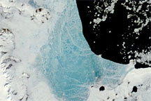
Changing weather conditions left their mark on sea ice along the Antarctic Peninsula in late 2008 and early 2009. In mid-December 2008, melt water resting on the sea ice colored it sky blue. At the beginning of 2009, however, the sea ice appeared snowy white, and cracks had begun along the ice margin.
Published Jan 9, 2009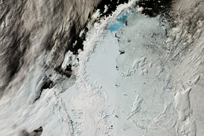
The northernmost arm of Antarctica is a hotspot of research because its retreating glaciers are a large contributor to sea level rise.
Published Feb 24, 2017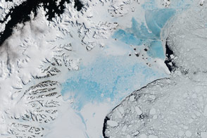
When this closely watched slab of floating ice births a giant iceberg, it will not be the first time it has seen dramatic change.
Published Feb 7, 2017Image of the Day Heat Land Water Snow and Ice Sea and Lake Ice
The MODIS instrument on NASA’s Aqua satellite captured this clear view of the Antarctic Peninsula, the Larsen Ice Shelf, and the sea ice covered waters around the region in October 2011.
Published Oct 15, 2011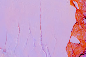
The impending birth of a big, new iceberg from Antarctica’s Larsen C Ice Shelf will not have an immediate effect on sea level, but it could be an indicator of future problems.
Published Apr 14, 2017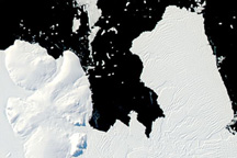
Low-angled sunlight highlights topography and ice textures along Walgreen Coast in West Antarctica on March 14, 2010.
Published Apr 13, 2010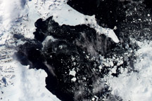
Acquired in 2003, 2004,and 2005, these images show an intermittently ice-filled bay in the wake of the 2002 collapse of the Larsen B Ice Shelf on the Antarctic Peninsula.
Published Apr 9, 2010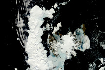
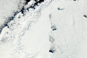
This rare, nearly cloud-free view of the northern tip of the Antarctic Peninsula provides a photo-like view of sea ice melting and pushing away from the continent in the late spring.
Published Nov 18, 2010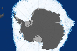
This map shows sea ice extent around Antarctica on September 22, 2013, when ice covered more of the Southern Ocean than at any other time in the satellite record.
Published Oct 1, 2013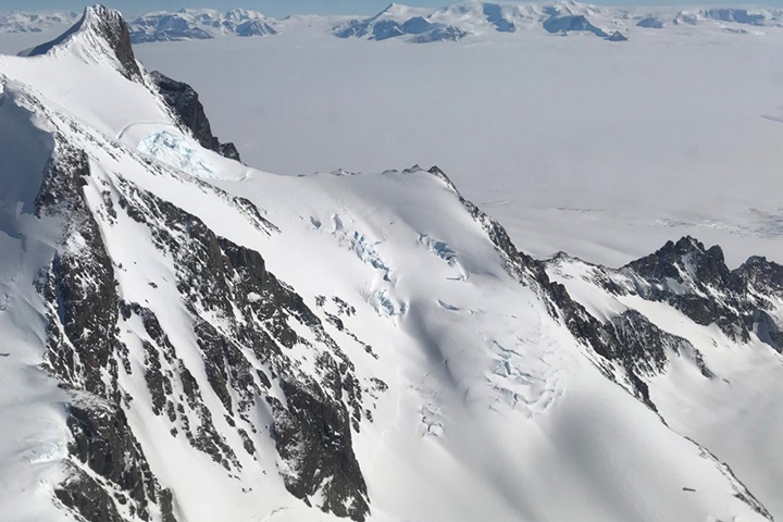
Approaching the icy continent by aircraft, the vast expanse of water and ice is suddenly broken by gray and brown rocky mountaintops
Published Dec 28, 2017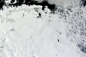
Winds pushed Antarctic sea ice north of its typical location in February 2013.
Published Mar 1, 2013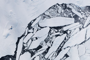
Wave action and glacial dynamics split another chunk of ice off of the Antarctic Peninsula in March 2013.
Published May 25, 2013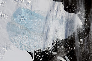
Moderate-resolution Imaging Spectroradiometer (MODIS) satellite imagery analyzed at the University of Colorado’s National Snow and Ice Data Center revealed that the northern section of the Larsen B ice shelf, a large floating ice mass on the eastern side of the Antarctic Peninsula, has shattered and separated from the continent. This particular image was taken on March 5, 2002.
Published Mar 20, 2002
This approximately true-color image shows ice fragments left over from previous breakups of the Wilkins Ice Shelf.
Published Apr 19, 2009