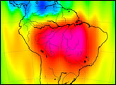
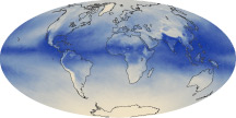
In much of the world, differences in seasonal precipitation—and in how that water gets stored on land—are big enough to affect Earth’s gravity field.
Published Oct 22, 2010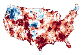
The GRACE satellites can detect the movement and depletion of water supplies at and below Earth’s surface.
Published Sep 20, 2012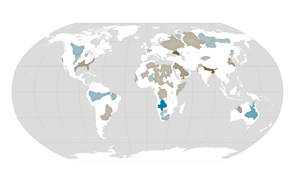
About one third of Earth’s large groundwater basins are being rapidly depleted by human consumption even though we have little accurate data about how much water remains in them.
Published Jul 24, 2015
An arid region grew even drier between 2003 and 2009 due to human consumption of water for drinking and agriculture.
Published Mar 13, 2013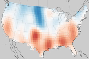
Groundwater supplies are decreasing across much of the world.
Published Nov 1, 2013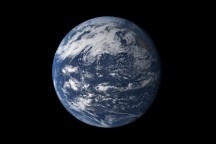
Earth is a water planet. Three-quarters of the planet’s surface covered by ice or oceans, and the sky is filled with clouds.
Published Oct 2, 2010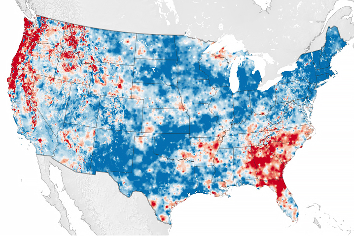
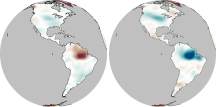
Scientists have developed a new way to measure water cycle intensity over time.
Published Jul 26, 2019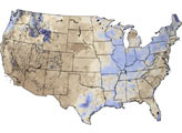
The tiny amount of water vapor in our atmosphere has an outsized influence on the planet as a potent greenhouse gas.
Published Oct 7, 2010
Natural vegetation and irrigated farmland along the Snake River Plain in Idaho use dramatically different amounts of water during the growing season.
Published Jan 26, 2010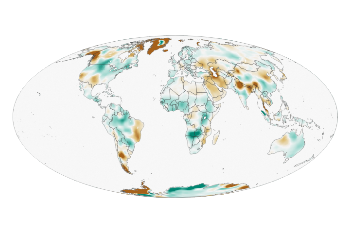
Wet landscapes are getting wetter and dry areas are getting drier due to a variety of factors, including water management, climate change, and natural cycles.
Published May 23, 2018
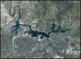
New maps show the fluctuating river and lake levels in the Murray-Darling Basin.
Published Jul 16, 2016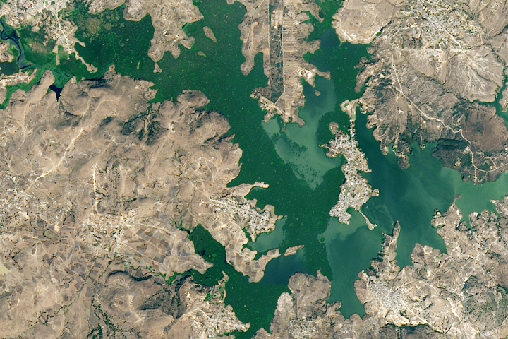
A new study found that the abundance of these floating plants has increased due to urbanization.
Published Sep 2, 2020
For more than 100 years, groups in the western United States have fought over water. During the 1880s, sheep ranchers and cattle ranchers argued over drinking water for their livestock on the high plains. In 1913, the city of Los Angeles began to draw water away from small agricultural communities in Owen Valley, leaving a dusty dry lake bed. In the late 1950s, construction of the Glen Canyon Dam catalyzed the American environmental movement. Today, farmers are fighting fishermen, environmentalists, and Native American tribes over the water in the Upper Klamath River Basin. The Landsat 7 satellite, launched by NASA and operated by the U.S. Geological Survey, documented an extreme drought in the area along the California/Oregon border in the spring of 2001.
Published Sep 8, 2001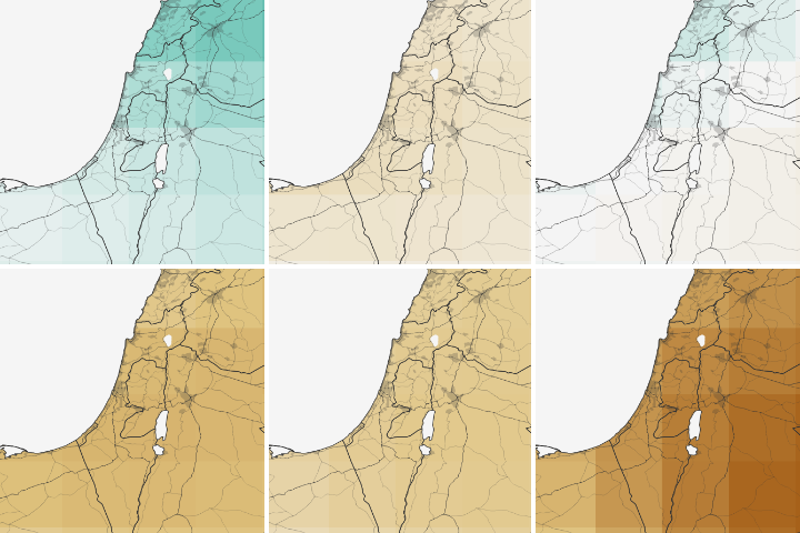
Water shortages in the Middle East lead to sanitation issues in schools, resulting in periodic school closures. NASA is working to change that.
Published Jul 27, 2018