In a country rich with compelling geologic phenomena, even the rivers are connected to the landscape of fire and ice.
Published Aug 6, 2019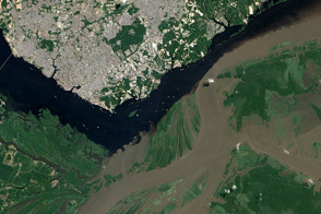
The confluence of the Rio Negro and Rio Solimões in Brazil is famous for unusual mixing patterns.
Published Sep 7, 2012
The impact of severe drought on the Negro River, a tributary of the Amazon River, and other rivers in the basin is dramatically evident in this pair of images, which show that every body of water has shrunk in 2010 compared to 2008.
Published Dec 11, 2010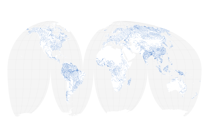
A new map of the world’s rivers and their widths shows that surface waterways are collectively wider and cover more area than previously thought.
Published Jul 18, 2018
Sunlight highlights details around Rio Paraná, Rio Tiete, and Rio Paranapanema.
Published Dec 22, 2019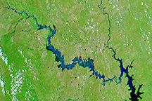
Acquired July 11, 2010, and June 21, 2010, these false-color images show northeastern Mexico before and after flooding along the Rio Salado.
Published Jul 15, 2010
Natural vegetation and irrigated farmland along the Snake River Plain in Idaho use dramatically different amounts of water during the growing season.
Published Jan 26, 2010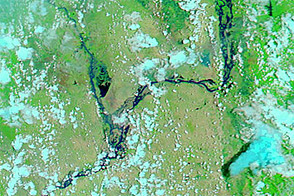
Acquired August 2, 2011, and March 6, 2011, these false-color images compare conditions along part of the Irrawaddy River in Burma, which rises substantially during the summer monsoon.
Published Aug 5, 2011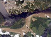
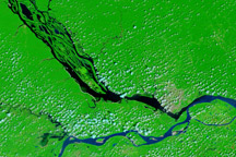
The largest river on the planet, the Amazon, forms from the confluence of the Solimões (the upper Amazon River) and the Negro at the Brazilian city of Manaus in central Amazonas. At the river confluence, the muddy, tan-colored waters of the Solimões meet the “black” water of the Negro River. The unique mixing zone where the waters meet extends downstream through the rainforest for hundreds of kilometers, and is a famous attraction for tourists from all over the world. The tourism contributes to substantial growth in the city of Manaus. Twenty years ago the large park near the city center (center) lay on the eastern outskirts of Manaus.
Published Feb 12, 2005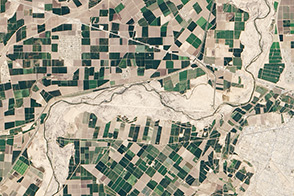
A one-time pulse of water is bringing a burst of new life to the lower Colorado River.
Published May 1, 2014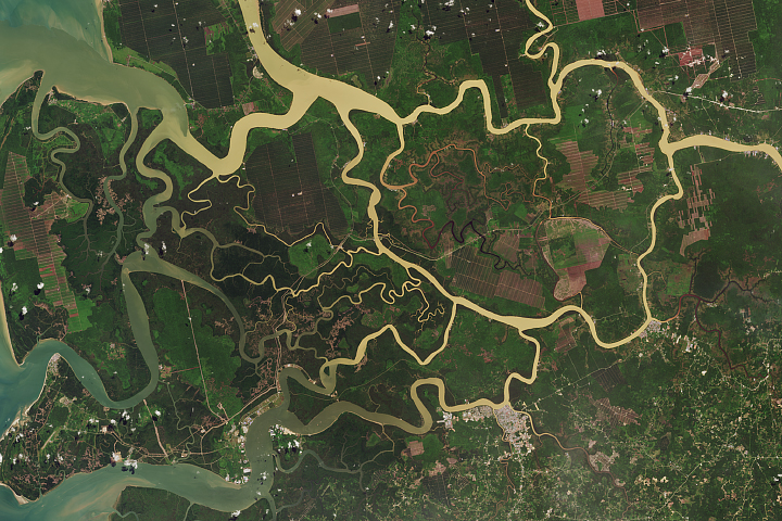
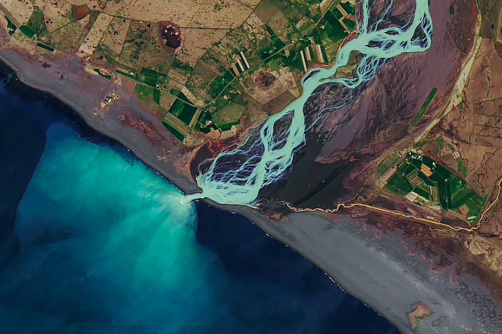
Faults and tides have helped to shape the rivers of this delta in East Malaysia.
Published Mar 6, 2018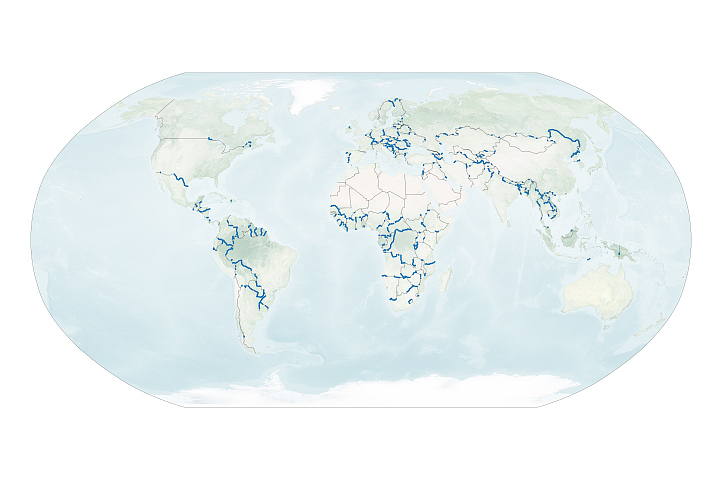
A new dataset reveals interesting patterns about where and why rivers define national borders.
Published Sep 17, 2020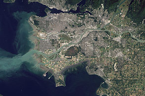
Flowing past the city of Vancouver, the Fraser River delivers a thick plume of sediment to the Strait of Georgia.
Published Mar 14, 2012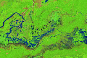
The course of the Maniqui and other small rivers in the Amazon Basin can shift dramatically in just a few years.
Published Dec 21, 2016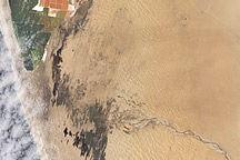
Acquired February 27, 2011, this natural-color image shows pools of water extending from the Kuiseb River to Walvis Bay, Namibia.
Published Mar 22, 2011