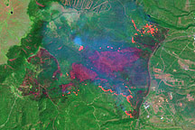
On May 9, 2000, the Landsat 7 satellite acquired an image of the area around Los Alamos, New Mexico.
Published May 11, 2000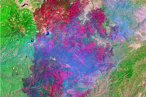
This image shows the extent of Arizona’s Wallow Fire on June 15, 2011.
Published Jun 16, 2011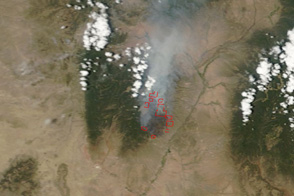
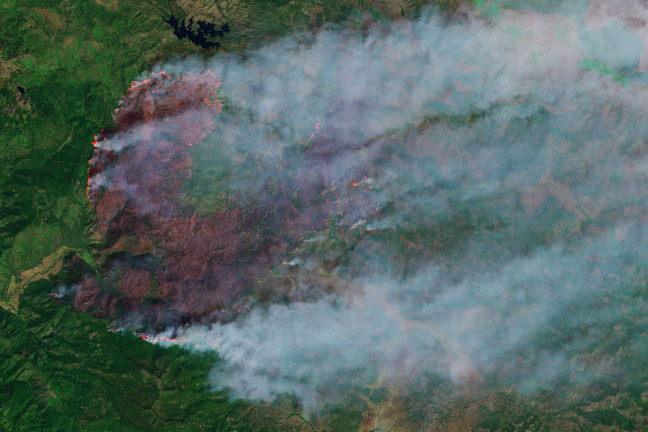
This pair of images shows the Las Conchas Fire burning near the western edge of Los Alamos National Laboratory on June 29, 2011.
Published Jun 30, 2011
This false-color image illustrates the extent of the Station Fire in southern California.
Published Sep 15, 2009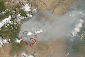
Burning immediately southwest of Los Alamos, New Mexico, the Las Conchas Fire covers the city in smoke in this image from June 27, 2011.
Published Jun 28, 2011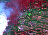
The wildfire has burned more than 50,000 acres, making it the state’s largest blaze in 2019.
Published Sep 13, 2019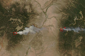
Taken an hour and a half after the Las Conchas Fire started in the mountains southwest of Los Alamos, New Mexico, on June 26, this image shows the large wildfire well underway.
Published Jun 27, 2011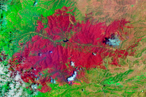
The EO-1 satellite observed the burn scar from the Little Bear Fire.
Published Jun 14, 2012
In August 2013, the Silver Fire burned 20,000 acres near Banning, California.
Published Aug 14, 2013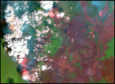
In east-central Alaska, the Pingo Fire was scorching hundreds of thousands of acres north of the Yukon River in early July 2004.
Published Jul 6, 2004