
The largest airport in Texas, Dallas-Fort Worth International (DFW) is also the fourth largest in the world, and it occupies more surface area than the entire island of Manhattan in New York. This astronaut photograph captures the entire airport and portions of the surrounding Dallas-Fort Worth metropolitan area.
Published Jul 3, 2006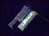

This image provides a good bird’s-eye view of the center of the city, including famous colonial and independence locations extending from Boston Common to the North End.
Published Nov 17, 2003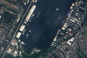
This view of airplanes stranded on a flooded airport tarmac highlights the seriousness of the flood disaster unfolding in Bangkok, Thailand.
Published Nov 2, 2011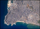
The capital of Lebanon, Beirut, is located along the southeastern shoreline of the Mediterranean Sea. The metropolitan area is built on a small peninsula composed mainly of sedimentary rock deposited over the past 100 million years or so. The growth of the city eastwards is bounded by foothills of the more mountainous interior of Lebanon.
Published Jan 14, 2008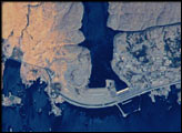
Astronaut photography of the Earth from the International Space Station has achieved resolutions close to those available from commercial remote sensing satellites—with many photographs having spatial resolutions of less than six meters. Astronauts take the photographs by hand and physically compensate for the motion of the spacecraft relative to the Earth while the images are being acquired.
Published May 6, 2002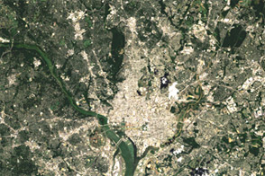
Acquired on August 27, 1984, and August 22, 2011, these images document growth around Washington, DC.
Published Jul 5, 2012
Rivers and bays were loaded with sediment and mud following the damaging storm.
Published Sep 5, 2018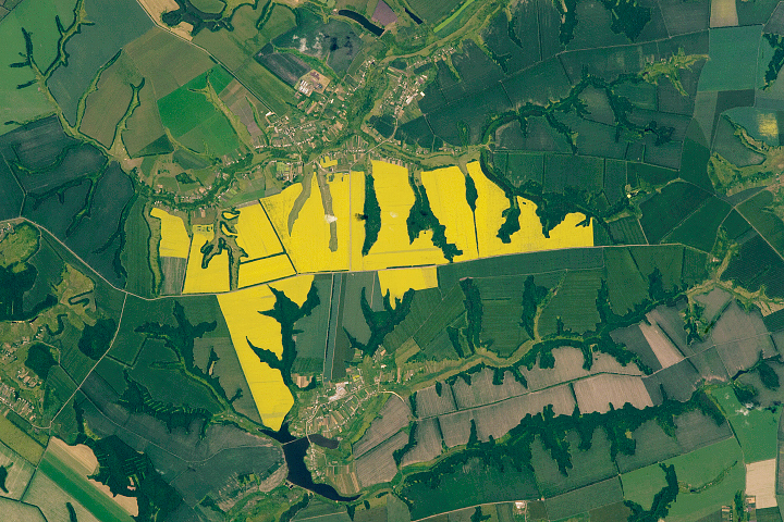
Yellow flowers brighten the landscape of southwestern Russia.
Published Oct 13, 2019
Aden lies near the south end of the Red Sea, at a critical point where major sea lanes converge—between Egypt and the Mediterranean Sea, the Persian Gulf and India, and the long shoreline of East Africa.
Published Aug 15, 2016
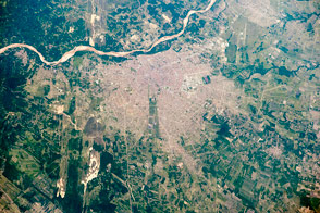
The metropolitan area is one of the fastest-growing cities in the world.
Published Apr 25, 2016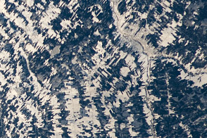
Is that a tapestry or an agricultural scene from Canada?
Published Jan 23, 2012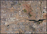
The Phoenix, Arizona, metropolitan area is the largest in the southwestern United States. This astronaut photograph of the central metro region includes the boundary area between three of the municipalities included in the conurbation of Phoenix: the cities of Phoenix (left), Tempe (center and lower right), and Scottsdale (upper right).
Published Jun 5, 2006