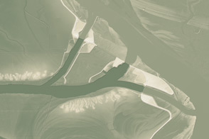
This model of the land elevation between the Mississippi, the Atchafalaya, and the Old River show the uphill fight to control river flow.
Published Jun 4, 2011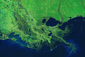
Engineers use levees, floodways, dams, and much more to control the ever restless Mississippi.
Published Mar 18, 2015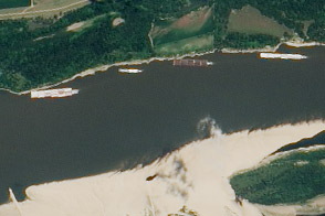
The drought of 2012 reduced traffic to one towboat at a time; groundings closed parts of the river for hours to days.
Published Aug 23, 2012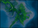
Time, weather, and human intervention have all shaped the Mississippi Delta in Louisiana, a giant bird’s foot shape protruding into the Gulf of Mexico. The Mississippi River deposits sediment into the ocean, and over 25 years, NASA Landsat satellites observed changes in the delta’s shape.
Published Oct 7, 2007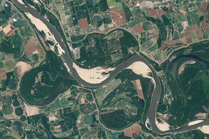
Coming off of the extreme floods of 2011, the river was approaching historic lows in the summer of 2012 near Memphis and along much of its lower reaches.
Published Aug 21, 2012
The wandering river is a boon to farming, but it has no interest in state borders.
Published Jul 19, 2020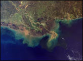
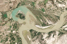
Observations by Landsat 1 from 1973 show the Morganza Floodway after its first and only opening in 57 years.
Published May 14, 2011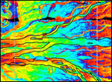
Between 1992 and 2009, a section of the lower Indus River changes course following the formation of an oxbow lake.
Published May 9, 2010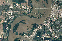
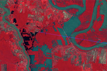
Acquired May 10, 2011, and April 21, 2010, these natural-color images show flooded and normal conditions along the Mississippi River in Memphis, Tennessee.
Published May 11, 2011