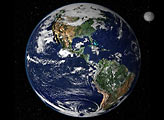
This true-color image shows North and South America as they would appear from 35,000 km (22,000 miles) above the Earth.
Published Oct 17, 2000


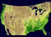
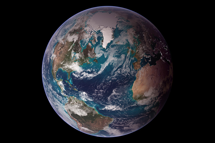
Using a collection of satellite images and data, scientists and visualizers stitched together months of observations of Earth’s land surface, oceans, sea ice, and clouds into a seamless, true-color mosaic.
Published Feb 11, 2002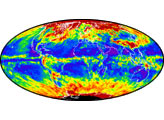
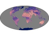
This view of Earth from space is a fusion of science and art, drawing on data from multiple satellite missions and the talents of NASA scientists and graphic artists.
Published Oct 9, 2007
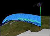
Orbiting the Earth at nearly 17,000 miles per hour, NASA's Ice, Cloud and land Elevation Satellite (ICESat) is collecting spectacular new three-dimensional measurements of the Earth's surface and atmosphere.
Published Dec 10, 2003