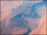
The Béchar Basin of northwest Algeria formed as layers of sedimentary rocks from the Paleozoic Era (250-540 million years ago) folded and cracked during collisions of Africa and Europe during the Tertiary Period (2-65 million years ago). In this photograph of part of the basin captured by astronauts, dark brown to tan folded ridges of these Paleozoic sedimentary layers extend across the image from top to bottom.
Published Aug 6, 2007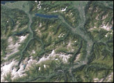
This geologic feature has captured the attention of astronauts for about as long as NASA has sent humans into orbit around Earth.
Published Apr 29, 2018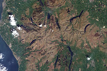
Acquired May 7, 2000, this natural-color image shows the Lake District National Park of North West England.
Published Dec 26, 2010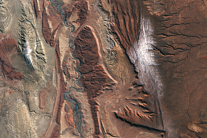
The distinctive sedimentary rock formations in west-central Argentina make for a geological and paleontological wonderland.
Published Oct 19, 2018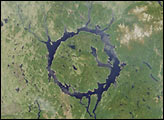
The impact that formed the lake is thought to have occurred about 200 million years ago and may have caused a mass extinction event.
Published Dec 6, 2001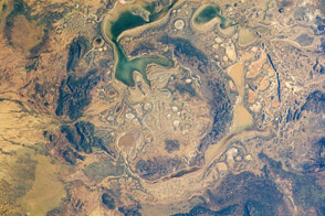
The Shoemaker impact site in Australia may have been formed as long as 1.63 billion years ago.
Published Jul 18, 2011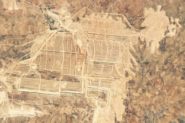
The mine is one of the few human patterns visible from space in this almost entirely uninhabited western extremity of the Sahara Desert.
Published Sep 23, 2018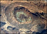
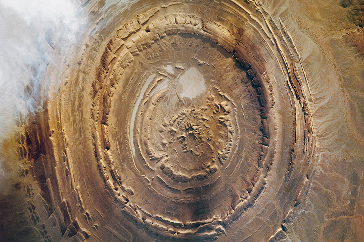
Upheaval Dome is a striking geologic structure in the Canyonlands National Park of southern Utah. The alternating rock layers make a nearly circular, 5.5-kilometer- (3.4-mile-) diameter “bull’s-eye.” This photograph of Upheaval Dome was taken by an astronaut onboard the International Space Station. The oblique viewing angle—in other words, not looking straight down—provides a sense of the topography within and around the structure. The dome appears more like an ellipse than a circle due to the oblique viewing perspective.
Published Jul 23, 2007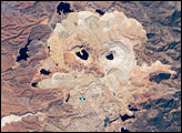
One of the largest open-pit copper mines in the world, the Cananea mine produced over 164,000 tonnes of copper in 2006. The active, 2-kilometer-diameter Colorada Pit is recognizable by the concentric steps, or benches, cut around its perimeter.
Published Apr 21, 2008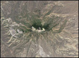
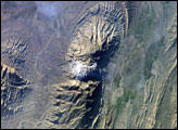
The Zagros Mountains in southwestern Iran present an impressive landscape of long linear ridges and valleys. Formed by collision of the Eurasian and Arabian tectonic plates, the ridges and valleys extend hundreds of kilometers. Stresses induced in the Earth’s crust by the collision caused extensive folding of the preexisting layered sedimentary rocks. Subsequent erosion removed softer rocks, such as mudstone and siltstone while leaving harder rocks, such as limestone and dolomite. This differential erosion formed the linear ridges of the Zagros Mountains. This astronaut photograph of the southwestern edge of the Zagros mountain belt includes another common feature of the region—a salt dome (Kuh-e-Namak or “mountain of salt” in Farsi).
Published Apr 17, 2006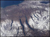
A late fall snowstorm frosted the hills of the Finger Lakes region of central New York in early December, 2004. Shapes of the snow-covered hills are accented by the low Sun angles, and contrast with the darker, finger-shaped lakes filling the region’s valleys. The steep, roughly parallel valleys and hills of the Finger Lakes region were shaped by advancing and retreating ice sheets that were as much as 2 miles deep during the last ice age (2 million years to about 10,000 years ago). River valleys were scoured into deep troughs; many are now filled with lakes. The two largest lakes, Seneca and Cayuga, are so deep that the base of their lakebeds are below sea level.
Published Dec 20, 2004