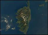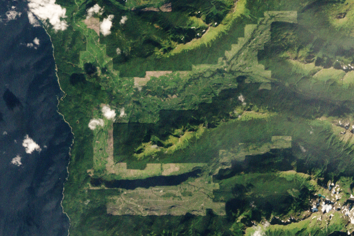
Brown bears abound on this Alaskan island, parts of which have seen both widespread clear-cutting and forest regrowth in recent decades.
Published Apr 24, 2020
This astronaut photograph shows the southern end of Paramushir Island after a snowfall. Four volcanic centers are brightly lit on their western slopes and deeply shadowed to the east.
Published Jul 12, 2010
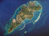
Guanaja Island is located in the western Caribbean, approximately 60 kilometers (about 37 miles) north of mainland Honduras. The island is near the western edge of the Cayman Ridge, a topographic feature made of rock types that indicate ancient volcanic islands, sedimentary layers, and ocean crust. The ridge resulted from tectonic interactions between the North American, South American, and Caribbean Plates. Guanaja and the nearby islands of Roatan and Utila (not shown) are the only portions of the western Cayman Ridge currently exposed above water.
Published Mar 26, 2007
On September 25, 2002, astronauts aboard the International Space Station viewed Easter Island, one of the most remote locations on Earth. Easter Island is more than 2000 miles from the closest populations on Tahiti and Chile—even more remote than astronauts orbiting at 210 nautical miles above the Earth. Archaeologists believe the island was discovered and colonized by Polynesians at about 400 AD. Subsequently, a unique culture developed. The human population grew to levels that could not be sustained by the island. A civil war resulted, and the island’s deforestation and ecosystem collapse was nearly complete.
Published Oct 6, 2002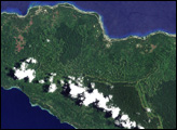
In June 2008, scientists published the country’s first detailed assessment of the type, extent, and health of Papua New Guinea’s forests, documenting the wide-spread deforestation and degradation of lowland rainforest on the islands east of the mainland, including the island of New Ireland.
Published Jun 19, 2008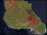
On May 10, 2007, a large human-caused fire broke out near the island’s only city, Avalon. Before it was contained five days later, the fire scorched 4,800 acres.
Published Nov 11, 2007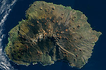
Acquired on on May 5, 2009, this true-color image shows Marion Island in the Indian Ocean. Sparsely vegetated, this volcanic island has remnants of snow near its summit.
Published Oct 18, 2009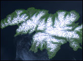
Attu Island is so far west, it’s actually in the Eastern Hemisphere. It is the westernmost of Alaska’s Aleutian Islands, even farther west than the Hawaiian Islands.
Published Jul 5, 2006