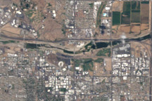
These satellite images show Tempe Town Lake before and after a rubber dam maintaining the reservoir burst.
Published Aug 8, 2010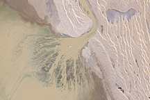
Muddy brown water spreads into Australia's Lake Eyre through a triangular delta in this natural-color Landsat image from May 9, 2009. The water transformed the dry basin into a vast inland sea where flocks of birds gathered to breed.
Published May 24, 2009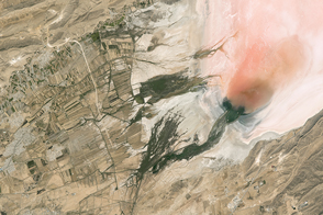
Salt and algae lend color to the bed of this desert lake in Iran.
Published Feb 20, 2017
In August 2010, Lake Mead reached its lowest level since 1956, the result of a persistent drought and increasing human demand.
Published Sep 23, 2010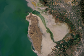
In October 2016, one of America’s largest lakes reached its lowest level on record.
Published Nov 3, 2016
Ongoing drought and diminished snowpack in the Rockies have combined with increasing demands downstream to cause the great reservoir to drop to historically low levels.
Published Aug 1, 2014
Man and nature have both altered the course of a southwestern U.S. river.
Published May 21, 2012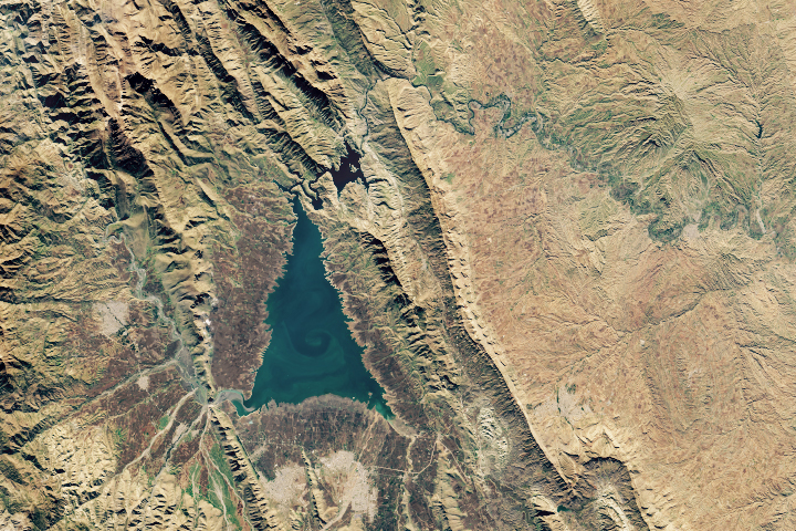
Shaped like an evergreen conifer, Lake Dukan is the largest lake in Iraqi Kurdistan.
Published Dec 25, 2018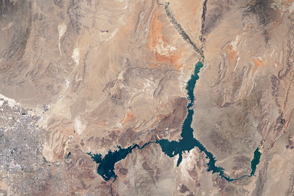
The water within a large, key reservoir in the southwestern United States has fallen to levels not seen since the 1930s.
Published Aug 18, 2015
In May 2016, the reservoir behind Hoover Dam reached its lowest level since the 1930s.
Published May 27, 2016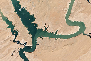
In spring 2014, visitors to Lake Powell will find beaches and rock formations that are usually underwater. After several years of drought, the reservoir has dropped below 50 percent capacity.
Published May 22, 2014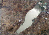
Astronauts aboard the Space Shuttle and Space Station have tracked regional environmental changes spanning decades. Lake Chapala, Mexico’s largest lake, serves as one example of an area experiencing significant changes that have been well documented from space. Over the past twenty years, the lake’s water levels have decreased in conjunction with increasing development from the fast-growing city of Guadalajara.
Published Aug 30, 2004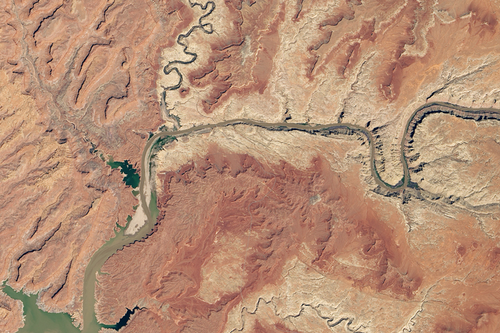
Heavy winter and spring snowfall provided much-needed meltwater, but the effects of long-term drought mean the lake is nowhere near its highs from the 1980s and 90s.
Published Oct 1, 2019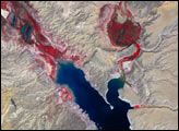

Surging with fresh water from heavy winter snow melt, Lake Powell rose significantly in the summer of 2011 after many years of low levels.
Published Aug 12, 2011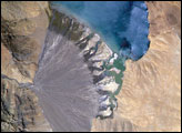
Meltwater from glaciers to the east and west drains into Lake Morari, a large lake that lies at an altitude of 4,521 meters (14,830 feet) on the Tibetan Plateau. A stream on the west side provides the lake’s main inflow. Mud from this river gives the light blue hues to the lake water. The well-formed alluvial fan (image center), built by sediment from the main inflow river, is the reason the lake has formed at this point in the valley.
Published Dec 18, 2006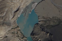
Acquired October 3, 2010, this natural-color images show slight changes in a landslide lake along the Hunza River in northwestern Pakistan.
Published Oct 13, 2010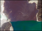
The Great Salt Lake of northern Utah is a remnant of glacial Lake Bonneville that extended over much of present-day western Utah and into the neighboring states of Nevada and Idaho approximately 32,000 to 14,000 years ago. The north arm of the lake, displayed in this astronaut photograph from April 30, 2007, typically has twice the salinity of the rest of the lake due to impoundment of water by a railroad causeway that crosses the lake from east to west. The causeway restricts water flow, and the separation has led to a striking division in the types of algae and bacteria found in the north and south arms of the lake.
Published Jul 16, 2007