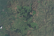
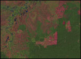
Gishwati Forest suffered severe deforestation, evident in these true-color images.
Published Jun 9, 2009
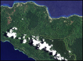
In June 2008, scientists published the country’s first detailed assessment of the type, extent, and health of Papua New Guinea’s forests, documenting the wide-spread deforestation and degradation of lowland rainforest on the islands east of the mainland, including the island of New Ireland.
Published Jun 19, 2008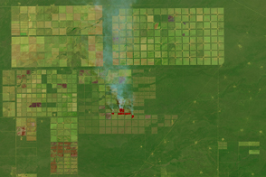
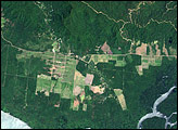
Ranching and farming operations have left a distinctive grid on the landscape.
Published Feb 27, 2016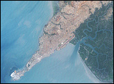
In June 2008, an international team of researchers released a report on the state of Papua New Guinea’s forests. The study summarized the findings from a five-year project in which the scientists compared high-resolution satellite imagery from the early 1970s and the early 2000s. The researchers found evidence of rapid deforestation and degradation, driven primarily by logging, subsistence agriculture, fires, and the development of mines and plantations.
Published Jun 8, 2008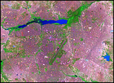
In western Africa, just south of the Sahara Desert, lies the landlocked nation of Burkina Faso. The nation experienced a 200 percent increase in urban population between 1975 and 2000. Much of that growth occurred in the capital city of Ouagadougou: Between 1960 and 1993, Ouagadougou experienced a 14-fold increase in area.
Published Jun 29, 2008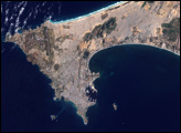
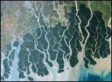
In the arid stretches of southern Algeria lies the Ouargla Oasis. The imagery shows both urbanization near the oasis, and an assortment of irrigated fields in the region.
Published Feb 1, 2009